Back to search results
LORD OF THE HILLS CREEK TRACK MINE SITE
WILLIAMS ROAD WANDILIGONG, ALPINE SHIRE
LORD OF THE HILLS CREEK TRACK MINE SITE
WILLIAMS ROAD WANDILIGONG, ALPINE SHIRE
All information on this page is maintained by Heritage Victoria.
Click below for their website and contact details.
Victorian Heritage Inventory
-
Add to tour
You must log in to do that.
-
Share
-
Shortlist place
You must log in to do that.
- Download report
On this page:
Statement of Significance
What is significant?
How is it significant?
Why is it significant?
Show more
Show less
-
-
LORD OF THE HILLS CREEK TRACK MINE SITE - History
The history of the workings along this line of reef is not known and the line does not appear on J P L Kenny’s map of the Bright, Wandiligong and Freeburgh Goldfields (Bulletin 44, GSV, 1925). Some references to reef discoveries and workings below the Lord of the Hills Reef (itself situated high up towards the ridgeline) were found from the 1890s.LORD OF THE HILLS CREEK TRACK MINE SITE - Interpretation of Site
The site has evidence of small scale prospecting by adits and shafts. Area very overgrown and impossible to survey properly.
Heritage Inventory Description
LORD OF THE HILLS CREEK TRACK MINE SITE - Heritage Inventory Description
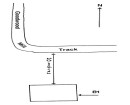
Large mullock heap on downslope sidewith main workings immediately to east. These consist of large excavated area from which at least 5 collapsed adits enter the hillside. Above is another open adit with two others nearby.
SiteCard data copied on 13/08/2024: The workings are typical of small-scale prospecting and mining works in mountain areas, with the use of adits rather than shafts. The features logged by the FMFQ project were two open adits and a small, filled prospecting shaft. In the broader site there are several adits, some surface stopes or costeans, a small open cut with tunnels exiting from it and a range of small trenches cut across the line. There appears to be an absence of layered archaeology across the whole site because no machinery (winders etc) was used and as the site is close to the township of Wandiligong, there was no need for accommodation huts. Crushing from these small mines were usually done at public crushing machines in the township. As part of the inspection the boundaries of H8224-0030 were re-mapped due its extent (a 200m circle from central grid point reference, mapped with the old datum, AGD66) having the wrong location and not being the correct size. The new extent will be a circle of 45m radius centred on 499368 E, 5929550 N UTM. This new circle will comfortably encompass all mining features mapped in January 1995 for the original VHI entry. These features represent the main mining on the reef. Minor features mapped to the south are prospecting works and have no visible layered archaeology (hut sites, machinery footings/sites etc). Expansion of the Inventory entry is not merited.
-
-
-
-
-
GROWLERS GOLD BUCKET DREDGE SITE
 Victorian Heritage Register H1303
 -
GANDERS REEF ADIT
 Victorian Heritage Inventory
 -
GANDERS REEF
 Victorian Heritage Inventory
-
-


