POINT HENRY MARITIME HERITAGE PRECINCT
POINT HENRY ROAD MOOLAP, GREATER GEELONG CITY
-
Add to tour
You must log in to do that.
-
Share
-
Shortlist place
You must log in to do that.
- Download report
Statement of Significance
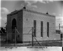
-
-
POINT HENRY MARITIME HERITAGE PRECINCT - History
The area was used as the first landing for Geelong by the vessel Francis Feeling in April 1836 to unload sheep, with more animals being unloaded in May. A bar between Pt Henry and Pt Lillias prohibited entry to the larger vessels into Geelong, which had to anchor and discharge cargo onto the beach before a pier was later built (Threlfall, nd:2).
The bar from Points Henry to Lillias was an important feature for early graziers, who ran and swam stock across the bar in the early 1840s.
Harbour Development/ Channel Dredging
Since its inception, access to the inner harbour of Geelong was blocked by a sandbar between Points Henry and Lillias. Two natural channels existed at Pt Henry, the Ship Channel and the Boat Channel, and although the former was 11 feet deep, larger vessels were forced to anchor outside the Points near Pt Henry, and tranship goods into Geelong via a small fleet of lighters. In 1841, the barque Socrates became the first three masted deep water vessel to cross the bar, when she anchored off the Eastern Pier to load wool bound for England. Increased international wool shipments, immigration and an upturn in the Bass Strait stock trade highlighted the need for better access to the inner harbour. Many vessels were forced to swim stock ashore at Pt Henry. Pt Henry had been named after the commander of the brig Henry after she visited there in Geelong's early days. A significant trade developed across Bass Strait, with timber being delivered from Van Dieman's Land, and departing with fattened cattle and sheep for the convict colonies of Hobart and Launceston (Brownhill, 1990: 45).
Pt Henry was often described as a sea of masts, as larger vessels unable to enter the port anchored there. In 1841, Major Mercer undertook surveys of the Ship and Boat Channels to determine the best strategy for cutting the sandbar, and determined that the former region provided the best opportunity for an artificial channel (Brownhill, 1990:45). In 1854, work on a new dredged channel (The North Channel) was begun to the north of the Ship Channel), but was only partially completed when works were retarded by submerged rocks. By 1858, a citizens committee was formed to hasten the government's approval of the construction of a new more efficient channel, and in 1859, a Bar Committee was formed to raise funds to supplement the allocated government funds. After an initial influx of funds, donations slowed, but the committee persevered until two dredges were employed to excavate a straight channel of 18ft depth. The channel was complete in 1861, and was used by the first large ship Nazarine, which was carrying livestock and general cargo for New Zealand (Brownhill, 1990: 287-289). Initial dredging for the Hopetoun Channel began in 1881, and was completed in 1893. The channel was 130 wide and provided a minimum depth of 23 feet (Threlfall, nd:2).Point Henry East Pier/ Boat Landing (Quarantine Jetty?):
A boat landing was constructed on the eastern side of Pt Henry in 1840 to discharge cargo from vessels anchored offshore. The pier was later covered by sand and shell progradation, but was uncovered again when during erosion of the area in the 1950s (Phillips, 1959:2; Threlfall, nd.:2).
Old Pilot JettyAn old pilot jetty was mentioned in November in 1871 in the Geelong Advertiser, but was " of little use and in want of repair", and was in the vicinity of the Henshaw' Tea Gardens (Threlfall, nd: 14).
Point Henry Tea Gardens:California Tea Gardens/Henshaw's Victoria Tea Gardens & Pier:Kossaks Jetty/ Bellarine Tea Gardens: (Howard Smith) New Western Jetty,Sinclairs Jetty West
S Hulks City of Melbourne and Briton: (Howard Smith) New Eastern Long Jetty: (Howard Smith) New Steamboat Pier/ Sinclairs PierThe first tea gardens at Point Henry were established by Messrs Bean and Hasler in 1849 who advertised the facility as a paradise. The California Tea Gardens were named after the large numbers of vessels that left from Point Henry to go to California gold fields. The following year the gardens enjoyed increased business from gold seekers coming into the colony, instead of vacating it and a small hire boat was available for cruising amongst the sailing vessels anchored offshore. By 1854, a regular service was being run between here and Geelong by the small steamer Diamond. The gardens were to be auctioned in1864, after one of the owners suffered ill health (Threlfall, nd:2,3).
The gardens lay derilect until 1871, when the area was rejuvenated into Henshaw's Victoria Tea Gardens. The gardens were located on a high cliff that projected towards the Corio Bay entrance, with an Esplanade on the top of the steep banks above a pebbled beach. An entertainment building with verandahs was constructed, that offered refreshments, wine and lodgings to both tourists and invalids. A wine cellar, 10000 gallon water tank, lawn and rotunda were also constructed onsite. The triangular shaped gardens occupied 5 acres of ground and there were about 2000 trees, including berry and fruit trees. The esplanade was about 60 ft above the beach level, and had an avenue of trees. The gardens were about 7 miles from Geelong, and could be reached by both road, and sea via a small jetty at the base of the cliffs. A screw steamer, the Sarah, regularly left the Yarra St Wharf and a return fare included lunch. The gardens were open the public in summer from November to April, but were offered for auction in February 1873, due to the owner's insolvency (Threlfall, nd:3).
The gardens were again opened in November 1873, but the opening was marred by a tragic accident, when several people drowned while trying to reach the paddle steamer offshore which could not access the pier due to strong winds (Threlfall, nd : 3,4). The gardens were again offered for sale in 1874, and by 1876 the area was occupied by small scale farmers and the gardens were neglected.
By the end of 1876, the gardens were re-opened by Messr Kossak, who renovated the house and received a publican's licence. He constructed a 150 ft long jetty, with a 20ft x 8ft cross pier (Threlfall, nd:4). A ferry, the Jaffa, ran between the Yarra St Pier and the gardens (Brownhill, 1990: 224). The gardens were taken over by Southey and Knowles in 1878, but were closed in 1879 due to lack of patronage. Sinclair took over the lease in 1880. He possibly purchased the land from Dobson in 1881, when he advertised the Point Henry Hotel. The land was again sold, along with 300 acres in 1885 (P59). The construction of the Clifton Springs resort and pier in the 1880s, along with the difficulty in landing passengers at the shallow Point Henry Jetty and boating accidents led to the downfall of the gardens (Threlfall, nd:4).
By 1889, The (William) Howard Smith Company had taken over the area, and the gardens were restored to their former glory. The Edina transhipped passengers to the gardens and the paddle steamer Bellarine, and late in the year the Bellarine Tea Gardens were launched. A new (western) jetty was tendered that year, and in February was extended from 125ft to 915ft, and was used by the steamer Bellarine to ferry visitors from Geelong. By July 1890, tenders were called for the extension of the eastern jetty, and by September work began on a new jetty 1865ft long to be ready by Christmas. The hulks Briton and City of Melbourne were used during this time as transhipment points for visitors, where the Edina dropped them off and the Bellarine collected them for the trip to the tea gardens. Summer houses were subsequently built along the beachfront, and a large pavilion to accommodate 350 people was constructed, and the facility offered temperance drinks. The site attracted over 22000 tourists from Melbourne and 50000 from Geelong in 1890 and eventually a hotel was constructed. The eastern pier was finished by November, along with a small new steamboat pier. The eastern pier had a clearance depth of 15ft, which enabled the Edina and other steamers to come alongside, rather than the more dangerous practice of transhipping passengers (Threlfall, nd:7,8; Brownhill, 1990:224).
By 1891, fresh plans were made to establish two additional sea front cottages and thirty shelter sheds above high tide mark, several bathing houses for women and children along the beach, and a shelter shed and aquarium on the jetty. In this year the Briton was removed from the seabed near the pier and towed 400 yards inshore By 1892, the eastern long pier had a tramway and truck for unloading heavy goods from and to steamers using the pier. The W.H. Smith fleet also accessed the company's butchery (located in Stingaree Bay), butter factory and other agricultural produce grown on the peninsula (Threlfall, nd:8, 14). By 1895, the eastern long jetty had been provided with a roofed shelter, and 30 roofed in seats had been erected along the Bay.
Shell Removal
In 1883, shell removal licences for the Point Henry area extended to only 1 chain above high water mark (Threlfall, :12).
Oyster Shell Cultivation:
In 1891, AC Clark, an oyster seller was fattening Pt Albert Oysters in troughs at the Point. The troughs were supplied with a constant supply of fresh sea water from Corio Bay, and the oysters were supplied to the Geelong Market (Threlfall, nd:5,14)
Other Components
Point Henry Quarantine Station
A quarantine station was shown at this site in an 1863 plan (V131). The current Alcoa Refinery pier was built in 1966 (Brownhill, 1990:707)
Point Henry Signal Station
Point Henry Anchorage
Since its inception, access to the inner harbour of Geelong was blocked by a sandbar between Points Henry and Lillias. Two natural channels existed at Pt Henry, the Ship Channel and the Boat Channel, and although the former was 11 feet deep, larger vessels were forced to anchor outside the Points near Pt Henry, and tranship goods into Geelong via a small fleet of lighters. In 1841, the barque Socrates became the first three masted deep water vessel to cross the bar, when she anchored off the Eastern Pier to load wool bound for England. Increased international wool shipments, immigration and an upturn in the Bass Strait stock trade highlighted the need for better access to the inner harbour. Many vessels were forced to swim stock ashore at Pt Henry. Pt Henry had been named after the commander of the brig Henry after she visited there in Geelong's early days. A significant trade developed across Bass Strait, with timber being delivered from Van Dieman's Land, and departing with fattened cattle and sheep for the convict colonies of Hobart and Launceston (Brownhill, 1990: 45).
Pt Henry was often described as a sea of masts, as larger vessels unable to enter the port anchored there. In 1841, Major Mercer undertook surveys of the Ship and Boat Channels to determine the best strategy for cutting the sandbar, and determined that the former region provided the best opportunity for an artificial channel (Brownhill, 1990:45).
Boat Channel
Major Mercer surveyed the Boat Channel and established its minimum depth at low tide to be five feet, with four feet of hard mud and shells (Brownhill, 1990: 44-45). The channel was still marked by buoys in 1864 (Henry), but was superceded by the construction of the Hopetoun Channel in 1893.
Irish Channel/South Channel
This feature was called the Irish Channel in 1851 (Ferguson, 1851). In 1854, work on a new dredged channel (The North Channel) was begun to the north of the Ship Channel), but was only partially completed when works were retarded by submerged rocks. By 1858, a citizens committee was formed to hasten the government's approval of the construction of a new more efficient channel, and in 1859, a Bar Committee was formed to raise funds to supplement the allocated government funds. After an initial influx of funds, donations slowed, but the committee persevered until two dredges were employed to excavate a straight channel of 18ft depth. Dredging of the South Channel began to provide deep water access for vessels up to 18 feet draught, although it was very narrow and not regarded as a success. The South Channel was complete sometime between 1861-62, and was used by the first large ship Nazarine, which was carrying livestock and general cargo for New Zealand (Phillips, 1959:3; Threlfall, nd:2; Brownhill, 1990: 287-289; V129). The last vessel used this channel in 1895, despite the previous completion of the Hopetoun Channel (Phillips, 1959:3), and the Channel was still evident on charts in 1914 (G154). Traces of the channel could still be seen to the north of the Hopetoun Channel (Threlfall, nd: 2).
North Channel
In 1841, the barque Socrates discovered a route which allowed Van Diemans Land trading vessels up to 11ft deep to gain access into the inner harbour of Geelong. Later that year, Major Mercer surveyed the Ship Channel and established its minimum depth at low tide to be eight feet, with nine feet of mud substrate, and recommended it as the preferred access route into Geelong (Brownhill, 1990: 44-45). The Ship Channel was noted on a chart from 1848 (G388) and in 1850 (G153a), and the sides of the channel were marked by dolphins in 1858 (VGG, 1858:1186).
With the increase in trade during the during the gold rush period, this partly natural channel was investigated in 1854 to assess its potential as an entrance to the inner harbour. Dredging of the first artificial channel began between 1855 -1856 by Capt John Napier. The channel was designed for use by small craft, and was dredged to 13 feet until a rock reef prevented further work (Phillips, 1959:2; Threlfall, nd:2; Geelong Maritime Museum Display). The channel allowed the first sizable shipment of wool directly from the inner harbour. However by 1858, the crooked channel was criticized as inadequate and difficult, and a new channel was called for (Brownhill, 1990: 287). The Channel was still shown on charts in 1864, where it had been renamed the North Channel, which appeared to be accessed via the new Ship Channel (#2) to the East (Cox, 1864).North Channel Lightship
Ship Channel #2
POINT HENRY MARITIME HERITAGE PRECINCT - Interpretation of Site
Qurantine station: The quarantine site now probably lies under the Alcoa Loading Facility warehouses. Most traces of the former station are likely to have been removed during the construction of the Alcoa loading facility and warehouses. The section of the tea gardens outside of the refinery area once occupied the wetlands area on the east side of Point Henry, west of the Alcoa Pier. There is a strong probability of archaeological evidence remaining in this area.
Point Henry Anchorage: The site has possible archaeological potential of remains from shipboard life from the 1840s onwards, similar to t he Hobsons Bay anchorage at Melbourne.
Heritage Study and Grading
Heritage Victoria - Maritime Infrastructure Assessment Project
Author: Heritage Victoria
Year: 2005
Grading:
-
-
-
-
-
POINT HENRY WEST HARD AND RUBBISH TIPVictorian Heritage Inventory
-
Memorial to Founding of GeelongGreater Geelong City
-
Navigation Station (Fmr) & Land within 20 metresGreater Geelong City
-
-