NORTH GRENVILLE CO
DANIELS ROAD SCARSDALE, GOLDEN PLAINS SHIRE
-
Add to tour
You must log in to do that.
-
Share
-
Shortlist place
You must log in to do that.
- Download report
Statement of Significance
This record has minimal details. Please look to the right-hand-side bar for any further details about this record.
-
-
NORTH GRENVILLE CO - History
Contextual History:History of Place:
Heritage Inventory History of Site:
NORTH GRENVILLE COMPANY
03.1864: returning large quantities of gold weekly.
06.1864: struck a good gutter to the west of the shaft.
09.1864: considerably improved; gutter found to be running parallel with the southern boundary will give them hundreds of feet of wash that was not expected.
12.1864: broken into the gutter coming from the Morning Light or Oldham Lead and their yield rose from 60 to 80 ozs per week.
03.1865: making extensive main drives.
06.1865: improving and when the main drives are completed it will give excellent returns.
09.1865: improving and promising good results.
12.1865: marked improvement.
03.1866: regularly at work and doing well.
06.1866: last week's yield was 105 ozs; discussing the possibility of sinking a new shaft to allow working of the unworked portion of their claim.
09.1866: continuing to give excellent returns; machinery purchased for the sinking of another shaft.
12.1866: yielding better than ever.
03.1867: yield from their old shaft is indifferent; sinking a new shaft and erecting machinery thereon
09.1867: new shaft completed and works will be transferred there soon; giving moderate returns.
03.1868: yield for the quarter 836 ozs 11 dwt 13 gr.
06.1868: yield for the quarter 781 ozs 13 dwt 9 gr
09.1868: yield for the quarter 270 ozs 14 dwt 10 gr
12.1863 to 09.1868: recorded production of 8163 ozs 15 dwt 4 gr ( or 254.005 kg).Heritage Inventory Description
NORTH GRENVILLE CO - Heritage Inventory Description
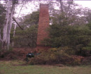
This site consists of an intact mullock and quartz wash heaps on the west side of a depression where the shaft used to be, with a section of stone walling plus a collection of stones east of the shaft. One of the quartz wash heaps runs north from the shaft, it is 30m long and 10m wide. The other two larger quartz wash heaps run west from this first heap and are 50m long by15m wide. Each of these three heaps is approximately 3m high. There is also a small heap of quartz 15m by 5m by 1m high on the northwest corner of the other heaps. The mullock heap is south of the quartz wash heaps. It commences 15 metres west of the shaft and is 40m long by 15m wide and 5m high.Twelve metreseast of the shaft there is a section of basalt stone walling 1.5m long by 0.6m high; the stones are held in place with mud mortar. This section of wall is part of an area 12m long and 5m wide which contains a concentration of basalt rocks with three introduced trees growing amongst them. Its location in relation to the shaft suggests that it is part of a setting for the machinery that was used for winding and pumping. While there in no indication of what machinery was used at the mine, it is nevertheless a very intact site in comparison to the others in this area and a good example of a deep lead mine of the 1860's and early 1870's./nIn addition to its integrity this site provides a good vantage point for interpreting the course of the deep lead in this vicinity, ie., to sites 64, 66, & 67.
Heritage Inventory Significance: Regional
-
-
-
-
-
BUTE CO NO.2 (MAIN SHAFT)
 Victorian Heritage Inventory
 -
DEEP LEAD MINE ON OLDHAM LEAD
 Victorian Heritage Inventory
 -
TRY AGAIN NO.1
 Victorian Heritage Inventory
-
-


