Back to search results
POUND HILL
WHYTES ROAD SMYTHES CREEK, BALLARAT CITY
POUND HILL
WHYTES ROAD SMYTHES CREEK, BALLARAT CITY
All information on this page is maintained by Heritage Victoria.
Click below for their website and contact details.
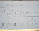
Victorian Heritage Inventory
On this page:
Statement of Significance
This record has minimal details. Please look to the right-hand-side bar for any further details about this record.
Show more
Show less
-
-
-
-
SMYTHESDALE COURT HOUSE
 Victorian Heritage Register H1653
 -
ROXBURGH CO.
 Victorian Heritage Inventory
 -
YELLOW GLEN MINE
Victorian Heritage Inventory
-
-