THE PINES (FORESHORE RESERVE)
BEACH ROAD AND CLIFF ROAD SHOREHAM, MORNINGTON PENINSULA SHIRE
 SOHE 2008")


Statement of Significance
What is significant?
The stand of about 250 Monterey Pine trees (Pinus radiata) on the foreshore at Shoreham (The Pines) is a place of cultural heritage significance at a State level as a representative surviving example of pine trees marking a beach resort. Pine trees were a classic seaside planting to provide windbreaks and protection for habitations behind the foreshore. Many such pine plantings around Port Phillip Bay and Western Port Bay have been or are being replaced. The landscape of which the pines constitute an important element, is of outstanding aesthetic significance. The Pines are a very impressive stand of trees, and are unique as the best example in Victoria of a stand of pines on a foreshore reserve.
How is it significant?
The stand of pines at Shoreham is of aesthetic significance. It is also of historical and social significance.
Why is it significant?
The Monterey Pines are a unique element in a significant landscape. They are of aesthetic significant as a key component of an organically evolved landscape with a high aesthetic value for its scenic beauty. The Pines are important for their landmark quality on the Western Port littoral of the Mornington Peninsula. They give the Shoreham foreshore its distinctive character. The vistas from the sand and from the water where The Pines are contrasted with the sea and sky are important to the site. The Pines create an unusual and distinctive experience of the intersection of beach and land which is visually different from the low indigenous cover to be seen at Honeysuckle Point and other areas along the coast.
The Pines are also of historical significance as an associative landscape marking the use of Shoreham as a beach and surfing resort. Early plantings of pines are the most visible reminder of the settlement period and pines became a classic seaside planting. The Pines stand as a representative marker in the imposed landscape following European settlement and in particular signify the recreational use of Shoreham as a beach resort from the 1920s although some of the trees probably date from earlier than 1920. Similar plantings protecting the beaches of Merricks, Somers and Balnarring have been partially removed in recent years, increasing the significance of The Pines as a surviving example of post European settlement beach planting.
-
-
-
-
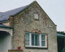
Early Settler's Hut
 National Trust
 -
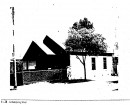
Progress Hall
National Trust
-
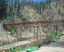
Western Port Coastline - West Head to Point Leo Beach
National Trust
-
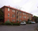
'Mororo' 13 Oxford Street, Malvern
 Stonnington City
 -
1 Arnold Street
 Yarra City
 -
1 Austin Street
Yarra City
-
-