BORRELL'S HOMESTEAD RUINS AND MARKET GARDEN SITE
745 OLD CALDER HIGHWAY KEILOR EAST, BRIMBANK CITY
-
Add to tour
You must log in to do that.
-
Share
-
Shortlist place
You must log in to do that.
- Download report
Statement of Significance
This record has minimal details. Please look to the right-hand-side bar for any further details about this record.
-
-
BORRELL'S HOMESTEAD RUINS AND MARKET GARDEN SITE - History
By 1857 Thomas Cahill owned seven and a half acres near the Keilor Bridge on which he established a prosperous small farm. When he died in 1879 his wife Eliza continued the farm until her death in 1885 after which their son Denis developed the farm as an orchard, relying on the rich river soil and convenient water of the Maribyrnong River for irrigation. The orchard passed through the ownership of the Goudie family and the Dodd's of Brimbank Farm to the south before the Spanish immigrant Jose Borrell acquired the site in 1917, to which he had added an adjacent 9 acres by 1921. Borrell employed 'Spanish methods' of manuring, irrigating, cultivation and levelling which were subject to constant experiment and improvement to increase the yields of vegetables. The land remained in the ownership of the Borrell family until 1983 when it was purchased by the MMBW and incorporated into Brimbank Park at which point most of the orchard trees were removed. The buildings became vacant, and subsequent vandalism and demolition has led to the present surviving fragment.
BORRELL'S HOMESTEAD RUINS AND MARKET GARDEN SITE - Archaeological Significance
Despite the demolition of the majority of the former house and its accompanying outbuildings, the terrace has not been subject to significant disturbance and therefore possesses a high potential for archaeological evidence of the buildings and for domestic and agricultural artifacts.
BORRELL'S HOMESTEAD RUINS AND MARKET GARDEN SITE - Historical Significance
Borrells farm is of historical significance as a remnant of the once prolific orcharding industry in Keilor.
BORRELL'S HOMESTEAD RUINS AND MARKET GARDEN SITE - Interpretation of Site
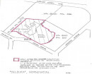
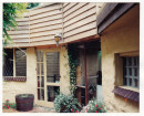
Within the site, a small plateau adjacent to the Old Calder Highway contains a single ruin of an early bluestone and brick building, which was adapted for domestic use and later formed a portion of a larger house. Having formerly had about eleven rooms, the timber sections and outbuildings were demolished by the MMBW in the 1980s following fires and vandalism. The ruin is presently fenced off in cyclone fencing, and the areas of the outbuildings appear to have been top-soiled. However, artefacts including glass and ceramic fragments relating to domestic activity can be seen on the surface.
A possible stone plinth may mark an entrance gate onto the access road to the north, alongside which erosion of the bank on which the current tarmac path is laid reveals an earlier roadway in the section.
The wider site comprises the land parcel around the plateau between the Old Calder Highway and the Maribyrnong River (known as Gumms Corner). This was used for orchards by the Cahills, and then provided the flat alluvial ground required for Borrell's favoured technique of furrow irrigation.Heritage Inventory Description
BORRELL'S HOMESTEAD RUINS AND MARKET GARDEN SITE - Heritage Inventory Description
The site comprises a small plateau containing the ruin of the mid-late 19th century farmstead, together with the site of market gardens on the land within the bend of the Maribyrnong River
-
-
-
-
-
BRIDGE
 Victorian Heritage Register H1427
 -
PREFABRICATED BUILDING
 Victorian Heritage Register H1971
 -
KEILOR HOTEL
 Victorian Heritage Register H1974
-
-


