FORMER STATE BANK
37 HARGRAVES STREET CASTLEMAINE, MOUNT ALEXANDER SHIRE
-
Add to tour
You must log in to do that.
-
Share
-
Shortlist place
You must log in to do that.
- Download report
Statement of Significance
This record has minimal details. Please look to the right-hand-side bar for any further details about this record.
-
-
FORMER STATE BANK - History
The land was surveyed and reserved for civic purposes in 1853. By 1857 the State Savings Bank had been constructed on the site. It was built in two phases, with an ornamental front being added in 1857 (See historical photograph and photo 4)
In the mid 1920s the Victorian Government did a deal which changed the functions of two buildings - the functions of the police station (then located at 220 Barker Street in VHR0580) were shifted to 37 Hargraves Street, and the bank's function, transferred to 220 Barker Street. This exchange resulted in the passing of the Castlemaine Land Bill. As part of the exchange, the stone lock up was relocated to its present site - originally is was located in Section 14, Lot 10.
In 1950s a new police station was built in Lyttleton Street and 37 Hargraves Street became State Offices.
FORMER STATE BANK - Interpretation of Site
The site has been used for three civic purposes:
State Savings Bank (c.1857-1920s)
Police Station (1920s to c. 1950)
State Offices (1950 to 2010).
The site is now to become the new Castlemaine Police Station
FORMER STATE BANK - Archaeological Significance
The car parking areas at the side and rear of 37 Hargraves Street are likely to contain archaeological features, deposits and relics documenting a chronology of civic activities - banking and law & order - from the mid 1850s.
FORMER STATE BANK - Historical Significance
Site is associated with a State and National significant event - the Mount Alexander Gold Rush.
Heritage Inventory Description
FORMER STATE BANK - Heritage Inventory Description
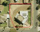
Building is now abandoned for re-use as part of the new Castlemaine Police Station. The land parcel contains parking areas, weatherboard police stables and a section of brick wall that may belong to the first Court House. The adjoining land parcel (to the south) contains the Court House and Lock up (VHR 1405) and the one to the north, contains a weatherboard house (c.1950).
-
-
-
-
-
FLOUR MILL
 Victorian Heritage Register H0395
 -
BANK OF NEW SOUTH WALES
 Victorian Heritage Register H0131
 -
FORMER CBC BANK
 Victorian Heritage Register H0712
-
-


