ROYAL PARK
ROYAL PARADE AND FLEMINGTON ROAD PARKVILLE, MELBOURNE CITY

-
Add to tour
You must log in to do that.
-
Share
-
Shortlist place
You must log in to do that.
- Download report


Statement of Significance
What is significant?
How is it significant?
Why is it significant?
-
-
ROYAL PARK - History
Royal Park was originally an important Aboriginal camping ground which fell within the territory of the Wurundjeri people, with whom John Batman made his infamous land deal in 1835.
The land today is a remnant of a much larger reserve of 625 hectares (2,500 acres) set aside for recreation purposes by Governor Latrobe in 1854. In 1868 and again in 1878 the size of the park was reduced for housing allotments. In the 1880s more land was lost to make way for trams, trains and roads.
Set up as "Camp Pell" (named after a US pilot killed in action) in 1942 for American Troops stationed in Australia during WWII, the park was used as a Transit Camp primarily for medical and vocational guidance units. In 1945, the site became a demobilisation centre for the War and was decommissioned in December of the same year. In 1946, the park was used by the Housing Commission for Emergency Public Housing, in the wake of acute post-war housing shortages. Dubbed "Camp Hell", its post-war use was initially intended to merely last one year, but in actuality lasted ten.
The tin huts of Camp Hell were demolished and the park was cleaned up in time for the 1956 Melbourne Olympic Games and still exists today as a recreational reserve.
SiteCard data copied on 18/02/2025:General History of Royal Park As part of Lieutenant-Governor Charles La Trobe’s vision for Melbourne, as a city surrounded by park lands for the health and wellbeing of the people, Royal Park was established in 1854 and gazetted in 1876 (Heritage Victoria 2014, p.4). From the arrival of Europeans, Royal Park was viewed as picturesque open landscape and was the subject of many paintings throughout the 19th century (Figure 14). Royal Park has been a site for various scientific, military, medical, and social endeavours including the Experimental Farm in 1858, as a reserve for the Acclimatisation Society of Victoria in 1861, which later became the Royal Melbourne Zoological Gardens, the starting point of Burke and Wills’ expedition to the Gulf of Carpentaria in 1860, a government powder magazine, a military camp during World Wars I and II, various institutions for public health and welfare, including the Royal Children’s Hospital. It has also served as a venue for various sporting competitions from the late 1850s, including cricket, football and golf. The approximate location of the model farm, Brunswick Cricket Club, the zoological gardens, and the Royal Park train station are demonstrated in Figure 15. Royal Park was a site of frequent attractions and was promoted as a place of healing due to its fresh air and natural environment (Heritage Victoria 2014, p. 16). The importance of maintaining the area as an open space was emphasised by the trustees of Royal Park, who actively lobbied to keep tree planting to a minimum to facilitate mass public gatherings (Heritage Victoria 2014, p. 16). The construction of Royal Park Station allowed for visitors to come from across Melbourne, despite the public outcry against the railway line’s presence in the park (Heritage Victoria 2014, pp. 16-19). The railway line to Coburg was originally planned to cut across Royal Park east of the Zoological Gardens (Figure 16); however, the line was adjusted as a concession to the public (Figure 15). Figure 15 demonstrates the location of the Brunswick Cricket Club with its designated grounds and building, which was established in 1858 and an associated building with a yard (Heritage Victoria 2014, p.18). This building was likely constructed between 1858 and 1883. History of the Melbourne to Coburg Line In 1884, the Melbourne to Coburg line officially opened. To inaugurate the line, the Governor of Victoria and an official party rode on the train line, and it was remarked that the facilities along the line were minimal; however, a signal box and gatekeeper’s cottage were noted at Royal Park (Saul et al. 1994, p. 4). In 1884, the Railway Construction Act No. 821 authorised the construction of the Royal Park to Clifton Hill line (Saul et al. 1994, p. 4). By 1886, works on the Royal Park to Clifton Hill line were under way and by 1888 Royal Park had become a junction station, with the opening of the line to Collingwood via North Melbourne, Royal Park, North Fitzroy, and Clifton Hill (Saul et al. 1994, pp 4-6). The 1902 Melbourne Metropolitan Board of Works (MMBW) plan demonstrates this junction and the intersection of the railway line and Park Road (Figure 17). Additionally, the 1902 MMBW plan demonstrates a gate house and associated outbuilding north of the Heidelberg line at the intersection of Park Road (Figure 17). This gate house may have been built for workers to service the junction; however, it was most likely the gate house referenced during the opening of the Melbourne to Coburg line. Two additional buildings with enclosed yards and associated outbuildings are depicted north of the Coburg line in the 1902 MMBW plan (Figure 17). These structures are associated with the Brunswick Cricket Club and are additions to the one depicted in Figure 15. Between 1889 and 1912, there was a goods siding near the station, named Royal Park Cutting Siding; however, it is unclear as to where this building was located (Saul et al. 1994, p.6). In 1892 the cutting at the down end was widened to accommodate four lines for the junction (Royal Park 2022). In 1919, the station building on the upside of the platform and the signal box burnt down (Royal Park 2022). The signal box was re-erected in 1920 and the station building’s roof was replaced with a tile roof in the “Gisborne style” (Royal Park 2022) (Saul et al. 1994, p. 16). In keeping with the movement to preserve Royal Park as an open landscape, the land around Royal Park train station and the rail siding remained relatively undeveloped and was utilised for sporting and recreation, as depicted in the 1931 aerial image (Figure 18). A series of rapid developments occurred in the 1930s and 1940s. In 1936 a new waiting shed, and ticket office were built to replace the previous structure on the downside platform at Royal Park (Saul et al. 1994, p. 18). In 1942, upgrades to the station buildings were commissioned to be more inclusive for women conductors (Figure 19). Sporting facilities Two cricket ovals were added to the park between 1931 and 1945 in addition to the oval associated with the Brunswick Cricket Club (Figure 20). A series of tennis courts and a building were constructed between 1931 and 1945 in between the junction of the Melbourne to Coburg line and the Royal Park to Heidelberg line; the gatehouse is no longer evident in the 1945 aerial (Figure 20). History of Military Presence at Royal Park Royal Park was utilised by the Australian military in 1888 in preparation for the Centennial Exhibition’s combined Imperial and Victorian naval display (Heritage Victoria 2014, p.17). In 1901 Australian and Fijian soldiers were stationed at Royal Park in preparation for the Opening of the Commonwealth Parliament in Melbourne (Heritage Victoria 2014, p.17). As a result of overcrowding and diseases spreading in military camps in Victoria, a large military camp was established in the southern portion of Royal Park in 1915 (Heritage Victoria 2014, p.17). Between 1931 and 1945, as a result of World Wars, the area south of the railway line on the eastern side of Royal Park was developed into a military camp which is depicted on a 1945 aerial image (Figure 20). This area operated as a recruit reception depot from 1940 and the area was also used as a staging camp for US troops enroute to the Pacific (Heritage Victoria 2014, p.18). The American camp was known as Camp Pell, and then later Camp Hell when it was utilised by the Housing Commission (Heritage Victoria 2014, p.18). The 1945 aerial demonstrates that there were approximately 1,200 tents and temporary buildings within the American encampment. The presence of American soldiers peaked in 1942, with approximately 30,000 men stationed in Melbourne who were training for a variety of tasks (Atkinson 2022) (Figure 21). Figure 22 demonstrates the approximate locations of the Red Cross Society Hut, that has been repurposed as “Anzac Hall” H1747, officers’ barracks, headquarters administration area, ration office situated in the western portion of the Royal Park in what is now known as Walker Oval and Smith Oval, and soldiers’ tents south of the Burke and Wills memorial cairn. The presence of American soldiers at Camp Pell sparked alarmist commentary and the slogan over paid, over sexed, and over here" became synonymous with the American presence in Royal Park (Atkinson 2022). However, these fears were realised, when an American soldier, known as the Brown-Out Serial Strangler, murdered three local women and was tried and hanged at Pentridge Prison, in Coburg (Whiticker 2005). The camp was demolished in the 1950s as part of the campaign to clean up the area for the 1956 Olympics and the Red Cross tent was converted into Anzac Hall; however, Anzac Hall was repurposed in 1958 for community programs (Heritage Victoria 2014, p.18). Site History Post Military Occupation The 1962 aerial demonstrates that the park remained relatively unchanged, except for the consolidation/demolition of the buildings associated with Camp Pell/Camp Hell (Figure 22). By 1965, the Northcote Loop Junction was closed and the junction at Royal Park only operated on weekends, servicing a line from Royal Park to Fitzroy (Saul et al. 1994, p. 25). Between 1965 and 1984 additional sporting fields were established north of the railway line on the western side of the park (Figure 23). In 1981, the Royal Park to Fitzroy line was officially closed. Heritage listing In 2012, Royal Park was included on the Victorian Heritage Inventory
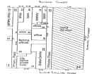
. The site card for Royal Park briefly discusses the park’s establishment as a reserve for recreation purposes; however, the site card almost exclusively discusses Camp Pell, which later was nicknamed “Camp Hell” in relation to the post-war housing commission. In 2014, Royal Park was recommended to the Heritage Council for inclusion on the Victorian Heritage Register. Site chronology 1854: Royal Park established 1858: Experimental farm established as well as the Brunswick Cricket Club in the central and northeastern portion of the park 1860: Burke and Wills expedition to the Gulf of Carpentaria left from Royal Park in the southern portion of the park 1861: Acclimatisation Society of Victoria established, which later became the Zoological Gardens in the central portion of the park 1884: Melbourne to Coburg line established, which transects the central portion of the park. Signal box and gatekeeper’s cottage were established at the Park Street level crossing 1886 to 1888: the Royal Park to Clifton Hill junction was established, branching off from the eastern portion of the site and continuing south towards Clifton Hill 1888: Utilised by Australian military for Centennial Exhibition’s combined Imperial and Victorian naval display 1889-1912: Goods siding named Royal Park Cutting Siding established; however, the location is unknown 1892: The cutting in the eastern portion of the park, associated with the Royal Park to Clifton Hill junction was widened 1901: Australian and Fijian soldiers were stationed at Royal Park 1902: additional buildings associated with the Brunswick Cricket Club had become established in the northeastern portion of the park 1915: Australian military camp established in the southern portion of the park 1919-1920: The station and signal box burnt down. The signal box was reconstructed and the roof of the station was replaced in the northern portion of the park 1936: New waiting shed and ticket office constructed at the station 1942: Station upgraded to be more inclusive for women in the rail workforce 1931-1945: Additional ovals and tennis courts established in the northeastern portion of the park. Camp Pell established in the central western portion of the park and the southern portion of the park. 1950s: After the war, the camp was utilised as community housing. In the lead up to the 1956 Olympics, the camps were demolished 1958: Red Cross Society Hut converted into Anzac Hall prior to 1958 and was used for community programs to the present day 1962: By 1962, the Camp Pell infrastructure was removed from the southern portion of the park. The land in the southern portion was converted back into sporting ovals. The Camp Pell infrastructure south of the railway line in the central western portion of the park was replaced by community buildings 1965: Royal Park to Clifton Hill (Royal Park to Northcote at the time) operated only on weekends 1965 to 1984: Additional sporting fields were established north of railway line on the western side of the park 1981: Royal Park to Clifton Hill (Royal Park to Fitzroy at the time) was officially closedROYAL PARK - Interpretation of Site
The site has been used for both military and civic/domestic purposes:.
-1835: Important Aboriginal camping ground of the Wurundjeri people until obtained by John Batman
1854: Site set aside for recreation purposes by Governor Latrobe
1942-1945: Camp Pel! (Military Camp)
1946-1956: Camp Hel! (Public Housing)
1956-present: Recreational Reserve
SiteCard data copied on 18/02/2025: Royal Park is a multifaceted site with a complex history that has been shaped by Victorian ideals and aspirations and two world wars. Established as an open-air park in 1854, the park was envisioned as a picturesque landscape. The park allowed for the establishment of Brunswick cricket club and became hub of sports and recreation in the late 19th century. The installation of the Melbourne to Coburg line, and later the Royal Park to Clifton Hill line facilitated the transport of Melbourne’s citizens to the reserve and zoological gardens. Archaeological potential related to Royal Park station, the historic Melbourne to Coburg line, the Royal Park to Clifton Hill line and the early iterations of the Brunswick Cricket Club are likely present in the northern and central portion of the park. Archaeological features in the form of footings and occupation deposits related to the construction and/or operation of the Melbourne to Coburg line, the Royal Park Clifton Hill Line, the Brunswick Cricket Club, and WW1 and WW2 military operations may still exist subsurface. The landscaping and development of new sporting facilities has likely resulted in the disturbance of the original Brunswick Cricket Club buildings; however, there is potential for features and or deposits to remain subsurface. The open landscape allowed for the use of military personnel in times of war and exhibition throughout the early and mid-20th centuries. Archaeological potential related to the various military camps established in the central and southern portion of the park is likely; however, the removal and subsequent landscaping of the ovals and grasslands has likely resulted in disturbance or total removal of the ephemeral archaeological traces. Former and extant features such as the gate keeper’s cottage associated with the Royal Park to Clifton Hill line, Anzac Hall, the former Brunswick Cricket caretakers cottage and pavilion, and the train station/Melbourne to Coburg line and associated rail corridor are believed to have moderate to high potential for archaeological features or deposits (Map 2 and Map 3). The military camps are believed to have low archaeological potential (Map 4). This is demonstrated on Maps 2-4.Heritage Inventory Description
ROYAL PARK - Heritage Inventory Description
SiteCard data copied on 18/02/2025: Royal Park is bounded by Park Street to the north, The Avenue to the east, Gatehouse Street and Flemington Road to the south, and Manningham Street and Oak Street to the west. The site can be characterised as a multifaceted site. The north comprises a series of ovals and historical pavilions (Figure 1, Figure 2, and Figure 3). South of that, the Upfield Railway line bisects the site, entering the site from the west at the Manningham Street level crossing and exiting the site from the east at the Park Street level crossing. The rail corridor includes an historic train station (Figure 4 and 5) in the central portion of the corridor and an historic gate keeper’s cabin/signal building and semaphore at the Park Street level crossing in the east (Figure 6, Figure 7, and Figure 8). South of the railway line, in the central portion of the site, is the Melbourne Zoo. West of the Melbourne Zoo, in the central portion of the site, is the original location of the north western extent of Camp Pell. The southern portion of Royal Park comprises a series of ovals, modern pavilions and landscaped gardens that were historically associated with the Burke and Wells expedition (Figure 9) and an expanse of temporary military tents and huts (Figure 10 and Figure 11) and the historic Walmsley House at the corner of Gatehouse Street and Royal Parade (Figure 12 and Figure 13). The extent of the VHI site is demonstrated in Map 1.
-
-
-
-
-
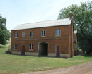
MOUNT ROYAL HOSPITALVictorian Heritage Register H1725
-
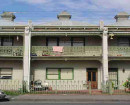
FORMER POLICE STATION COMPLEXVictorian Heritage Register H1545
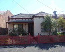
-
DELORAINE TERRACEVictorian Heritage Register H0098
-
-