FORMER EUREKA LEAD GOLD SLUICING COMPANY PUMP SHED
113 LOFVEN STREET NERRINA, BALLARAT CITY
-
Add to tour
You must log in to do that.
-
Share
-
Shortlist place
You must log in to do that.
- Download report
Statement of Significance
What is significant?
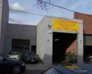
The former Eureka Lead Gold Sluicing Company's pump shed site at 113 and 135 Lofven Street Nerrina is significant. The elements of significance include the primary components of the place, which are the corrugated iron pump shed, machinery foundations within and outside the shed, and all associated artefacts and archaeological deposits.How is it significant?
The former Eureka Lead Gold Sluicing Company's pump shed is of historical significance to the City of Ballarat.Why is it significant?
The former Eureka Lead Gold Sluicing Company pumping site is historically and technologically important as characteristic and well-preserved archaeological evidence of hydraulic sluicing technology involving a suction gas engine and producer plant. Evidence of the actual mining that was undertaken also survives nearby in the form of a large sluice pit. The hydraulic sluicing carried out at this site was associated with the revival of gold mining in Victoria in response to the Great Depression of the 1930s and the Eureka Lead Gold Sluicing Company was the foremost mine of the Ballarat gold mining revival in at this time. Mining-related heritage is of crucial importance to the City of Ballarat because of the role gold played in the development of Ballarat as a city. (Criterion A & C).-
-
FORMER EUREKA LEAD GOLD SLUICING COMPANY PUMP SHED - History
Original site card history:
Ballarat's 1930s mining revival was, however, largely due to the efforts of D. Jackson (a retired dredge master), who formed a company to undertake large-scale hydraulic sluicing operations along the line of Eureka Gully. He raised the necessary capital by showing how, from only two months' sluicing each year for 21 years, he had obtained gold from the gully worth £20,000. The company he formed was initially called the Little Bendigo Sluicing Company, but was re-named the Eureka Gold Lead Sluicing Company.
By June 1931, Jackson had negotiated to lease of 101 acres of ground. His initial plan was to employ twenty men, sluice four acres a year, and produce from 12,000 to 16,000 ounces of gold. Water for the sluicing was to be supplied by a 15-mile-long water race and, due to the large volume required, pumps would be used to recycle the water.The water was directed at the gravel deposits through a nozzle carrying a pressure of 75lbs and throwing a stream of 130 feet.The sluicing operations worked northwards up the gullies into the Nerrina area. From time to time, it was necessary to dismantle the machinery and relocate it further north. For example, this occurred in July 1932, requiring the construction of new concrete foundations for the power plant; and again in 1934, when it was repositioned at Nerrina. The company was still sluicing in the Nerrina area four years later, and was also crushing quartz from the old Temperance Mine dump. The impact of sluicing on the environment was significant and is still evident today in the Nerrina landscape (Nerrina Parklands). A report in 1936 stated that the company had eight settling ponds, one of which covered 12 acres; when its bank collapsed, some 500,000 gallons of water escaped into Yarrowee Creek. The highly mechanised nature of Ballarat's greatest 1930s gold mining revival operation is best shown by the 1947 auction notice for the company's plant and property, and which included two large engines - 300-h.p. Hornsby Twin Engines, Suction Gas Engine and Plant; Robison 10in. 2-Stage Centrifugal Pump, Driven by 160-h.p. Compound Suction Gas Engine and Producer Plant; and a range of sheds - Corrugated Iron Engine and Producer Houses and 11 Assorted C.G.I. Pump Houses.
Updated site card history:
The Eureka Lead is believed to have been named by Dr Timothy Doyle, and was opened up in 1852 at Little Bendigo, with gold bearing material found at a depth of four feet. In the early 1850s it was followed from what is now known as Nerrina south beneath Yarrowee Creek into Pennyweight flat in 1853, and on to what is now the Eureka in Ballarat East, where the depth of mining was up to 120 feet. This was also where the Eureka rebellion occurred in late 1854. Surface mining at Little Bendigo, or Nerina as it became known, had probably ceased within a few years of the original rush, but a number of quartz crushing machines were operating for the surrounding gold diggings. In 1858 an Anglican school was opened and a Methodist church followed in 1865. In 1878 a government school replaced the earlier building. Two hotels were recorded in the 1890s in the Victorian municipal directory, which estimated the population to be about 400 people. A revival of mining occurred in the 1930s using hydraulic sluicing.
The Bannear CMP offers the following history of the Eureka Lead Gold Sluicing Company pump site:
Shallow alluvial deposits are the gravels and sands that fill gullies and form the banks of creeks. The mining of these deposits began when John Dunlop and James Regan found gold in August 1851, and triggered Victoria’s first great gold rush. The 1930s pump shed stands at the end of a long history of re-working the shallow ground, using a range of technologies – puddling machines, ground sluicing, dredging and hydraulic sluicing.
From 1853-54 large areas of gullies and creek flats were quarried (called paddocking) and the excavated soil and gravel from the surface to a depth of several metres treated in puddling machines. Sluicing with powerful jets of water was also widely used. By January 1858 half the mining population of Ballarat (including most of the Chinese) were engaged in either sluicing or puddling, with large sums of money being invested in the construction of races to convey water to claims. On the whole these ventures proved short-lived.
Large-scale mining of shallow deposits did take place in the 1890s, when two dredges worked their way along Yarrowee Creek. After this, productive alluvial gold mining at Ballarat ended.
In July 1930, a public meeting was held in Ballarat’s city hall with a view to a mining revival. One speaker was W. Baragwanath, director of the Geological Survey of Victoria. He suggested several areas at Ballarat that could be prospected, and identified the abandoned shallow ground as an area worth exploring. The meeting resulted in the formation of a local committee to support a mining revival. The mayor, Cr. A. R. Stewart, was appointed chair.
Ballarat’s 1930s mining revival was, however, largely due to the efforts of D. Jackson (a retired dredge master), who formed a company to undertake large-scale hydraulic sluicing operations along the line of Eureka Gully. He raised the necessary capital by showing how, from only two months’ sluicing each year for 21 years, he had obtained gold from the gully worth £20,000. The company he formed was initially called the Little Bendigo Sluicing Company, but was re-named the Eureka Gold Lead Sluicing Company.
By June 1931, Jackson had negotiated to lease of 101 acres of ground. His initial plan was to employ twenty men, sluice four acres a year, and produce from 12,000 to 16,000 ounces of gold. Water for the sluicing was to be supplied by a 15-mile-long water race and, due to the large volume required, pumps would be used to recycle the water. The water was directed at the gravel deposits through a nozzle carrying a pressure of 75lbs and throwing a stream of 130 feet.
The sluicing operations worked northwards up the gullies into the Nerrina area. From time to time, it was necessary to dismantle the machinery and relocate it further north. For example, this occurred in July 1932, requiring the construction of new concrete foundations for the power plant; and again in 1934, when it was repositioned at Nerrina. The company was still sluicing in the Nerrina area four years later, and was also crushing quartz from the old Temperance Mine dump.
The impact of sluicing on the environment was significant and is still evident today in the Nerrina landscape. A report in 1936 stated that the company had eight settling ponds, one of which covered 12 acres; when its bank collapsed, some 500,000 gallons of water escaped into Yarrowee Creek.
The Second World War spelled the end of Eureka Lead Gold Sluicing Company.
This history does not establish the earlier mining activity in the little Bendigo area, or the owners of the property and operators of the businesses that were carried out there prior to the establishment of the Eureka Lead Sluicing company in the 1930s. This has some bearing on the significance and management of the surviving heritage place, as the prior mining history establishes the continuity of industrial scale goldmining on this site from the mid nineteenth century to the mid twentieth century, and helps understand the surrounding features of the site such as mining remains that predate the Eureka Sluicing company works. It limits the understanding of the context in which the building sits. The following might be added to the history to broaden it and fulfil the objective of ‘Understanding of the place’ defined by Kerr in the Conservation Plan (Kerr 2013, p. 4).FORMER EUREKA LEAD GOLD SLUICING COMPANY PUMP SHED - Archaeological Significance
Documentary evidence shows that the shed and foundations belong to the 1930s mining operations of the Eureka Gold Lead Sluicing Company. The shed was likely to have been constructed in 1934. The site contains a corrugated iron pumping shed located next to a large sluice hole, engine mounting beds, and pumping related remains. Works around this building have exposed artefacts and buried features likely to contain deposits and artefacts. There is significant potential for historical archaeological features, deposits or artefacts.
FORMER EUREKA LEAD GOLD SLUICING COMPANY PUMP SHED - Historical Significance
The former Eureka Lead Gold Sluicing Company's pump shed is significant as a characteristic and well-preserved example of hydraulic sluicing pumping facility and the foremost mine of Ballarat's 1930s mining revival. The pump shed is significant as an industrial example associated with the operations of the Eureka Lead Gold Sluicing Company. The place and its local history are important in understanding the surrounding gold mining landscape during the early twentieth century.
FORMER EUREKA LEAD GOLD SLUICING COMPANY PUMP SHED - Interpretation of Site
The Nerrina area was initially heavily forested and avoided by the first wave of European settlers. A B Yuille took up the Ballarat Squatting run prior to 1847, with the Wyndham run located immediately to the north, and their common boundary running roughly through the Nerrina area. However, it is unlikely they exploited this part of their runs very much apart from collecting firewood and gathering stray livestock. The initial survey of the area was carried out in about 1859, as mining had become well established and both roads and local facilities were desired by a more stable population. This survey primarily served to align existing tracks and establish allotments for the small businesses along the main road. A number of mining operations were carried out in the immediate area of the subject site in the nineteenth century. Mining maps indicate that the One and All Company operated a mine with its main shaft just 20-30 metres south west. The One and All Company commenced operations in May, 1859, with two shafts on the ground to the north of the Band of Hope Company claim. The company ceased operation in September 1867, with the areas remaining unworked until the Evening Star Company took over in February 1870. This is likely to be the plant and buildings which were still present when a new lease was given over the surrounding land. The main shaft of the mine is likely to be in the undeveloped roadway to the south west of the present site, while the battery and engine house are depicted on the following lease plan which has been overlaid with modern features. Harvey, Hoskins & Co and Watson are also recorded on plans in Little Bendigo. Several buildings, puddling machines and two ‘Engine’s presumably meaning steam engines for driving pumps or crushing plants are shown on the Ballaarat gold field map,of 1861,15 while a Battery and Engine house in a similar position to the later Eureka Lead pump house is shown on the 1891 plan. The lot on which part of the Eureka Lead Gold Sluicing Co pump shed was established was purchased in 1871 by Oscar Skoglund, who was already well established in Little Bendigo. The provision of lots for sale appears to have been sporadic in the Little Bendigo area, probably responding to the already established businesses and settlements on crown land, with the alignment of roads and position of allotments drawn up to best accommodate the existing buildings and activities. A deputation of Little Bendigo residents made a request to the Bungaree Road District Board in 1865, for “…a line of road to be defined past Lofvein’s store” referring to local Swedish storekeeper Robert Lofven. One of these was Oscar Skoglund, who like Lofven, was from Sweden. Skoglund was a shareholder in the Hero Quartz Mining Co at Little Bendigo in 1862, and in the same year was granted the licence for the Scandinavian Hotel in Little Bendigo. He held various allotments in Little Bendigo, including the subject site, a block just north of the Church of England (which was possibly the site of the Scandinavian Hotel), and an earlier unauthorised lot immediately north of the Weslyan Church which was resumed for Church Street. Immediately south of the subject site, a series of mining ventures are documented in Mining Lease Plans, with Ah Fook holding a lease here in 1860. Watson and Harvey are also identified as having mining leases immediately south west of the subject site in the 1890s. In 1871, Skogund obtained the crown grant for the property comprising lot 26 Section AA in the township of Nerrina, located on the main road in Little Bendigo. He was recorded as being granted a licence to sell explosives in 1887, presumably from his store. Skoglund was well-known as one of the oldest residents of Little Bendigo, and later ran a large grocery store in Sturt-street. However, in 1890 he committed suicide, by hanging himself in his stable and left “…a note saying he was very miserable, and could not stand the worry any longer, and asking his brother to be kind to his wife. Deceased was 53 years of age, and leaves a widow and adult family.” His son died from injuries in the Sunshine Rail Disaster in 1908, and his widow moved to Melbourne. Skoglund held other land in Little Bendigo, and so it is unclear if this property (lot 26) was associated with his Scandinavian Hotel. There is some likelihood this was the case, because when Skoglund died in 1890, his widow sold the property to James Coghlan, of Coghlan & Tulloch’s Ballarat Brewing Company Limited. The Brewery then mortgaged the property to the Equity Trustees Executors and Agency Company Limited in 1898, and presumably when the mortgage was paid out, it was transferred to the Ballarat Brewing Company Proprietary Limited of Dana St Ballarat, in 1916. This title was ultimately cancelled on 17 October 1958 when the Carlton and United Breweries took over the Ballarat Brewery. The property was subsequently sold to Roy Butler, an engineer of Nerrina, in August 1959. Butler died in 1976 and the estate was transferred to Catherine Butler, and then to Kenneth Alfred Butler at the same time. Kenneth died in 1997 and probate on his will was granted to Geoffrey William Torney of South Ballarat who then sold it to Bayden Christopher Butler and Vanessa Leigh Stonehouse in 2016. Finally the property was sold to the present owners Bree and Shane Kermeen in 2018. Mining landscape To the north of the former Eureka Lead pump house building is a deep sluice pit measuring about 50 metres wide and 250 metres long. In its bottom are a number of earth banks, one running for about 100 metres towards the south west. These are likely to have been for diverting tailings of sludge from the sluicing activities (Figure 23). To the north east and north west of the pit, a series of small dams occur. These have the form of tailings dams. As hydraulic sluicing was generally banned from about 1904 due to the damage it was causing to downstream waterways, it is likely that the dams are remnants of the system to capture and recycle waste water and sludge from the sluicing operations. Between the deep sluice pits and the tailings dams, there is an elevated area of land that has not been sluiced. This has a number of subtle surface features relating to gold mining activity including mullock heaps,shallow shafts, water races and possibly a puddling machine or other structures (Figure 24). There are several roughly rectangular, levelled areas that may be former building platforms. Scattered among this landscape are fragments of handmade brick and squared blocks of stone (Figure 25), possibly related to mining machinery shown on early plans (Figure 4). The Bannear CMP makes mention of the sluice pit, but does not discuss the wider mining landscape or consider the potential significance of this landscape in connection with the pump house.
Heritage Inventory Description
FORMER EUREKA LEAD GOLD SLUICING COMPANY PUMP SHED - Heritage Inventory Description
The Victorian Heritage Inventory description from original site card: FORMER EUREKA LEAD GOLD SLUICING COMPANY PUMP SHED - Heritage Inventory Description Pump shed - 10.4 metres x 7.9 metres, corrugated iron, timber framed, with gable roof and scissor trusses. Machinery foundations in the shed -There are twin engine bed (1.6 metres wide and 4.1 metres long, and raised 0.2 metres above a concrete floor) between which is a deep 3-metre-long and 0.9-metre-wide wheel pit Earthworks along the east side of the shed have exposed concrete foundations Artefacts and deposits - Earthworks involved in demolishing the wall and lean-to have exposed fragments of iron tools and iron pipe. Pottery and glass pieces are also present in the disturbed ground. The pump pit associated with the engine beds contain machinery pieces. Likely to be archaeological deposits/artefacts associated with the concrete features outside the shed. Foundations outside the shed Sluice hole (Nerrina Parklands) - 15 metres to the west, [actually north] on public land, is a deep, overgrown sluice hole. Updated site description: The place comprises a timber framed corrugated iron clad shed comprising a single internal space with concrete machinery footings and earth floor, as well as portable objects and to the north an extensive area of gold workings including the large sluice pit. The existing building comprises a timber framed galvanised corrugated iron clad shed measuring 10.4 metres x 7.9 metres. It has a shallow pitched gabled roof, and formerly a small lean-to extension on the north east corner. A small hipped ventilator is positioned in the middle of the roof ridge. The external cladding comprises short sheets of galvanised corrugated iron nailed horizontally across closely spaced hardwood timber studs. These are set at between 550 and 850 mm with adjustments made for windows and doorways. The positions of the studs along the missing north west wall are evident from checks in the top and bottom plates, suggesting that this was a continuous wall prior to the construction of the lean-to. A remnant stud in the middle of the wall has an electrical outlet and batten suggesting a doorway was once here. There is a pedestrian door in the south east wall, double width sliding doors in the end walls, with three low and one high level window as shown in the following images The interior is unlined, and for the most part has no noggings with only a single wind brace on the south east wall and paired wind braces on the end walls. It would appear that the wall studs and roof truss timbers are all of the same dimensions, and regular lengths. For example the gable ends are made of separate stud lengths sitting on the top plate rather than longer studs running through. The roof trusses are formed from simple crossing bottom chords with no king post forming the simplest form of scissor truss. The roof trusses do not match the wall stud spacing but are set wider apart at about 900mm. A number of metal pipes projecting through the roof indicate the exhaust of the original engines. Similarly the roof vent demonstrates the building function as it was required to allow fumes and heat to escape. Windows appear to have been originally double hung sashes with large single panes, and the doors are timber ledged and braced. Overall the construction indicates the most utilitarian and cost effective design, as would be expected from a structure built during the 1930s depression era. To the north of the building is a deep sluice pit measuring about 50 metres wide and 250 metres long. In its bottom are a number of earth banks, one running for about 100 metres towards the south west. These are likely to have been for diverting tailings of sludge from the sluicing activities. To the north east and north west of the pit, a series of small dams occur. These have the form of tailings dams. As hydraulic sluicing was generally banned from about 1904 due to the damage it was causing to downstream waterways, it is likely that the dams are remnants of the system to capture and recycle waste water and sludge from the sluicing operations. Between the deep sluice pits and the tailings dams, there is an elevated area of land that has not been sluiced. This has a number of subtle surface features relating to gold mining activity including mullock heaps, shallow shafts, water races and possibly a puddling machine or other structures. There are several roughly rectangular, levelled areas that may be former building platforms. Scattered among this landscape are fragments of handmade brick and squared blocks of stone, possibly related to mining machinery shown on early plans.
-
-
-
-
-
LITTLE BENDIGO PRIMARY SCHOOLVictorian Heritage Register H1632
-
TEMPERANCE MINE SITE AND HEAD OF EUREKA LEADVictorian Heritage Inventory
-
Former St James' Church of EnglandNational Trust
-
-