Back to search results
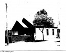
FORMER HAVELOCK STATION
MARYBOROUGH-DUNOLLY ROAD HAVELOCK, CENTRAL GOLDFIELDS SHIRE
FORMER HAVELOCK STATION
MARYBOROUGH-DUNOLLY ROAD HAVELOCK, CENTRAL GOLDFIELDS SHIRE
All information on this page is maintained by Heritage Victoria.
Click below for their website and contact details.
Victorian Heritage Inventory
On this page:
Statement of Significance
What is significant?
Archaeological features which may be present would be associated with the now-demolished railway platforms and associated infrastructure, as described in the background history of Havelock.
How is it significant?
The Former Havelock Station site is of local archaeological significance.
Why is it significant?
There is moderate potential for archaeological sites to be present within the railway reserve at the locations of the former Havelock Station. This is based on the Havelock Railway Station background history, and by the results of the aerial imagery review.
Show more
Show less
-
-
-
-
SWAN HILL WATER TOWER
 Victorian Heritage Register H2452
 -
RULES OF THE MELBOURNE FOOTBALL CLUB
Victorian Heritage Register H2428
-
MOUNT LITTLE DICK FIRE TOWER
Victorian Heritage Register H2461
-
-