ROCKY POINT HERITAGE AREA
49-53 RIVERSDALE ROAD NEWTOWN, GREATER GEELONG CITY
-
Add to tour
You must log in to do that.
-
Share
-
Shortlist place
You must log in to do that.
- Download report
Statement of Significance
-
-
ROCKY POINT HERITAGE AREA - History
Dates of events vary between sources, but it seems the most significant activity related to the use of a cave on the site occurred in the mid 1850s. The seems to be little no historical activity on site prior to or post these events. The area is within an area of cultural heritage sensitivity as it is approximately 50m north of the Barwon River.According to Lang (2003, p57) the title deed for the site originally belonged to Reverend Andrew Love in 1854. It was then taken over by Ebenezer Davies who leased the site to James Harrison.It is unclear if the cave was pre-existing or if it was purpose built. There are claims that a hut was partially built into the cave (Geelong Advertiser ca1970), and an advertisement for excavating and building rubble stone walls at Rocky Point was placed by Harrison in 1855 (Geelong Advertiser Saturday, November 3, 1855), so it is likely that some construction was undertaken around this time. A second shed some distance away may been associated with extracting water from the river (ABC 2022; Lang, 2003, 57).The cave is believed to be the site of James Harrison’s early experiments with icemaking, where he constructed a “closed cycle of operations in the Perkins model, but possibly without knowledge of that” (Roy Lang, p57, 2003). This involved attaching a pump to a coil from a heating device, pouring ether into the coil, closing the other end and operating the pump. This would apparently create ice on a wet surface (Lang, 57, 2003). Water was sourced from the Barwon River.Harrison submitted a patent in 1855 for a refrigerating machine, using ammonia and other gaseous substances. This was ultimately successful and Harrison commercially developed the invention, selling them internationally until at least 1878 (Churchward, M. (2006)ROCKY POINT HERITAGE AREA - Interpretation of Site
Include phases in the development of the site, functions and activities represented, as well as current place use: 1854-55 – site leased by Harrison and some construction of rubble walls and possibly a hut or shed took place. A second shed up to 50 metres away was built which for the drawing of water from the Barwon River. This water converted to ice using the condensor (ABC 2022) The site was the location of Harrison’s chemical experiments and development of an ice-making system. Activities include drawing water from the river, using a compressor to force gas through a condenser, and experiments with chemicals such as ammonia and ether. Harrison was injured in accidents during these experiments, so at some point the cave was deemed unsafe and “filled in” (ABC 2022), potentially in the C20th and possibly with concrete. It is unclear how deep the infill extends into the cave
Heritage Inventory Description
ROCKY POINT HERITAGE AREA - Heritage Inventory Description
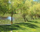
The site is a shallow cave on an escarpment above which sits a modern warehouse/industrial building near the banks of the Barwon River. A sign notes the site as the location of James Harrison’s icemaking machine. The site of the cave has now collapsed, and a rock tumble is visible.
-
-
-
-
-
SWAN HILL WATER TOWER
 Victorian Heritage Register H2452
 -
RULES OF THE MELBOURNE FOOTBALL CLUB
 Victorian Heritage Register H2428
 -
MOUNT LITTLE DICK FIRE TOWER
 Victorian Heritage Register H2461
-
-


