Back to search results
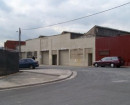
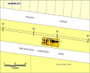
FORMER BENDIGO SANITARY DEPOT
2-10 PIPER LANE, EAST BENDIGO, VIC
FORMER BENDIGO SANITARY DEPOT
2-10 PIPER LANE, EAST BENDIGO, VIC
All information on this page is maintained by Heritage Victoria.
Click below for their website and contact details.
Victorian Heritage Inventory
On this page:
Statement of Significance
What is significant?
The site at 2–10 Piper Lane comprises a portion of former Crown land historically associated with the Wellsford Sanitation Depot or Bendigo Sewage Farm and Manure Depot, gazetted in 1892. Its establishment was a direct response to mounting public health concerns and complaints about unsanitary conditions in Bendigo during the 1870s to 1880s. The relocation of sewage treatment operations to this site marked a significant shift in the city’s approach to waste management.
The artefact scatter at the site may be associated with two overlapping historical processes:
- Refuse disposal practices: Historical records and newspaper accounts (e.g. Bendigo Advertiser, 1943) indicate that trade refuse was deposited at the sewage farm. This was due to ongoing rat infestations and broader sanitation concerns occurring in the Bendigo region. The artefacts may relate to these disposal activities and they may offer insights into the material culture of Bendigo’s residents and the evolving patterns of urban waste management.
- Depot operations and occupational activity: Alternatively, the artefacts may reflect the daily routines of depot workers and the infrastructure of the sanitation depot itself. In this context, the scatter could represent domestic or work-related refuse linked to outbuildings or workspaces that once stood nearby, as confirmed by historical aerial imagery.
How is it significant?
The site at 2–10 Piper Lane is of local historical and archaeological significance because it retains material evidence that can contribute to understanding historical sanitation practices, occupational activity, and waste disposal systems in regional Victoria. The concentrated artefact scatter identified during the CHMP survey—including complete glass bottles, glass, ceramics, leather shoes, brick and metal fragments—suggests a coherent deposit with potential subsurface integrity, despite some modern disturbance. Its proximity to the documented Bendigo Sanitary Depot/Wellsford Sanitation Depot, which operated from 1892 into the mid-20th century, strengthens the likelihood that these materials are linked either to depot operations or to refuse disposal processes. If associated with trade refuse or domestic waste, the artefacts may offer insights into the material culture of Bendigo’s residents and sanitation workers, including the tools, routines, and infrastructure used in early waste management. Given the site’s undeveloped condition and limited recent disturbance, there is reasonable potential for subsurface features such as trench remnants, refuse pits, or structural footings to survive in the broader area. These could provide stratified archaeological contexts suitable for controlled excavation and analysis, making the site a rare and valuable opportunity to investigate sanitation landscapes in regional Victoria.
Why is it significant?
The site is significant at the local level for its ability to illuminate Bendigo’s early public health infrastructure and sanitation practices. It is directly associated with the Bendigo Sanitary Depot/Wellsford Sanitation Depot, a purpose-built facility gazetted in 1892 in response to mounting concerns over urban hygiene and waste management. Historical accounts, including a detailed 1913 inspection report, portray the depot as a model of early 20th-century sanitation—methodical, hygienic, and professionally operated. The historical artefact scatter identified during the survey may reflect either refuse disposal practices or occupational activity linked to depot operations, offering rare material insights into the lived experience of sanitation workers and the broader community’s relationship with waste.
Archaeologically, the site retains integrity in a concentrated artefact scatter and may contain subsurface deposits capable of yielding further information about depot logistics, refuse handling, and environmental engineering. Its proximity to Bendigo Creek and Spring Gully Channel situates it within a historically modified landscape shaped by sludge management and drainage works. The site also reflects broader patterns of land transformation, from sanitation infrastructure to grazing and light agricultural use following the depot’s closure.
Show more
Show less
-
-
-
-
-
SWAN HILL WATER TOWER
 Victorian Heritage Register H2452
 -
RULES OF THE MELBOURNE FOOTBALL CLUB
Victorian Heritage Register H2428
-
MOUNT LITTLE DICK FIRE TOWER
Victorian Heritage Register H2461
-
-