BOWMAN'S TRACK
ONEILL ROAD, BEACONSFIELD, CARDINIA SHIRE
-
Add to tour
You must log in to do that.
-
Share
-
Shortlist place
You must log in to do that.
- Download report


Statement of Significance
Blazed in the 1860s, the line of Bowman's Track is significant to the Cardinia Shire because it provides both symbolic and actual evidence of early exploration and pioneering surveys of the area and the development of transport networks across the district.
The track is also significant for its early date, particularly as a privately funded transport project, and the potential to interpret the site historically (documentary evidence produced as a result of the recent Bicentennial sign posting project). Its construction was a reflection of the dedication and effort of a locally important woman (Mrs Bowman), a rarity in public life of the 19th century. The concept was rare as a type of undertaking (private road construction) and evidence of now discontinued activities (construction of major transport routes to promote a private business).
Regional Significance
-
-
BOWMAN'S TRACK - Physical Description 1
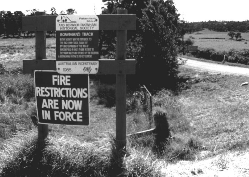
The route is signposted (1988 Bicentennial) and starts at the Beaconsfield Central Hotel site at the Cardinia Creek, and runs north-east for about 50 miles to the Jordan goldfields (later the town of Jericho south of Woods Point), via part of O'Neil Road, Hughendon Road and the Telegraph Road. The first track marker is at the O'Neil Road and Princes Highway corner.
With its frequent bushland verges and gravel surface, the route resembles in many places early roads and tracks in the shire although not the original track which as a bridle track would have been unformed and relatively uncleared. The track over time eventually formed the boundaries of parishes and counties in the district (parishes of Beenak and Tonimbuk, counties of Mornington and Evelyn) as an indication of its antiquity.
BOWMAN'S TRACK - Physical Conditions
The original track which as a bridle track would have been horse width, unformed and relatively uncleared along most of its length. Today this route is generally at least two car widths, mostly formed and cleared along its length and hence is only a suggestion of what the original path might have looked like.
BOWMAN'S TRACK - Historical Australian Themes
Themes
2.1 Early explorers
2.3 Early district surveys
6.1 Early pack tracksBOWMAN'S TRACK - Physical Description 2
Associations - Bowman, Janet; Victorian Colonial Government
Heritage Study and Grading
Cardinia - Cardinia Shire Heritage Study 1996
Author: Graeme Butler & Associates
Year: 1996
Grading: Local
-
-
-
-
-
BOURKE HOUSE & STABLES
 Cardinia Shire
 -
PAKENHAM HOTEL
 Cardinia Shire
 -
GRASON
 Cardinia Shire
-
'CARINYA' LADSONS STORE
 Victorian Heritage Register H0568
 -
1 Alexander Street
 Yarra City
 -
1 Botherambo Street
 Yarra City
-
-


