CROOKED RIVER ALLUVIAL WORKINGS: STONEWALL
BREWERY CREEK ROAD WONGUNGARRA, WELLINGTON SHIRE
-
Add to tour
You must log in to do that.
-
Share
-
Shortlist place
You must log in to do that.
- Download report
Statement of Significance
This record has minimal details. Please look to the right-hand-side bar for any further details about this record.
-
-
CROOKED RIVER ALLUVIAL WORKINGS: STONEWALL - History
Heritage Inventory History of Site: In 1906-7, the Crooked River Dredging Co. erected a barge-mounted dredge (ex-Omeo) to work a lease near the junction of Good Hope and Jungle creeks. The plant dredged an extent of three miles, from Winchester to Good Hope Creek. The last ground worked was in the neighbourhood of Talbotville in 1912, after which the dredge was removed to Tongio West.Heritage Inventory Description
CROOKED RIVER ALLUVIAL WORKINGS: STONEWALL - Heritage Inventory Description
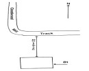
Stonewall? On the northern side of Crooked River is a large (100-200 m) dredge-hole with stone-retained pebble dumps and tail race. Water for sluicing was supplied by water races which run above the workings. A well-preserved baker's oven is located approximately 20 metres upstream from the sluice-hole.
Heritage Inventory Significance: National EstateScientific significanceùThe three localities give a clear illustration of past alluvial mining (dredging) activity, which took place at Crooked River from 1861.Network valuesùThe dredged workings form part of the site network comprising the Grant Historic Reserve, which also includes mining settlements, cemeteries, quartz mines and alluvial mining landscapes, all overgrown, but linked by a navigable network of carting tracks.
-
-
-
-
-
CROOKED RIVER MINING SETTLEMENT: BULLTOWN
 Victorian Heritage Inventory
 -
CROOKED RIVER ALLUVIAL WORKINGS: STONEWALL
 Victorian Heritage Inventory
-
-


