Back to search results
Menzies Creek Gold Diggings
Menzies Creek Walking Track, Monbulk VIC 3793 - Property No S03558
Menzies Creek Gold Diggings
Menzies Creek Walking Track, Monbulk VIC 3793 - Property No S03558
All information on this page is maintained by Yarra Ranges Shire.
Click below for their website and contact details.
Yarra Ranges Shire

Menzies Creek Gold Diggings

On this page:
Statement of Significance
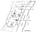
Menzies Creek Gold Diggings have high local significance as part of the "Emerald Goldfields", a place where an early Dandenong Ranges goldfield was opened in 1851 at a time when the first gold finds were made at Warrandyte and Clunes and the rich fields at Ballarat and Buninyong. There was a revival of mining along Menzies Creek during the 1890s and 1930s depressions. A Menzies Creek Walking Track has historical significance as the original route from the Avard Park area (once a mining camp) to the diggings in the Kidd's Bridge area. Traces of gold diggings and remains of a water race are said to be visible along Menzies Creek near the Avard picnic ground.
Show more
Show less
-
-
-
-
Former St Cuthbert's Church of England
 National Trust
 -
Sassafras, Perrins And Ti-Tree Creeks
National Trust
-
Anderson's Sawmill
 Yarra Ranges Shire
-
-