Back to search results
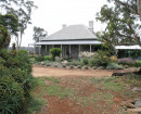
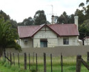
GRAND TRUNK LEAD GOLD MINING CO
909 LINTON-PIGGOREET ROAD PIGGOREET, GOLDEN PLAINS SHIRE
GRAND TRUNK LEAD GOLD MINING CO
909 LINTON-PIGGOREET ROAD PIGGOREET, GOLDEN PLAINS SHIRE
All information on this page is maintained by Heritage Victoria.
Click below for their website and contact details.
Victorian Heritage Inventory
On this page:
Statement of Significance
This record has minimal details. Please look to the right-hand-side bar for any further details about this record.
Show more
Show less
-
-
-
-
NORTH PORT ARTHUR CO
 Victorian Heritage Inventory
 -
ALPHA CO
Victorian Heritage Inventory
-
SOUTH PORT ARTHUR CO
Victorian Heritage Inventory
-
-