Back to search results
Lerderderg River engineering works.
Holts Lane to Wheelans Road BACCHUS MARSH, MOORABOOL SHIRE
Lerderderg River engineering works.
Holts Lane to Wheelans Road BACCHUS MARSH, MOORABOOL SHIRE
All information on this page is maintained by Moorabool Shire.
Click below for their website and contact details.
Moorabool Shire

Lerderderg River engineering works.
On this page:
Statement of Significance
Engineering earth works by the Shire council from 1878-90 and from 1933 to formalise a channel for the Lerderderg River through the town to reduce flooding and reclaim marshland for agricultural use.
The works are of local historical significance for their association with agricultural and water management developments in the community life ofthe district and in demonstrating the effect of an initiative of local government.
The site is of scientific significance for its archaeological research potential.
Show more
Show less
-
-
-
-
-
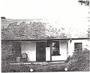
FORMER LEAHY'S RESIDENCE
 Victorian Heritage Register H0907
 -
HOPETOUN CEMETERY
Victorian Heritage Register H2059
-
HOPETOUN CEMETERY AND CHAPEL
 Victorian Heritage Inventory
-
177 Fenwick Street
 Yarra City
 -
19 Cambridge Street
Yarra City
-
2 Derby Street
Yarra City
-
-