Swan Island Fort
2 MAIN ROAD SWAN ISLAND, QUEENSCLIFFE BOROUGH
-
Add to tour
You must log in to do that.
-
Share
-
Shortlist place
You must log in to do that.
- Download report
Statement of Significance
This record has minimal details. Please look to the right-hand-side bar for any further details about this record.
-
-
Swan Island Fort - Physical Description 1
The Swan Island Fort was established as part of the Port Phillip Bay defence scheme in 1879. There had been concern about harbour defences in the colonies from 1858, and the Russo-Turkish war of 1876 heightened international tensions about conflict in the Pacific Ocean. In 1877 a scheme was designed by Colonel Dummond Jervois (Deputy-Inspector General of Fortifications in Britain) and Captain Peter Scratchley. It was designed to defend shipping in Port Phillip and Hobson's Bays, and envisioned a threat by a raider cruiser squadron. The scheme, involving massive expenditure, comprised a forward defence system of forts at Port Phillip heads dominated by Fort Queenscliff and South Channel Fort (artificial island), and a network of coastal batteries. Some development of fortification had occurred in the 1850s, but it was the impetus of the Jervois-Scratchley reports which led to major work being undertaken in the 1880s. The overall defence plan involved a combination of guns, mines (known as electric torpedos) and ships to defend the entrance to Port Phillip Bay. Swan Island Fort would be used to protect the minefields in the harbour, and to engage enemy shipping that managed to pass the primary defences of Forts Queenscliff and Nepean.
The fort is significant as an example of late nineteenth century British military fortification design, including a distinctive V-shaped battery sited low and close to the sea, a rear garrison or keep, and extensive use of concrete, parapets and bursting layers of sand and concrete.
Veterans Description for Public
Swan Island Fort - Veterans Description for Public
The Swan Island Fort was established as part of the Port Phillip Bay defence scheme in 1879. There had been concern about harbour defences in the colonies from 1858, and the Russo-Turkish war of 1876 heightened international tensions about conflict in the Pacific Ocean. The fort is comprised of about 140 hectares and is located 3km north-east of Queenscliff. Between 1879 and 1921 the island was associated with the Victoria Military Forces, the Royal Australian Engineers and the Royal Australian Artillery, encompassing an important period in the formation of the Australian Defence Forces.
In 1877 a scheme was designed by Colonel Dummond Jervois (Deputy-Inspector General of Fortifications in Britain) and Captain Peter Scratchley. It was designed to defend shipping in Port Phillip and Hobson's Bays, and envisioned a threat by a raider cruiser squadron. The scheme, involving massive expenditure, comprised a forward defence system of forts at Port Phillip heads dominated by Fort Queenscliff and South Channel Fort (artificial island), and a network of coastal batteries. Some development of fortification had occurred in the 1850s, but it was the impetus of the Jervois-Scratchley reports which led to major work being undertaken in the 1880s. The overall defence plan involved a combination of guns, mines (known as electric torpedos) and ships to defend the entrance to Port Phillip Bay. Swan Island Fort would be used to protect the minefields in the harbour, and to engage enemy shipping that managed to pass the primary defences of Forts Queenscliff and Nepean. As a result, Swan Island Fort was also designed as a submarine mining depot. New gun technology in the form of Armstrong's powerful chambered, long guns, meant the Fort could be sited at a greater distance from the channel. Jervois accordingly modified his plan for a West Channel shoal fort in favour of Swan Island.
The Swan Island Fort exemplifies late nineteenth century British military fortification design, including a distinctive V-shaped battery sited low and close to the sea, a rear garrison or keep, and extensive use of concrete, parapets and bursting layers of sand and concrete. The initial design of the battery included five heavy guns (three new type 10in Armstrong Rifled Muzzle and two 9in rml), plus two eighty pounder for defence of the flanks and rear. Mines were laid as part of an inner line of defence. Unemployed labourers constructed the basic earthwork faces, and ponds and swamps were created as a result of soil being dug from parts of the island. The design was amended in the early 1880s after a study of the Royal Navy's bombardment of coastal defences in Egypt, and the introduction of Armstrong's hydropneumatic gun carriage (5in hp guns). By 1887 construction was mostly completed, urged on by a war scare, and the establishment of a Victorian Department of Defence. In 1894 the final Fort design included gun positions, magazines, pump chambers for the 5in hp guns and lamp passages developed by RE officers at the London War Office.
By 1900, the Swan Island fortifications were inadequate for engaging modern warships, and the Fort was used primarily for instructional schools and field training, supporting the Countess of Hopetoun, (the principle harbour vessel, maintaining permanent submarine mining defences, and as a military camp. The Royal Australian Artillery Regiment assumed control in 1903, and the island continued as a training area duringthe First World War for Signals, Field and Fortress engineering schools. The transition of the island from an army establishment to a full naval facility was completed by 1922. In 1920 it became a Permanent Mines Depot for the RAN to store explosives, and the seventy six buildings on the island were adapted as part of the RAN's construction program for its mine defence scheme. The Army retained use of a jetty and the rifle range. The decommissioned J-3 submarine hull was brought to the island to provide emergency power to enable a mine preparation works program to be implemented, and it also provided a deep water jetty.
A road and firebreak system was established in 1939-40, replacing the 3ft gauge tramway that had serviced the Fort and connected the island with Queenscliff. With the Second World War came expansion of facilities (eleven new buildings and trolley lines), and the mobilisation of female personnel. The island depot stored, prepared and delivered mines and depth charges for laying off New Guinea. After the war it continued to function as RAN's mine depot, and bulk storage of explosives. The Mine Depot was finally closed in 1960, when Mk17 mines were no longer required in the Asian and Pacific region, and a new explosives jetty was built at Point Wilson. The redundant depot contained 119 structures (including forty three built by the RAN), sealed roads, bridges, three jetties, and sixteen groynes to prevent beach erosion. (Four buildings on the eastern shore were abandoned in 1959 due to threat by erosion). In addition, the island featured a golf course constructed by the Queenscliff community in 1919. The Army was granted long term permissive occupancy in 1960 to use the former defence facilities as a training area.
Between c 1940-72 a series of beach preservation works were constructed to prevent beach erosion and damage to army facilities caused by shifting sands on the shoreline. The degree of shoreline movement is due to waves, tidal current, wind blown sand and the existence of man made structures on the foreshore. The groyne fields proved to be ineffective because of an irregular supply of sand, apparently caused by the Queenscliff boat harbour built in 1956 causing sand to be trapped by the training wall.The Swan Island Fort still contains a series of eight gun emplacements (including two rapid gun fire emplacements, although the guns have since been removed) facing east and south-east set behind a mound extending along the eastern side of the V-shaped fort, and ranging from 12ft-20ft high. An eight foot high platform provides access to the gun emplacements. The embankment contains a network of underground tunnels, including the former command centre at the southern end. The 7,660 yards of 3in gauge tramline that once traversed the centre of the fort (north-south) was dug up for scrap in 1959 and no traces remain although the current main road on the island follows the original route. At the northern end of the fort are several buildings contained within the Barrack Square surrounded by a 12ft high mound. This area originally contained an office, library, commanding officer's office, store for West Channel Defences, store for South Channel Defences, general store, loaded mine store, and smith and carpenter building.
Heritage Inventory Description
Swan Island Fort - Heritage Inventory Description
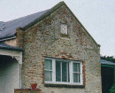
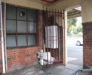
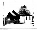
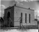
Fortifications and buildings forming part of the outer defence system of Port Philip Bay. All original earthworks and most of the associated underground magazines survive basically intact. Many buildings date from the 19th century and appear to be original. Other than fortifications there were a large number of corrugated iron buildings, at least one brick barracks building, and a series of weatherboard houses.
Heritage Inventory Significance: State
-
-
-
-
-
SWAN ISLAND
 Victorian Heritage Inventory
 -
Swan Island Fort
 Vic. War Heritage Inventory
 -
Swan Island Submarine Mining Station
 Vic. War Heritage Inventory
-
-
