ADIT GOLD MINE
27-31 Tacoma Street and McIntyres Road PARK ORCHARDS, Manningham City

-
Add to tour
You must log in to do that.
-
Share
-
Shortlist place
You must log in to do that.
- Download report
Statement of Significance
Of local interest. Requires further investigation and research
-
-
ADIT GOLD MINE - Historical Australian Themes
Local Themes
6.04 - Local commerce & industry
ADIT GOLD MINE - Physical Description 1
The horizontal shaft of this mine runs perpendicular into the hill slope. The tunnel is straight, appears to be at least 40 metres long and terminates in a squared-off end. The mouth of the tunnel is rocky, rounded, approximately 1.2m high and 1m wide and faces west. The walls and roof of the tunnel are wet, and the floor from the entrance to its furthest visible extent has water to at least a depth of 20 to 50cm. The entrance is unprotected. The tunnel was not pursued beyond about 8m because the water was becoming deeper and adequate lighting was not available. However, Mr Parr Smith reported that he subsequently went back into the tunnel with boots and a torch and discovered that it may be as much a 50m long of which the last 5m consist of a vertical shaft about 2m square and full of water. The depth of the shaft is unknown. He further reported that a colony of bats occupy the tunnel.
The mullock heap sits just west of the entrance in the main part of the drainage gully. Its volume appears not to match the volume of material that would have been excavated from the tunnel, though it has obviously been gradually washed down the gully and removal of material from it cannot be eliminated at this time.
An outcrop of quartz spills out on the slope of the gully about 40m away, helping to support the identification of the adit as a gold mine following gold in a quartz vein.
Although vegetation now masks the area, a track can be intermittently identified as it follows westwards around the northern bank of the Mullum Mullum Creek from where the minor drainage line enters the Creek. It then follows along the creeek flats just below where the slope begins to steepen, and then winds up the slope up to McIntyres Road. On this slope, it crosses an old and rusty metal culvert. In one place on the Creek bank below the adit, there appears to be some quarrying of the rock face. One interpretation could be that this was cut in order to provide more space between the cliff and the Creek for a track to run from the adit. Certainly the ground above the adit is very steep and not conducive to easy access to McIntyres Road.
ADIT GOLD MINE - Integrity
Integrity Not known
Heritage Study and Grading
Manningham - Manningham Heritage Study Review
Author: Context Pty Ltd
Year: 2006
Grading:
-
-
-
-
-
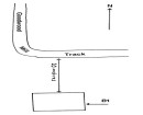
MCINTYRES ROAD MINE SITEVictorian Heritage Inventory
-
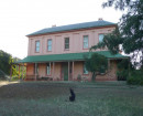
ROBERT AND ELIZABETH LEY HOUSEManningham City
-
ARCHAEOLOGICAL SITEManningham City
-
-