VILLAGE SETTLEMENT
Settlement and Portland Road COLERAINE, Southern Grampians Shire
-
Add to tour
You must log in to do that.
-
Share
-
Shortlist place
You must log in to do that.
- Download report
Statement of Significance
What is significant?
The former Village Settlement (also known as the Hilgay settlement) is an area of 540 acres of land which created 28 farmlets on the southern outskirts of Coleraine. The principal access road is Settlement Road, and about ten houses, dated from the last decade of the 19th century, are scattered along its length. The distinctive features of the Village Settlement subdivision are the circular design of Settlement Road, reminiscent of Garden City design principles, and the proximity of the houses, as the land holdings were small. The settlement developed as a result of the 1890s depression forcing many city dwellers into rural areas as part of charitable schemes, particularly dominated by the Presbyterian Church. The first and only settlers arrived in Coleraine in October 1893 with no equipment or provisions. The theory behind the scheme was to put the destitute poor in a position where they could make a home and a livelihood for themselves and their families. Many of the townspeople donated food, goods and equipment to assist the settlers in their new venture. The Utopian values of the settlement did not thrive, and although the settlement was considered a 'success', it ultimately failed due to the refusal of individual farmers to form the intended co-operative. This meant that some (who had obtained the better land) were able to survive, while those who had taken up the 'inferior' land, or who had very little experience failed, and sought work on surrounding stations in order to survive
How is it significant?
The Village Settlement land is of historical significance to the township of Coleraine and the Southern Grampians Shire.
Why is it significant?
The Village Settlement is of historical significance as it is a physical reminder of the 1890s depression, and the exodus from cities by the unemployed and their families. The land retains several features which indicate the way in which the residents of the settlement lived, subdivisions which break the land up into small farmlets; primitive buildings; water storage and small cottage garden remnants. These are also historically important as they are representative of those who were able to prosper on the settlement. As a wider representation of a charitable movement, the site is also of historical interest.
-
-
VILLAGE SETTLEMENT - Physical Conditions
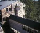
A number of the houses appear to have been abandoned, or are in a neglected state of repair.
VILLAGE SETTLEMENT - Physical Description 1
The Village Settlement is an 1893 subdivision of some 540 acres of land which created 28 farmlets on the southern outskirts of Coleraine. The principal access road is Settlement Road, and about ten houses, dated from the last decade of the 19th century, are scattered along its length. The distinctive features of the Village Settlement subdivision are the circular design of Settlement Road, reminiscent of Garden City design principles, and the proximity of the houses, as the land holdings were small. Many of the farms appear to have been merged in later years to create larger, more economically viable acreages.
VILLAGE SETTLEMENT - Historical Australian Themes
Theme 2: Peopling Australia
2.5 Promoting Settlement
Theme 3: Developing local, regional and national economies
3.5 Developing primary production
3.5.1 Grazing Stock
3.5.3 Developing agricultural industries
3.16 Struggling with remoteness, hardship and failure
3.18 Financing Australia
3.18.4 Cooperating to raise capital
Theme 4: Building settlements, towns and cities
4.1 Planning urban settlements
4.1.1 Selecting township sites
4.4 Living with slums, outcasts and homelessness
4.5 Making settlements to serve rural Australia
4.6 Remembering significant phases in the development of settlements, towns and cities
Theme 5: Working
5.1 Working in harsh conditions
5.1.1 Coping with unemployment
5.8 Working on the land
VILLAGE SETTLEMENT - Usage/Former Usage
Farming and grazing
VILLAGE SETTLEMENT - Integrity
Low.
VILLAGE SETTLEMENT - Physical Description 3
Section B
Heritage Study and Grading
Southern Grampians - Southern Grampians Shire Heritage Study
Author: Timothy Hubbard P/L, Annabel Neylon
Year: 2002
Grading:
-
-
-
-
-
HOLY TRINITY ANGLICAN CHURCH COMPLEX
 Victorian Heritage Register H0246
 -
MECHANICS INSTITUTE
 Southern Grampians Shire
 -
STORE (FORMER) AND BOARDING HOUSE
 Southern Grampians Shire
-
"1890"
 Yarra City
 -
'BRAESIDE'
 Boroondara City
 -
'ELAINE'
 Boroondara City
-
-


