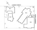
Lethbridge Precinct
LETHBRIDGE, Golden Plains Shire

Statement of Significance
What is significant?
The township of Lethbridge is located on the Midland Highway, approximately 32 kms northwest of Geelong. It was established on land which was part of the Wabdallah Run, part of the greater Golf Hill holdings of the Clyde Company managed by George Russell and adjacent to the Moranghurk Run, established by Peter Sharp and William Sharp. The topography of the township is relatively flat, although the nearby Moorabool River valley located only 2 km to the east is composed of a series of dramatic undulations. The township comprises two formal grids that are aligned to the Midland Highway and the Geelong-Ballarat Railway line respectively. The original site of the Lethbridge township, first known as 'Muddy Water Holes', was aligned to the tracks made by the horse-drawn wagons of early settlers, which followed the route of the present Midland Highway. By the early nineteenth century, this track became the primary transportation route connecting the goldfields of Ballarat to the port of Geelong. The second grid of allotments is located approximately 700 metres to the west of the Midland Highway and was laid out following the construction of the Geelong-Ballarat Railway line in 1858/62. The township was renamed Lethbridge in 1854, after the Railway Engineer who oversaw the construction of the Geelong-Ballarat Railway line.
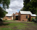
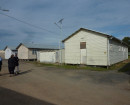
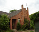
The construction of the Railway Station dramatically reoriented the configuration of the original township and re-focused the commercial, residential and public activities. Important buildings located within this grid include: the Lethbridge Uniting Church and Sunday School Hall; Lethbridge General Store; Lethbridge Public Hall. The Lethbridge Lake and Recreation Reserve is fed by Bruce's Creek and features a public swimming hole, BBQ shelters and the former Railway Water Tank. This site was originally gazetted as a Railway Reservoir to supply water for steam engines required to take on water at Lethbridge station. The prosperity experienced by the township as a commercial centre servicing surrounding pastoral properties and trade generated during the gold rush and the construction of the railway line has since diminished. The township has experienced a decline in commercial activity and population. The township of Lethbridge remains substantially intact and the surviving buildings and infrastructure from a range of periods retain a high degree of integrity and are in good condition.
How is it significant?
The township of Lethbridge is of historical, architectural and social significance to the Golden Plains Shire.
Why is it significant?
The township of Lethbridge is of historical significance as one of the earliest settlements established along the major trade route linking the port of Geelong to the interior of Victoria and the Ballarat Goldfields. Surviving buildings and infrastructure also reflect its prominence as a commercial centre servicing trade generated from the railway and surrounding pastoral properties. Lethbridge is of architectural significance for its range of civic infrastructure and building types dating from the nineteenth and early twentieth centuries. Lethbridge is of social significance as the focus of community activities and as a representation of the inter-relationship between pastoral, mining, agricultural and viticultural industries.
-
-
-
-
Road Bridge, Lethbridge
 Golden Plains Shire
 -
Lethbridge Railway Station
Golden Plains Shire
-
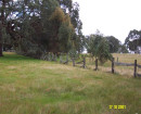
Moranghurk
Golden Plains Shire
-
-