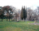
MALMSBURY POST OFFICE ROAD.
BAKER STREET MALMSBURY, MACEDON RANGES SHIRE
-
Add to tour
You must log in to do that.
-
Share
-
Shortlist place
You must log in to do that.
- Download report
Statement of Significance
This record has minimal details. Please look to the right-hand-side bar for any further details about this record.
-
-
MALMSBURY POST OFFICE ROAD. - History
Heritage Inventory History of Site: This road is now known as Malmsbury Post Office Road, and also as Elphinstone Access Road. However, the accounts of the Lausiston and Edgecombe District Road Board do not record any money spent on a road with either of these names, although most of the names recorded in these accounts are no longer used today. It is likely, however, that this road dates to the early days of Malmsbury. The earliest cadastral plans show this road extending north to meet with a road that ran from Elphinstone to the Barfold diggings during the 1850s and 1860s. Today the road ends approximately 800 metres south-east of the "Limestone" property. This road would have provided access to several houses that are now abandoned.Heritage Inventory Description
MALMSBURY POST OFFICE ROAD. - Heritage Inventory Description
A cobbled roadway, approximately 3 metres wide. The surface is of cobbles of various sizes set between larger curbing stones.
Heritage Inventory Significance: Low archaeological significance (4). Of high regional historical significance, as this is a well preserved and extensive section of rural cobbled highway.
Recorded by: Vincent Clark. Date Recorded: September 1998 Heritage Inventory Site Features: Cobbled road surface.
-
-
-
-
-
MORDEN
 Victorian Heritage Inventory
 -
ROLLINSONS ROAD HOUSE SITE
 Victorian Heritage Inventory
 -
MALMSBURY POST OFFICE COBBLED ROAD AND WALL
 Victorian Heritage Inventory
-
-


