CRUSOE 1930S MINING AREA
CRUSOE ROAD KANGAROO FLAT, GREATER BENDIGO CITY
-
Add to tour
You must log in to do that.
-
Share
-
Shortlist place
You must log in to do that.
- Download report
Statement of Significance
This record has minimal details. Please look to the right-hand-side bar for any further details about this record.
-
-
CRUSOE 1930S MINING AREA - History
Heritage Inventory History of Site: 1930s mining activities
CRUSOE 1930S MINING AREA - Interpretation of Site
Heritage Inventory Interpretation: Remnant mining features associated with re-working of the area for gold deposits during the depression. David Bannear has inspected this site and considers these features to be of low/moderate historic significance and low archaeological significance.
Heritage Inventory Description
CRUSOE 1930S MINING AREA - Heritage Inventory Description
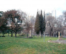
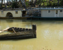
Site comprises a shallow earthen aquaduct that follows the contour line of a creek to the north. The aquaduct is largely intact though it has been destroyed by later activities in several places. There is also a small dam. Both features are common throughout the area.
Heritage Inventory Significance: Low local historical and low historic archaeological significance.
Heritage Inventory Site Features: Aquaduct, dam Heritage Inventory Key Components: Earthen water race 100 x 50 cm that winds through the reservoir.Small dam, 10 x 10m.
Archeological Potential: Potential (area),Remnant Structure
-
-
-
-
-
COLIBAN WATER SUPPLY SYSTEM
 Victorian Heritage Register H1021
 -
COLIBAN WATER SUPPLY SYSTEM
 Victorian Heritage Inventory
 -
CRUSOE 1930S MINING AREA
 Victorian Heritage Inventory
-
-


