448 Canning Street
448 Canning Street, CARLTON NORTH VIC 3054 - Property No 286425
North Carlton Precinct
-
Add to tour
You must log in to do that.
-
Share
-
Shortlist place
You must log in to do that.
- Download report

Statement of Significance
Precinct statement of significance
Component streets include:
Amess Street, Birdsall Place, Canning Street, Curtain Street, Davids Lane, Davis Street, Drummond Lane, Drummond Street, Earl Street, Fenwick Street, Fletcher Lane, Henry Street, Herbert Street, Hughes Street, Lee Street, Lygon Street, Macpherson Street, Mary Street, Newry Street, Nicholson Street, Ogrady Street, Park Street, Pigdon Street, Princes Street, Rathdowne Street, Reserve Street, Richardson Street, Shakespeare Street, Station Street, Sutton Street.
Statement of Significance
What is significant?
Survey patterns
Land that was to become North Carlton and Princes Hill, developed from the 1850s as an outpost of Melbourne Town, with a blue stone quarry reserve, an associated penal station, and the Melbourne General Cemetery as the main attributes set among native woodland.
North Carlton (66) was surveyed in 1869 (67) as an extension for Melbourne's residential suburbs. The new half-acre blocks extended as far as Fenwick St, continuing the north-south grid of Carlton, with 30 metre frontage allotments served by generous 20 and 30 metre wide government roads. Reserves were set aside for public buildings and gardens. The renowned surveyor, Clement Hodgkinson, was the initiator of the 1869 North Carlton plan, as head of the Crown Lands and Survey Department (68).
In 1876 the balance of North Carlton, north of Fenwick St (approximately 173 acres), was subdivided into small suburban lots typically with 15 metre frontages but each was provided with the Victorian-era amenity of rear service lanes, separating utilitarian household functions such as coal and other deliveries, nightsoil cartage and stabling, from the formal house facade. The 30m wide roads of Drummond, Rathdowne and Canning Streets were also continued north. The subdivision led to a distinctive form of housing development where closely spaced, sometimes richly decorated, houses are viewed over low formally arranged front gardens and fences, forming a continuous and distinctive residential Victorian-era streetscape.
The extension of the Melbourne Building Act in 1872 to cover all of the Melbourne municipality ensured fire proof regulated construction and promoted a more homogenous built character for North Carlton (69).
Transport
Public transport which was at first a horse-drawn omnibus service along Nicholson St to the city, stimulated development in Canning and Station Streets where standard pattern terrace housing predominated. With the population growth came the first government primary school (opened 1873, later replaced by the Lee St Primary School, 1878 (70), shops, shop rows, and corner hotels.
The 1883 announcement of Rathdowne and Nicholson Sts as future cable tram routes meant an explosion of dense residential development of terrace housing in almost every street north to Park Street. In 1887-8 new cable tram and Inner Circle railway services gave this area perhaps the best access to public transport of any Victorian-era inner Melbourne suburb: rows of shops and residences were built along the tram routes. At the cable tram terminus in Nicholson St, adjoining the North Fitzroy Inner Circle railway station, a major shopping centre developed with grand shop rows, extending from Macpherson to Park Streets. Then at the fringe of suburbia, northern sections of Canning and Drummond Sts were popular for larger, detached late Victorian houses that might have been served by private transport in the form of stabling. The Inner Circle passenger train link to the Melbourne (Princes Bridge) was completed in 1901 and operated until 1948 which explains the popularity of North Carlton in the Edwardian and Interwar eras.
Landscape
Significant public landscape in the area is both early, in the form of Curtain Square with its Victorian era residential perimeter, and residual, such as the linear park along the former Inner Circle railway in Park St. Significant street trees include median planting of Drummond St (mature poplars) and Canning St (mature palms alternating with poplars), more recent median planting of exotic trees along the line of the former cable tram route in Rathdowne Street(pin oaks), and the plane trees along the centre of Newry St. Small front gardens in the dominant terrace housing of the suburb make up most of the private landscape, including typically low and visually transparent iron and masonry fences, ornamental borders to garden beds, and paved paths and verandah floors: all often highly decorative.
These living landscape elements along with the hard landscape of the street and its fittings, such as the stone paving and cast-iron street furniture, reinforce the strong sense of period in the suburb.
Main development phases
Post 1900, infilling of North Carlton's vacant sites proceeded quickly and by about 1915 the suburb was virtually complete, with religious and educational buildings, and government services following each development surge.
The suburb, once developed, was almost entirely residential with some factory-warehouse development after 1900 serving the commercial development in Nicholson and Rathdowne Streets.
As a result North Carlton is a highly homogenous 19th and early 20th century residential suburb largely occupied by dense terrace development, set within a rigid rectilinear grid of north-south and east-west streets, served by rear lanes as an obligatory feature of polite suburban life of the era. Early and original rear outbuildings are an integral feature of the Victorian and Edwardian era character of North Carlton and are of particular historic significance where houses are on corner allotments where their outbuildings are exposed to public view.
Immigration
As a dense residential enclave close to Melbourne, employment centres, and the metropolitan public transport hub, North Carlton has also shared in the accommodation role of other inner suburbs, absorbing waves of immigration into aged but cheap housing stock and developing specific ethnic attributes, among the existing Victorian and Edwardian-era infrastructure, with each successive immigration wave.
Traces of the Jewish (71), Greek, Italian (72), Lebanese and Turkish communities that settled in the suburb are still evident. Their community gathering places include those for the Serbian Orthodox, and Ukrainian Orthodox Church communities, the 1932-3 Kadimah (former Jewish centre), St. John the Baptist's Greek Orthodox Church, and the more recent Mosque in Drummond Street. Often they occupy the Victorian-era Christian buildings.
Beyond the meeting places are the distinctive house renovations that transformed the Victorian-era Italianate into a form of post WW2 Italianate. Examples of these have been documented by the National Trust of Australia (Vic) (73): all of these places are important milestones in North Carlton's development as a reception centre for immigrants.
Main development era
The main development period evident in the heritage overlay is that of the Victorian and Edwardian-periods. There is also a contribution from well preserved inter-war buildings, documented examples of immigrant meeting places and house renovations, and individually significant places of all eras.
Contributory elements
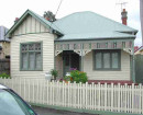
Contributory buildings or elements in the North Carlton Heritage Overlay Area (HO326) include typically (but not exclusively) attached and some detached Victorian-era and Edwardian-era one and two-storey house groups and rows having typically:
. Pitched gabled or hipped roofs, mainly set behind facade parapets,
. Face brick (red, dichrome and polychrome) or stucco walls;
. Corrugated iron roof and slate roof cladding, with some Marseilles pattern unglazed terra-cotta tiles;
. Chimneys of either stucco finish (with moulded caps) or of matching face brickwork with corbelled capping courses;
. Post-supported verandah elements facing the street, set out on two levels as required, with cast-iron detailing;
. Less than 40% of the street wall face comprised with openings such as windows and doors; and
. Front gardens, originally bordered by typically timber or iron picket front fences of around 1m height;
. Some face brick (typically red brick) stables with lofts at the rear of the larger houses, and brick privies, all set on rear lanes; also
. Corner shops and residences with display windows and zero boundary setbacks.
Contributory elements also include attached Victorian-era and Edwardian-era mainly two-storey shop and residence rows in the major north-south streets, having typically:
. Facade parapets, with pitched roofs behind;
. Face brick (red, dichrome and polychrome) or stucco walls;
. Corrugated iron and slate roof cladding;
. Chimneys of either stucco finish (with moulded caps) or of matching face brickwork with corbelled capping courses;
. Post-supported, mainly Corporation Style iron street verandahs as shown on the MMBW Detail Plans (74);
. Less than 40% of the street upper wall face taken up with openings such as windows;
. No front or side setbacks; also
. Timber framed display windows and entry recesses.
Contributory elements also include:
. Well preserved buildings including one storey houses and industrial buildings from the pre Second War era;
. Curtain Square, as a typical Victorian-era Garden Square, with mature exotic formally arranged planting;
. Mature street and park tree plantings (fig, palms, plane and elm trees);
. Regular rectilinear allotment layout, street patterns and widths;
. Provision of some public and church reserves in the town plan;
. Public infrastructure, expressive of the Victorian and Edwardian-eras such as bluestone pitched road paving, crossings, stone kerbs, and channels, iron bollards and gas lamp bases, and asphalt paved footpaths.
How is it significant?
North Carlton Heritage Overlay Area (HO326) is aesthetically, socially and historically significant to the City of Yarra (National Estate Register [NER]Criteria E1, G1, A4)
Why is it significant?
The North Carlton Heritage Overlay Area is significant:
. For its association with Melbourne's early history, as seen in the former Collingwood Stockade quarry reserve sites (such as Curtain Square), and the Penal Station (later the Lee St. Primary School site).
. As a demonstration, in plan form (south of Fenwick St), of 1869 urban design and the formal aesthetic of colonial urban planning for orderly development and suburban amenity within Melbourne's 5-mile township reserve, with the wide streets and intersections (laid out in a north south grid) providing a superb framework for the ornamental, highly cohesive built form of the precinct, with its intact 19th century terraces, corner shops, hotels, and the plan's provision for public, garden and religious building reserves, all enhanced by the adjoining public landscape of the Melbourne General Cemetery;
. For the association with Clement Hodgkinson, the initiator of the 1869 North Carlton plan, who was head of the Lands and Survey Department and an important figure in the development of Melbourne's inner-urban suburbs, parks, and 19th century infrastructure;
. For the historical importance of the 1876 government subdivision (North of Fenwick St) for its deliberate inclusion of much smaller, affordable allotments in order to capture the rising market of small investors, then aided by Building Society finance. This yielded the rapidly built, dense Boom-era terrace housing, and the later similarly dense attached Edwardian housing. No parks or reserves for religious use were provided;
. For inclusion in this subdivision of larger, 1/2 acre allotments, as elevated sites along the wide streets of Lygon, Drummond and Park Sts. The residual adjacent quarry-damaged areas delayed the sale and development of these allotments such that they became superb sites for large detached inter-war villas;
. For the representation in the subdivisions of the conventions of Victorian and Edwardian life where utilitarian features such as coal sheds, privies, stables/garages, rubbish containers, vehicular entrances or driveways, were concealed off lanes from public view;
. For the early engineering and infrastructure such as the strict grid formation of street, lane and allotment layouts, dressed bluestone kerbs, pitched bluestone guttering, lanes and crossovers, asphalt footpaths and roads, and the presence of formally planted street trees which provided an important setting for a fine collection of residential, community and commercial buildings;
. For the high aesthetic value of the precinct as evident in the continuous rows of similarly designed Victorian and Edwardian-era architecture, the regular street pattern and wide north south streets;
. For the valuable landscape features such as Curtain Square, with its monuments and large trees, views to the Melbourne General Cemetery, the formal 20th century European tree and palm plantations in Drummond, Canning, and Rathdowne Streets, and plane trees planted in Newry and Nicholson Streets, plus important private gardens;
. As a highly intact example of a residential suburb built substantially between 1868 and c1915, reflecting well the 1880-1891 Boom era and the Federation recovery period of 1900-1915, a fine physical illustration of its major development period, with shops and hotels built on corners to the residential streets, providing Victorian-era, pre motor car convenience within walking distance;
. As evidence of the effect on development of public transport in the form of cable trams in Nicholson and Rathdowne Sts, and the Inner Circle Railway (1888) that promoted dense, rapid development of the precinct and the distinctive late Victorian commercial shopping strips in these streets;
. As the largest and most cohesive collection of small Victorian and Edwardian terrace and attached housing forms of any suburb in the State, with many small row houses and pairs sited in the longer, narrower streets of the 1876 northern subdivision;
. For the many examples of grandiose terrace housing, contrasting with the simplicity of the less common early terrace forms;
. For the important landmark buildings and community focal points in the locality that include public buildings such as the Lee St Primary School,19th century churches and halls, corner shops and hotels, and the 20thcentury meeting places for immigrants, including Serbian Orthodox, Ukrainian Orthodox Church communities, the 1932-3 Kadimah (former Jewish centre), St. John the Baptist's Greek Orthodox Church, and the more recent Albanian Mosque in Drummond Street; and
. For the individually significant buildings from all eras and well preserved building examples, from pre World War Two, that express a rich assembly of architectural design within the characteristics of Victorian and Federation-era residential styles, some factories and warehouses, Moderne style flats, and large inter-war villas.
References
66 north of Princes St, also known as `Collingwood Stockade' and later lunatic asylum
67 Yule (ed): 25 cites Parish plan dated 16 November 1869, with notes that sales were to start Jan 1870
68 From 1860, Clement Hodgkinson was appointed the administrative head of the Lands Department, and displayed a strong interest in the planning and development of Melbourne's suburbs and parks. 1861- 1874 Clement Hodgkinson was the Victorian Assistant- Commissioner of Crown Lands and Survey.
69 Yule (ed): 447
70 also known as North Carlton Primary or State School
71 Yule (ed): 59, 72-73, 304 Jewish influx 1880s-90s inner city, 1920s-50s Carlton centre of State population until WW2; Italians, Greeks, Turks, Lebanese main phase 1950s-60s, Carlton as `Little Italy' by 1960, peak 28.5% of Nth Carlton population by 1971, also growth inter-war
72 Yule (ed): 476 1920s wave as escape from fascism, post WW2 wave
73 see Yule (ed): 473 A Willingham
74 See MMBW Detail Plan 1196 of 1899
-
-
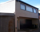
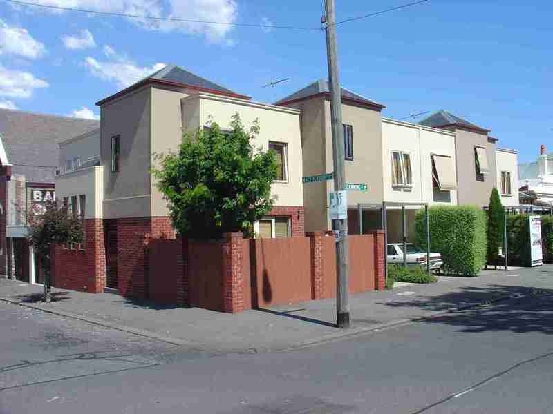
448 Canning Street - Physical Description 2
Previous C2 graded Edwardian-era Baptist Church outbuildings- demolished; infill; architect designed
448 Canning Street - Integrity
Good
Heritage Study and Grading
Yarra - Carlton, North Carlton and Princes Hill Conservation Study
Author: Nigel Lewis and Associates
Year: 1984
Grading:Yarra - City of Yarra Heritage Review
Author: Allom Lovell & Associates
Year: 1998
Grading:Yarra - City of Yarra Review of Heritage Overlay Areas
Author: Graeme Butler & Associates
Year: 2007
Grading: No Signif.
-
-
-
-
-
CAMBRIDGE TERRACE
 Victorian Heritage Register H1606
 -
TERRACE
 Victorian Heritage Register H0076
 -
TERRACE
 Victorian Heritage Register H0078
-
1 Curtain Street
 Yarra City
 -
10 Forest Street
 Yarra City
 -
10-22 Taplin Street
 Yarra City
-
-


