Back to search results
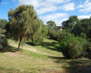
FORD RUINS
695 CRAIGIEBURN ROAD WOLLERT AND 715 CRAIGIEBURN ROAD CRAIGIEBURN, WHITTLESEA CITY, HUME CITY
FORD RUINS
695 CRAIGIEBURN ROAD WOLLERT AND 715 CRAIGIEBURN ROAD CRAIGIEBURN, WHITTLESEA CITY, HUME CITY
All information on this page is maintained by Heritage Victoria.
Click below for their website and contact details.
Victorian Heritage Inventory
On this page:
Statement of Significance
Data has been updated as a result of the Outer Western Metro Project, Context, March 2010.
Show more
Show less
-
-
-
-
WHITTLESEA 5
 Victorian Heritage Inventory
 -
FORD RUINS
Victorian Heritage Inventory
-
Craigieburn War Memorial
 Vic. War Heritage Inventory
-
-