Back to search results
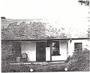
SOLOMONS FORD
CANNING STREET AVONDALE HEIGHTS AND DUKE STREET SUNSHINE NORTH AND BRAYBROOK, MOONEE VALLEY CITY, BRIMBANK CITY, MARIBYRNONG CITY
SOLOMONS FORD
CANNING STREET AVONDALE HEIGHTS AND DUKE STREET SUNSHINE NORTH AND BRAYBROOK, MOONEE VALLEY CITY, BRIMBANK CITY, MARIBYRNONG CITY
All information on this page is maintained by Heritage Victoria.
Click below for their website and contact details.
Victorian Heritage Inventory
On this page:
Statement of Significance
This record has minimal details. Please look to the right-hand-side bar for any further details about this record.
Show more
Show less
-
-
-
-
SOLOMONS FORD
 Victorian Heritage Inventory
 -
Solomon's Ford
 National Trust
 -
Maribyrnong River
National Trust
-
-