Trestle Bridge Arundel Road Bridge
Arundel Road, KEILOR VIC 3036 - Property No 12
Keilor Market Gardens Cultural Landscape
-
Add to tour
You must log in to do that.
-
Share
-
Shortlist place
You must log in to do that.
- Download report


Statement of Significance
The Arundel bridge is significant at the State level as the earliest and probably the most visually prominent and notable public work which survives to testify to the importance of the Closer Settlement Act in influencing settlement in Victoria. The Arundel Road bridge is significant as an intact and good representation of an all-timber, trestle bridge common at the beginning of this century. Very few examples of this type of bridge now remain and its location close to the metropolitan area makes it particularly unusual. It is also important for its associations with the Closer Settlement schemes of the early twentieth century. It would appear that the bridge may have been the first major public work completed under the Closer Settlement Act, 1904. The only other expenditure listed in the Board's 1905-7 Reports was the contribution of £1,341 to the construction of levee banks on the Wyuna irrigation estate. A further advantage of this site is its close proximity to a number of other bridges of varying ages and diverse forms of construction, including a wrought iron girder bridge (1868) also over the Maribyrnong River. This should make the area of considerable interest for bridge engineers.
Precinct statement of significance::
The market gardens of Keilor are of regional historical significance as they are associated with the beginnings of irrigated horticulture in Victoria and have been continuously cultivated since the mid nineteenth century. The landscape is of regional significance as an expression of the early and long- lived farming practices adapted to the richer soils of the river terraces. The farms themselves also have long links with local families, such as the Milburns and Senserricks, and the pattern of houses and farm buildings reflect the original population distribution.
-
-
Trestle Bridge Arundel Road Bridge - Physical Description 1
Description
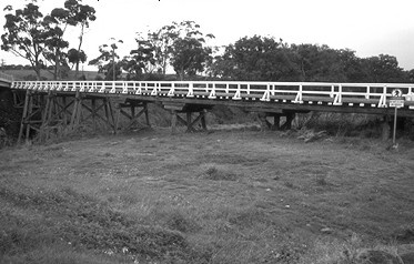
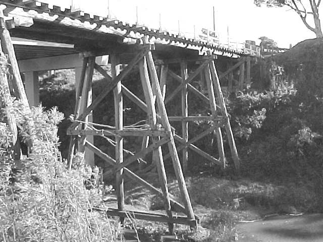
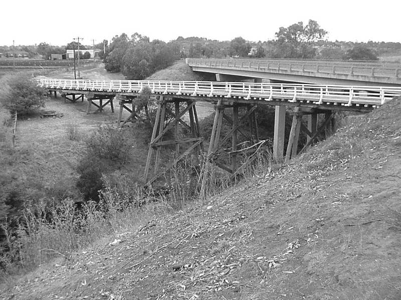
Timber trestle bridge constructed from eucalypt tree poles consisting of nine timber beam spans on timber trestle piers. The bridge slopes from the high bank on the north down to the Keilor side of the river where a high earth embankment forms the approach on the flood plain. It has a total length of 72 m. and a roadway width of 3.7 m. the greatest span is 30 ft. (9.1m.) Sawn timber handrails and decking have probably been replaced over the years and longitudinal running planks have been laid. Additional piles on each end of the piers were added to increase its stability. A new concrete bridge has been built immediately up-stream and the trestle bridge no longer takes vehicle traffic. Although its condition had deteriorated, as expected in a timber bridge of this age, the bridge remained open to traffic until the construction of a new bridge alongside it in 1989. Some major maintenance work was carried out in 1977-78. The bridge has undergone little change in its life, apart from the installation of longitudinal planks over the original transverse deck planks and the addition of extra piles on each end of the piers in the river to improve its stability against floods and as compensation for deterioration of the original piles. Since its closure, it has been left unsecured and neglected and there has been substantial vandalism of its superstructure during 1991, including the removal of planking and rails. Substantial interest in its preservation by local and State bodies and the Council encouraged a structural appraisal to determine options and costs for its preservation, and Council reconsidered its 4 June 1991 decision to demolish the bridge, instead finding funding for its restoration in 1996-7.
Condition/Integrity
In good condition. However, the bridge deteriorated following closure and subsequent vandalism of its superstructure during 1991, including the removal of planking and rails. Local council and Government funding led to its restoration in 1996-7. It is now used for pedestrian traffic.
Trestle Bridge Arundel Road Bridge - Physical Conditions
In good condition. However, the bridge deteriorated following closure and subsequent vandalism of its superstructure during 1991, including the removal of planking and rails. Local council and Government funding led to its restoration in 1996-7. It is now used for pedestrian traffic.
Trestle Bridge Arundel Road Bridge - Historical Australian Themes
3 Developing local, regional and national economies
3.8 Moving goods and peopleHeritage Study and Grading
Brimbank - Brimbank City Council Post-contact Cultural Heritage Study
Author: G. Vines
Year: 2000
Grading: StateBrimbank - Melbourne Western Region Industrial Heritage Study
Author: G. Vines & A. Ward
Year: 1989
Grading:
-
-
-
-
-
TRESTLE BRIDGE
 Victorian Heritage Register H1952
 -
Keilor Market Gardens Cultural Landscape
 Brimbank City
 -
Arundel Farm
 National Trust
-
'Aqua Profonda' sign wall sign, Fitzroy Swimming Pool
 Yarra City H1687
 -
'DRIFFVILLE'
 Boroondara City
 -
1 Sydney Road, Brunswick
 Merri-bek City
-
-


