VICTORIA FALLS HYDRO-ELECTRIC POWER STATION
VICTORIA FALLS ROAD COBUNGRA, EAST GIPPSLAND SHIRE
-
Add to tour
You must log in to do that.
-
Share
-
Shortlist place
You must log in to do that.
- Download report

Statement of Significance
What is significant?
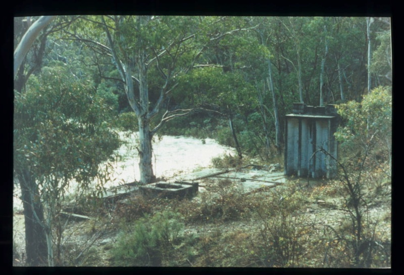
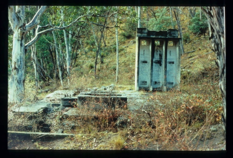
The Victoria Falls Hydro-Electric Power Station was constructed by the Cassilis Gold Mining Company on the Cobungra River, just below the Victoria Falls. It is the site of Victoria’s earliest large-scale hydro-electric power scheme constructed for gold mining purposes. Power was generated through a Pelton wheel. The scheme was completed in 1907, and by 1909 all steam engines at the mine in Power’s Gully at Cassilis had been replaced with electric motors. The power station operated until the mine closed in 1916. The machinery from the power station was sold and removed to Tasmania where it continued it involvement with the mining industry. The significant visible components of the site are:
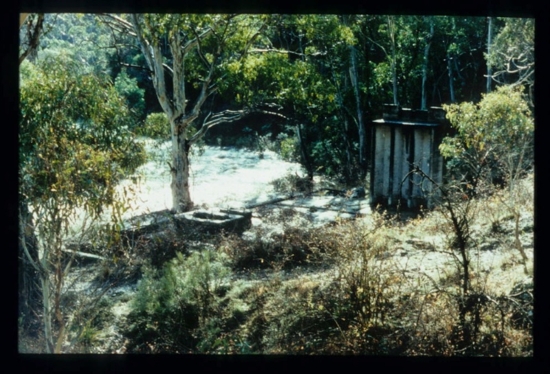
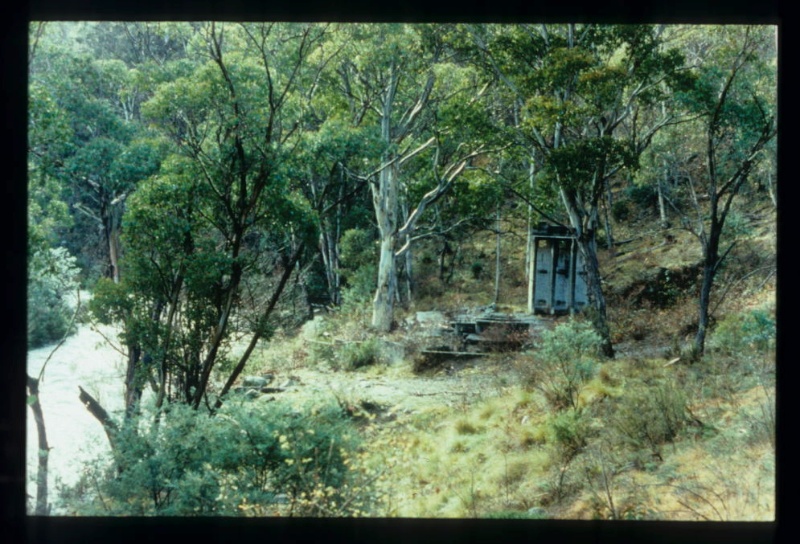
* Concrete and stone foundations of the power station.
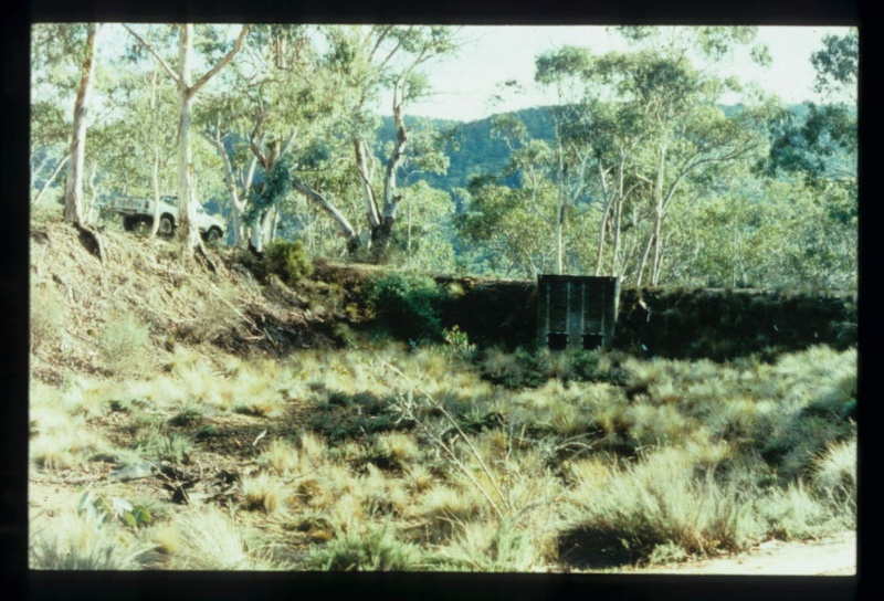
* Settling dam with masonry outlet
* Pipeline route
How is it significant?
The Victoria Falls Hydro-Electric Power Station is of historical and technological significance to the State of Victoria.
Why is it significant?
The Victoria Falls Hydro-Electric Power Station is historically important due to its association with the construction of Victoria’s earliest gold related hydro-electric scheme. The gold mine was located at Cassilis, 27kms away.
The Victoria Falls Hydro-Electric Power Station is of technological importance for the survival of a range of foundations and earthworks that illustrate all aspects of the underlying technology. No other site of its age and type retains this evidence. The site is archaeologically important for its potential to yield artefacts and evidence which may be able to contribute to an understanding of the use of hydro electric power in Victoria.
[Source: Victorian Heritage Register]
-
-
VICTORIA FALLS HYDRO-ELECTRIC POWER STATION - History
Heritage Inventory History of Site: In 1907, the Cassilis GMC constructed a hydro-electric power station on the Cobungra River, about 6.5 km from its junction with the Victoria River, just below the Victoria Falls. Water from Victoria River was delivered to the power station by a race built along the spur separating the Cobungra and Victoria Rivers. The race was unlined and measured 3 ft deep, 4 ft wide at the bottom, and 7 ft wide at the top. It filled a settling dam at the top of the spur, from which point water was delivered to the power plant by 1650 ft of piping, which reduced in size from 34 inches to 38 inches diameter. The powe station was equipped with a Voith pelton wheel, and began operating in 1908. A power line ran between the power station and the Cassilis mine, a distance of some 27 km.A holding dam of 250 million-gallon capacity was to have been constructed on the Victoria River, at the commencement of the water race, but this was not done. As a result, an insufficient supply of water caused frequent power shortages and stoppages at the Cassilis mine. The power station's poor performance was largely to blame for the ultimate closure of the Cassilis mine in 1916. Early in that year, a dam was built above the power plant, but the first substantial rains washed it away. The power plant was sold to a Tasmanian silver mine in 1917.Heritage Inventory Description
VICTORIA FALLS HYDRO-ELECTRIC POWER STATION - Heritage Inventory Description
Features include concrete floor and footings, tower, settling dam, pipeline site and former water race. Forms network with Cassilis GMC treatment works-Victoria Falls hydro-electric power station
Heritage Inventory Significance: National EstateScientific significanceùrange of features in network
Heritage Inventory Site Features: Power stationùA concrete floor (48 ft x 32 ft) with mounting beds, etc., for a large pelton wheel, and a concrete tower. The tower (11 ft x 5 ft x 12 ft high) has three cubicles, which housed the choke coils. The largest mounting bed (10 ft x 6 ft, 2 ft high, with 1¢ft-thick walls) has a 7ft-deep sump from which runs a 4ft-wide, 3ft-deep culvert which drains to the river. The pelton wheel has been removed from the site. Settling damùAn oval-shaped dam, measuring approximately 40 m x 25 m, is located at the top of the spur overlooking the power station. The dam has a large concrete outlet station (9 ft x 6 ft, with 1ft-thick walls) which has a 16ft-deep sump.PipelineùAn overgrown channel running down the spur marks the position of the pipeline which ran from pressure dam to generating plantWater raceùThe old water race from Victoria River to the power station now forms the road to the Victoria Falls
-
-
-
-
-
VICTORIA FALLS HYDRO-ELECTRIC POWER STATION
 Victorian Heritage Register H1942
 -
VICTORIA FALLS HYDRO-ELECTRIC POWER STATION
 Victorian Heritage Inventory
-
-


