PIONEER CO
49 LINTON-NARINGHIL ROAD LINTON, GOLDEN PLAINS SHIRE
-
Add to tour
You must log in to do that.
-
Share
-
Shortlist place
You must log in to do that.
- Download report
Statement of Significance
This record has minimal details. Please look to the right-hand-side bar for any further details about this record.
-
-
PIONEER CO - History
Contextual History:History of Place:
Heritage Inventory History of Site:
PIONEER COMPANY
22.08.1860: still hard at work getting everything in order for a fair start; they expect to have the lifts all in next week, and from the large size of the pipes and the powerful engine, they will soon beat the water.
11.1860: bottomed at 100 feet; using the depths of the Edinburgh it appears that the company has another 26 feet to sink.
03.1861: driving east for the lead.
06.1861: have not yet found anything of a payable nature.
08.1861: getting nothing.
10.1861: very poor at 2 ozs per machine.
11.1861: to be let on tribute for a three month trial, if unsuccessful then the company will be wound up.
12.1861: operations have ceased after a long struggle and the expenditure of £8000.
(now called the Phoenix Co.)
15.08.1862: seem likely to be rewarded for their long and expensive labours, are now in the wash and gold can be seen in every bucket.
(new company - June 1881)
06.1881: erecting machinery.
LINTON PARK CO.
12.1865: returns are satisfactory.
06.1881: the only deep lead company at Lintons actually working.
1890: the Linton Park Co., originally the Pioneer, finally closed; the last party that worked in the mine was a Chinese tribute party.Heritage Inventory Description
PIONEER CO - Heritage Inventory Description
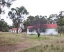
A large site which has been substantially altered by the removal of nearly all the quartz wash heaps. The majority of the three fingered mullock heap is still intact. Half of the western finger of mullock has been removed, and the west side of the tip of the other two fingers appear to be eroding. The largest finger of the mullock heap is 70m by 15m by 8m high, a second finger 40m by 15m by 8m high branches off from the western side of the first finger. The third finger of mullock 25m by 12 mby 4m high begins from the same starting pointing as the first finger, adjacent to the shaft which is now just a depression. The remains of the quartz wash heaps are spread over an area approximately 75m by 50m. A plantation of mature pines separates the mine from the nearby houses.
Heritage Inventory Signficance: Local
-
-
-
-
-
EDINBURGH CO NO.2 SHAFT
 Victorian Heritage Inventory
 -
DEEP LEAD MINE
 Victorian Heritage Inventory
 -
ATLAS CO
 Victorian Heritage Inventory
-
-


