COBBLEDICKS FARMHOUSE RUIN SITE
DUKELOWS ROAD WYNDHAM VALE, WYNDHAM CITY
-
Add to tour
You must log in to do that.
-
Share
-
Shortlist place
You must log in to do that.
- Download report
Statement of Significance
This record has minimal details. Please look to the right-hand-side bar for any further details about this record.
-
-
COBBLEDICKS FARMHOUSE RUIN SITE - History
Site taken up by Samuel Cobbledick in the earlyy 1860s. The farmhouse was built soon afterl A 1935 auction notice describes the site as including a 4 room bluestone house, large milking shed, necessary out buildings on rich river flats suitable for dairying and mixed farming. The first instances of foot and mouth diseas in Australia were reported at the farm in 1872.COBBLEDICKS FARMHOUSE RUIN SITE - Interpretation of Site
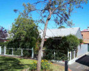
Site is a farm house ruin and remains of a dairy complex. Part of the site has been cleared/ disturbed to the north of the ruin. It appears that a structure was located in this area. No standing structures other than the house ruin remain.
COBBLEDICKS FARMHOUSE RUIN SITE - Archaeological Significance
Cobbledicks Farmhouse Ruin is of archaeological significance for the ptoential to provide further information about the place and its use and early farming practices in the region. The ruin maintains a high degree of integrity and a medium level of intactness. The area to the north of the site contains a pile of building rubble and artefacts that have been pushed to the edge of the slope. There is potential for subsurface evidence to remain on site associated with the use of the place.
COBBLEDICKS FARMHOUSE RUIN SITE - Historical Significance
Cobbledicks Farmhouse Ruin is of local historical significance for its association with local farmer Samuel Cobbledick. The site is important as it represents the early farming phase in the development of the area. The site is important as the first instances of foot and mouth disease in Australia were recorded there in 1872.
Heritage Inventory Description
COBBLEDICKS FARMHOUSE RUIN SITE - Heritage Inventory Description
Site is located on south and east side of Werribee River on river flats and on top of a ridge adjacent the river. Comprises bluestone ruin of a house; artefact scatters; drystone walls; rows of coppiced sugar gums; piles of stones; collapsed windmill and water pipes. The area to the north of the ruin along the ridge has been disturbed.
[Assessed for the Outer Western Metro Site Reassessment Project - Melton & Wyndham, March 2010]
-
-
-
-
-
MOUNT COTTRELL SCHOOL SITE
 Victorian Heritage Inventory
 -
COBBLEDICK'S FORD
 Victorian Heritage Inventory
 -
Werribee River
 National Trust
-
-


