Back to search results
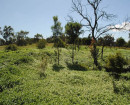
COBBLEDICK'S FORD
1200 COBBLEDICKS FORD ROAD MOUNT COTTRELL, WYNDHAM CITY
COBBLEDICK'S FORD
1200 COBBLEDICKS FORD ROAD MOUNT COTTRELL, WYNDHAM CITY
All information on this page is maintained by Heritage Victoria.
Click below for their website and contact details.
Victorian Heritage Inventory
On this page:
Statement of Significance
1862 ford paving, important river crossings between Melbourne and Werribee plains. Surrounding reserve has also been an important public recreation reserve since the 1860s. High local significance.
Show more
Show less
-
-
-
-
MOUNT COTTRELL SCHOOL SITE
 Victorian Heritage Inventory
 -
COBBLEDICKS FARMHOUSE RUIN SITE
Victorian Heritage Inventory
-
Werribee River
 National Trust
-
-