LAND BOOM JETTY AND PIVOT PIER
THE ESPLANADE AND SEA BREEZE PARADE NORTH SHORE, GREATER GEELONG CITY
-
Add to tour
You must log in to do that.
-
Share
-
Shortlist place
You must log in to do that.
- Download report
Statement of Significance
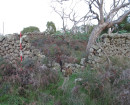
Used for first land sales in this area to attract buyers to the area. Later used by Pivot fertilisers for loading produce. Only example sighted of a stone access jetty in this area
-
-
LAND BOOM JETTY AND PIVOT PIER - History
The jetty/ pier is marked on various charts dating from 1915 – 1930, and it is still listed as “the Phosphate Jetty” on another map for that year. The pier is still shown on a 1950s map. The pier is not shown on plans after this time, and local sailing directions record the pier as ruinous in 1959. A local resident, Rob Craddock, remembers a short pier at this site many years ago, which he used to fish from.LAND BOOM JETTY AND PIVOT PIER - Interpretation of Site
Two phases of construction. Sandstone pier built as a landing originally, and was probably later extended with a pier by Pivot for loading fertiliser.
Heritage Inventory Description
LAND BOOM JETTY AND PIVOT PIER - Heritage Inventory Description
Dressed sandstone jetty and seawall. Timber pier piles, both on shore and in water
Probable archaeological deposits associated with jetty/pier use (discard and lost items)
Probable structural remains - stone jetty, timber piles
Archeological Potential: Good
-
-
-
-
-
LAND BOOM JETTY AND PIVOT PIER
 Victorian Heritage Inventory
 -
LASCELLES WHARF
 Victorian Heritage Inventory
 -
NORTH SHORE BATHS
 Victorian Heritage Inventory
-
-


