Back to search results
Ranelagh Estate
Canadian Bay Road, Mt Eliza Way, MOUNT ELIZA VIC 3930 - Property No G13010
Ranelagh Estate
Canadian Bay Road, Mt Eliza Way, MOUNT ELIZA VIC 3930 - Property No G13010
All information on this page is maintained by National Trust.
Click below for their website and contact details.
National Trust
-
Add to tour
You must log in to do that.
-
Share
-
Shortlist place
You must log in to do that.
- Download report
On this page:
Statement of Significance
Ranelagh Estate, subdivided in 1924 according to a plan of Walter Burley Griffin, architect, landscape architect and pioneering town planner of international renown, and developed as a country club, is of national cultural significance:
- as an outstanding and intact example of Griffin's town planning, still apparent in the road layout, disposition of allotments and reserves, and complementary relationship of plan with topography; the Ranelagh Estate is his only fully realised residential estate and is comparable with his better-known Castlecrag estate in Sydney.
Ranelagh Estate is also of statewide cultural significance:
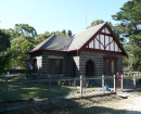
- for the historical significance of the Ranelagh club and estate and its ability to demonstrate the features of a country club estate in Victoria dating from the interwar period and based on American precedents; this is a rare and relatively intact example of a country club development and attributes include the clubhouse, subdivision plan of 1924, road formations, several residences, the inclusion of many notable purchasers among its early members, its long continuity of existence and the retention of recreational elements for both active and more passive recreation (such as the bathing boxes, garden reserves and sports facilities);
- for the inclusion of several individually significant residences and gardens, including Roy Ground's own residence (35 Rannoch Avenue), Nithsdale (30-34 Rannoch Avenue), several American-influenced residences (e.g. Lot 54, Rannoch Avenue and Lot 244, Ravenscourt Crescent);
- for design qualities of the plan which have a bearing on the current visual qualities of the estate, such as gently curved and semi-circular roads, the incorporation of open space backing onto many allotments, incorporation of dramatic coastal site;
- for the retention of 99 feet foreshore reserve (1873), set aside in response to controversy over sale of foreshore land on the Mornington Peninsula and a contemporary desire to conserve this resource; the bathing boxes and beach frontage (part of this foreshore reserve) are an integral component of the recreational history of Ranelagh; and
- for its ability to demonstrate a phase in Melbourne's inter-war metropolitan expansion, especially through the involvement of surveyor Saxil Tuxen (linked with many Melbourne estates) and developer John Taylor (of Sequoia Company Ltd, also linked with Edna Walling's Bickleigh Vale estate).
Ranelagh Estate is also of regional cultural significance:
- for the survival of the early residence in Rosserdale Avenue and some remnant landscaping, a reminder of early settlement of Mount Eliza, and complementary to neighbouring residences such as Beleura and Heronswood, overlooking Port Phillip Bay on land surveyed and subdivided in 1854-56; and
- for retention of early street tree planting (especially cypress in Wimbledon Avenue).
Show more
Show less
-
-
Ranelagh Estate - Physical Description 1
Area bounded by Canadian Bay Road, Mt Eliza Way (formerly a section of Point Nepean Road), Earimil Creek and the coastline of Port Phillip Bay. Lodged plans of subdivision LP 10716, 10717 and 10718 (as amended)
-
-
-
-
-
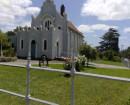
ST JAMES THE LESS ANGLICAN CHURCH
 Victorian Heritage Register H1890
 -
RANELAGH ESTATE
 Victorian Heritage Register H1605
 -
St James The Less Anglican Church & Organ
 National Trust H1890
-
-


