Back to search results
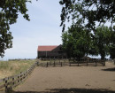
Sandfly Gully Historic Area - Sandfly Reef Mine and Alluvial Workings and Shamrock Reef Mine and Cyanide Works
119 Millers Flat Road, WHIPSTICK VIC 3556 - Property No 201340
Sandfly Gully Historic Area - Sandfly Reef Mine and Alluvial Workings and Shamrock Reef Mine and Cyanide Works
119 Millers Flat Road, WHIPSTICK VIC 3556 - Property No 201340
All information on this page is maintained by Greater Bendigo City.
Click below for their website and contact details.
Greater Bendigo City

Sandfly Reef Mine and Alluvial Workings

On this page:
Statement of Significance
(Sandfly Reef Mine and Alluvial Workings)
The site is representative of relatively undisturbed late 19th century quartz workings (criterion D).
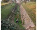
(Shamrock Reef Mine and Cyanide Works)
The site is now associated with the small-scale re-treatment of tailings by the cyanide process and represents the last phase of mining on the Shamrock Reef which first began in 1865 (criterion A). The site is representative of the smaller cyaniding sites in the study area (criterion D) and has the potential for education and interpretation about this phase of mining in the area as part of the Loeser Picnic Area (criterion C).
Show more
Show less
-
-
-
-
-
-
Elliott's Reef Mine
 Greater Bendigo City
-
'Altona' Homestead (Formerly 'Laverton' Homestead) and Logan Reserve
 Hobsons Bay City
 -
-
-
-