-
Save Search
You must log in to do that.
-
Share Search
-
Download Search
The download will only include records from the current search page. You can increase the number of records to download by changing the number of 'listings per page' at the bottom of this page. Note that the maximum number of records that can be listed per page is 300. The download may exceed the number of records listed as any 'nested' records that have met the search criteria will also download.
Download file (.xls)
Success
Error
-
Save Search
You must log in to do that.
-
Share Search
-
Download Search
The download will only include records from the current search page. You can increase the number of records to download by changing the number of 'listings per page' at the bottom of this page. Note that the maximum number of records that can be listed per page is 300. The download may exceed the number of records listed as any 'nested' records that have met the search criteria will also download.
Download file (.xls)
-
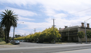
1-99 ST VINCENT PLACE SOUTH AND 2-94 ST VINCENT PLACE NORTH AND ST VINCENT GARDENS EAST AND ST VINCENT GARDENS WEST AND 10 MERTON STREET AND MONTAGUE STREET (PART) ALBERT PARK, PORT PHILLIP CITY

Victorian Heritage Register
VHR H1291The St Vincent Place precinct was first designed in 1854 or 1855, probably by Andrew Clarke, the Surveyor-General of Victoria. The current layout is the work of Clement Hodgkinson, the noted…
-
EMERALD HILL ESTATE RESIDENCES
2 FISHLEY STREET SOUTH MELBOURNE, PORT PHILLIP CITY

Victorian Heritage Register
VHR H1727A homogenous area closely linked with south Melbourne’s early history. It is an area of mixed residential, commercial and civic use and most of its buildings were constructed during the…
-
EMERALD HILL ESTATE RESIDENCES
6 FISHLEY STREET SOUTH MELBOURNE, PORT PHILLIP CITY

Victorian Heritage Register
VHR H1728Emerald Hill Estate Residences (6 Fishley Street, South Melbourne) VHR H1728 How is it significant? A homogenous area closely linked with south Melbourne’s early history. It is an area of…
-
95-133 WELLINGTON PARADE SOUTH AND 49-55 CHARLES STREET AND 50-62 AGNES STREET EAST MELBOURNE, MELBOURNE CITY

Victorian Heritage Register
VHR H2009 H7822-0003Jolimont Square in East Melbourne is bounded by Wellington Parade South, Agnes Street, Palmer Street and Charles Street. The Square, two acres (0.8ha) in extent, was established after the…
Also listed in:
-
LOWER HEIDELBERG ROAD AND OUTLOOK DRIVE AND SUMMIT DRIVE AND MALTRAVERS ROAD AND BURLEY GRIFFIN PLACE AND THE EYRIE EAGLEMONT, BANYULE CITY

Victorian Heritage Register
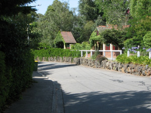
VHR H2104The Mount Eagle Estate, Eaglemont, is a residential estate designed by Walter Burley Griffin (1876-1937) and Marion Mahony Griffin (1871-1961) in 1914. It was developed on land owned by…
-
LOWER HEIDELBERG ROAD AND GLENARD DRIVE AND MOSSMAN DRIVE AND THE BOULEVARD EAGLEMONT, BANYULE CITY

Victorian Heritage Register
VHR H2103The Glenard Estate, Eaglemont, is a residential estate designed by Walter Burley Griffin (1876-1937) and Marion Mahony Griffin (1871-1961) in 1915. It was developed on land owned by Peter…
Also listed in:
-
DIAMOND HILL ROAD SPRING GULLY, GREATER BENDIGO CITY

Victorian Heritage Inventory
H7724-0160 -
POWLETT RESERVE UNDERGROUND STRUCTURE
ALBERT STREET EAST MELBOURNE, MELBOURNE CITY

Victorian Heritage Inventory
H7822-0234This place is included on the Victorian Heritage Inventory, for its potential to contain historical archaeological remains associated with the settlement and growth of early Melbourne. Under…
-
EAST SHEPPARTON, ORRVALE & LEMNOS CLOSER SETTLEMENT SCHEME HOUSES
DOYLES ROAD GRAHAMVALE AND DOYLES ROAD SHEPPARTON EAST AND DOYLES ROAD ORRVALE, GREATER SHEPPARTON CITY

Victorian Heritage Inventory
H7925-0025 -
WARBURTON-WOODS POINT ROAD MATLOCK, MANSFIELD SHIRE

Victorian Heritage Inventory
H8122-0006 -
DONNELLYS CREEK ROAD TOOMBON, BAW BAW SHIRE

Victorian Heritage Inventory
H8122-0028 -
WARBURTON-WOODS POINT ROAD MATLOCK AND WARBURTON-WOODS POINT ROAD JERICHO, MANSFIELD SHIRE, BAW BAW SHIRE

Victorian Heritage Inventory
H8122-0080 -
FORD STREET AND CHURCH STREET AND LOCH STREET AND CAMP STREET BEECHWORTH, INDIGO SHIRE

Victorian Heritage Inventory
H8225-0076 -
GLENDART TRACK DARTMOUTH, TOWONG SHIRE

Victorian Heritage Inventory
H8424-0006 -
320 ELLIS ROAD AND MORRISON ROAD TONIMBUK, CARDINIA SHIRE

Victorian Heritage Inventory
H8021-0007 -
PATCHEWOLLOCK ORIGINAL TOWN SITE
181 HOPETOUN-PATCHEWOLLOCK ROAD PATCHEWOLLOCK, YARRIAMBIACK SHIRE

Victorian Heritage Inventory
H7327-0014Unknown.
-
SINGAPORE PENINSULA, WILSONS PROMONTORY NATIONAL PARK WILSONS PROMONTORY, SOUTH GIPPSLAND SHIRE

Victorian Heritage Inventory
H8120-0026The location of the seaforth Township has now been confirmed withthe identification of the township and the seaforth Inn archaeologicla sites. The cleared areas of this site are interpreted…
-
PIONEER CEMETERY, 14 LOWER NINE MILE ROAD STANLEY, INDIGO SHIRE

Victorian Heritage Inventory
H8225-0120 -
GOORAMADDA ROAD GOORAMADDA, INDIGO SHIRE

Victorian Heritage Inventory
H8226-0003 -
MAIN STREET ELDORADO, WANGARATTA RURAL CITY

Victorian Heritage Inventory
H8225-0136 -
SUNDAY CREEK CHINESE CAMPS AND MARKET GARDENS SITE
WEST OF DISTILLERY ROAD WAHGUNYAH AND RUTHERGLEN, INDIGO SHIRE

Victorian Heritage Inventory
H8125-0027 -
CHRISTMASTOWN ROAD, CORNISHTOWN ROAD AND HALL ROAD CORNISHTOWN, INDIGO SHIRE

Victorian Heritage Inventory
H8225-0143 -
MAIN STREET AND DRUMMOND STREET RUTHERGLEN, INDIGO SHIRE

Victorian Heritage Inventory
H8125-0026 -
HILLSBOROUGH FORMER TOWNSHIP SITE
OFF HILLSBOROUGH ROAD BRUARONG, INDIGO SHIRE

Victorian Heritage Inventory
H8225-0125 -
BRUARONG LANE BRUARONG, INDIGO SHIRE

Victorian Heritage Inventory
H8225-0126


