account anchor arrow-down arrow-left-thick arrow-right-solid arrow-right-thick arrow-right arrow-up audio bookmark-solid bookmark close compass dashboard delete download email explore hamburger help home image locate login marker-icon marker-multiple marker-single minus note options pause pdf play plus print refine search share shortlist signup skip sort-detail sort-image sort-list star tick timeline tour vhr welcome zoom
  • Home
  • Skip to content
  • Create account
  • Log in
Victorian Heritage Database
Search in:
  • Advanced places/objects search
  • Advanced shipwreck search
  • Search tips

Browse heritage places

  • and

Browse Shipwrecks

  • and
  • and

Browse Tours

  • Recommended tours
  • Contributed tours
  • Create your own tour
Account login
Create account

Browse heritage places

  • and

Browse Shipwrecks

  • and
  • and

Browse Tours

  • Recommended tours
  • Contributed tours
  • Create your own tour
Back to search
  • Save Search
    You must log in to do that.
  • Share Search
  • Download Search

    The download will only include records from the current search page. You can increase the number of records to download by changing the number of 'listings per page' at the bottom of this page. Note that the maximum number of records that can be listed per page is 300. The download may exceed the number of records listed as any 'nested' records that have met the search criteria will also download.

    Download file (.xls)
Search results:
Back to search

Refine results by

    • CAMPASPE SHIRE (2)
    • MACEDON RANGES SHIRE (2)
    • COLAC OTWAY SHIRE (1)
    • CORANGAMITE SHIRE (1)
    • DAREBIN CITY (1)
    • EAST GIPPSLAND SHIRE (1)
    • ALPINE SHIRE (1)
    • GREATER BENDIGO CITY (1)
    • HEPBURN SHIRE (1)
    • MITCHELL SHIRE (1)
    • MOONEE VALLEY CITY (1)
    • MORNINGTON PENINSULA SHIRE (1)
    • MOYNE SHIRE (1)
    • SURF COAST SHIRE (1)
    • WHITTLESEA CITY (1)
    • YARRA CITY (1)
    • BOROONDARA CITY (1)
    • Victorian Heritage Register (11)
    • Moonee Valley City (1)
    • Greater Bendigo City (1)
    • Pre-separation Colonial Vernacular 1836-50 (1)
    • Interwar Period (c.1919-c.1940) (1)
    • 1850 - 1879 (5)
    • 1910 - 1939 (3)
    • 1940 - 1969 (3)
    • 1880 - 1909 (1)
    • Registered place (11)
    • Registered archaeological place (4)
    • Registered object integral to a registered place (1)
    • 1. Shaping Victoria's environment (13)
      • 1.1 Tracing climate and topographical change (1)
      • 1.2 Tracing the emergence of Victoria's plants and animals (2)
      • 1.3 Understanding scientifically diverse environments (3)
      • 1.5 Living with natural processes (6)
      • 1.6 Appreciating and protecting Victoria's natural wonders (4)
    • 4. Transforming and managing the land (6)
      • 4.1 Living off the land (1)
      • 4.3 Grazing and raising livestock (1)
      • 4.4 Farming (1)
      • 4.6 Exploiting other mineral, forest and water resources (4)
      • 4.7 Transforming the land and waterways (3)
    • 6. Building towns cities and the garden state (6)
      • 6.2 Creating Melbourne (1)
      • 6.3 Shaping the suburbs (2)
      • 6.5 Living in country towns (1)
      • 6.6 Marking significant phases in the development of Victoria's settlements, towns and cities (3)
      • 6.7 Making homes for Victorians (1)
      • 6.8 Living on the fringes (1)
    • 5. Building Victoria's industries and workforce (4)
      • 5.7 Catering for tourists (3)
      • 5.8 Working (2)
    • 2. Peopling Victoria's places and landscapes (2)
      • 2.3 Adapting to diverse environments (2)
      • 2.7 Promoting settlement (2)
    • 3. Connecting Victorians by transport and communications (2)
      • 3.4 Linking Victorians by road in the 20th century (1)
      • 3.7 Establishing and maintaining communications (1)
    • 8. Building community life (2)
      • 8.2 Educating people (1)
      • 8.5 Preserving traditions and commemorating (1)
    • 7. Governing Victorians (1)
      • 7.4 Defending Victoria and Australia (1)
    • 9. Shaping cultural and creative life (1)
      • 9.1 Participating in sport and recreation (1)
      • 9.3 Achieving design and artistic distinction (1)
    • Parks, Gardens and Trees (4)
      • Commercial nursery (1)
      • Garden Institutional/ Research (1)
      • Planting exotic (1)
      • Reserve (1)
    • Landscape - Natural (4)
      • Coastal environment (1)
      • Fauna habitat (1)
      • Geological site or area (1)
      • Other - Landscape - Natural (1)
    • Forestry and Timber Industry (3)
      • Arboretum/Nursery/ Experimental Tree Farm (2)
      • Fire Tower/Lookout (1)
    • Utilities - Water (2)
      • Storm Water Drain (1)
      • Water Pipe (1)
      • Weir (1)
    • Science (2)
      • Scientific Field Site (2)
    • Landscape - Cultural (2)
      • Historic Landscape (1)
      • Other - Landscape - Cultural (1)
    • Education (2)
      • Field Studies Centre (1)
      • Infants school (1)
    • Mining and Mineral Processing (1)
      • Gold Mining Site (1)
    • Monuments and Memorials (1)
      • War Memorial (1)
    • Postal and Telecommunications (1)
      • Objects (movable) (1)
      • Housing & Quarters (1)
      • Postal or Telecommunication Precinct (1)
    • Utilities - Drainage (1)
      • Storm Water Culvert (1)
      • Storm Water Drain (1)
    • Residential buildings (private) (1)
      • Hut/Shack (1)
    • Transport - Road (1)
      • Road (1)
    • Transport - Water (1)
      • Objects (movable) (1)
      • Pier/Jetty (1)
    • Exploration, Survey and Events (1)
      • Cairn (1)

Success

Error

Back to search
  • Save Search
    You must log in to do that.
  • Share Search
  • Download Search

    The download will only include records from the current search page. You can increase the number of records to download by changing the number of 'listings per page' at the bottom of this page. Note that the maximum number of records that can be listed per page is 300. The download may exceed the number of records listed as any 'nested' records that have met the search criteria will also download.

    Download file (.xls)
Search results:
Results filtered by: 1. Shaping Victoria's environment
Displaying 1-25 of 13 records found 13 results
Name, details and heritage listing
Other authorities
  • TORRUMBARRY WEIR LOCK CHAMBER, STEAM BOILER AND STEAM WINCH COMPLEX

    TORRUMBARRY WEIR ROAD PATHO, CAMPASPE SHIRE

    Victorian Heritage Register

    VHR H0993
    Shortlist
    You must log in to shortlist items.
    Download

    The Torrumbarry Weir Complex incorporates the original lock (1924) and a concrete-reinforced rubble wall surviving from the former weir. The old trestles and original steam boiler and…

    Shortlist
    You must log in to shortlist items.
    Download
     
  • SAWPIT GULLY NURSERY AND PLANTATION

    SAWPIT GULLY ROAD CRESWICK, HEPBURN SHIRE

    Victorian Heritage Register

    VHR H1951
    Shortlist
    You must log in to shortlist items.
    Download

    The Sawpit Gully Plantation contains the site of the first State Nursery established at Creswick in 1888 and a collection of exotic and native trees. The trees were planted under the…

    Shortlist
    You must log in to shortlist items.
    Download
     
  • FORMER SMITHS NURSERY

    721 KILMORE ROAD AND 731 KILMORE ROAD AND 14 FLOUR MILL LANE AND 20 FLOUR MILL LANE AND 18 FLOUR MILL LANE AND 26 FLOUR MILL LANE AND 38 FLOUR MILL LANE RIDDELLS CREEK, MACEDON RANGES SHIRE

    Victorian Heritage Register

    VHR H2060
    Shortlist
    You must log in to shortlist items.
    Download

    Smiths Nursery, one of Victoria's earliest plant nurseries, was established in 1863 at Riddells Creek and consists of an area of land to the south of Riddells Creek with the remains of…

    Shortlist
    You must log in to shortlist items.
    Download
     
  • HANGING ROCK RESERVE

    SOUTH ROCK ROAD NEWHAM, MACEDON RANGES SHIRE

    Victorian Heritage Register

    VHR H2339
    Shortlist
    You must log in to shortlist items.
    Download

    Hanging Rock Reserve is a public reserve of approximately 67.6 hectares (167 acres) located near Woodend. It contains the Hanging Rock geological formation, the woodland that surrounds it…

    Shortlist
    You must log in to shortlist items.
    Download
     
  • YAN YEAN WATER SUPPLY SYSTEM

    CLONBINANE, WHITTLESEA,HUMEVALE, YAN YEAN, DOREEN, MERNDA, SOUTH MORANG, MILL PARK, BUNDOORA, THOMASTOWN, RESERVOIR, PRESTON,THORNBURY, NORTHCOTE AND FITZROY NORTH, MITCHELL SHIRE, WHITTLESEA CITY, DAREBIN CITY, YARRA CITY

    Victorian Heritage Register

    VHR H2333
    Shortlist
    You must log in to shortlist items.
    Download

    The Yan Yean Water Supply System was constructed from 1853 as the first large scale engineered water supply system in Victoria. It consists of a series of catchment weirs and reservoirs…

    Shortlist
    You must log in to shortlist items.
    Download
     
  • GREAT OCEAN ROAD

    GREAT OCEAN ROAD BETWEEN TORQUAY AND ALLANSFORD, SURF COAST SHIRE, COLAC OTWAY SHIRE, CORANGAMITE SHIRE, MOYNE SHIRE

    Victorian Heritage Register

    VHR H2261
    Shortlist
    You must log in to shortlist items.
    Download

    The Great Ocean Road stretches 242 kilometres from Torquay to its junction with the Princes Highway east of Allansford in western Victoria. It was designed and supervised by Country Roads…

    Shortlist
    You must log in to shortlist items.
    Download
     
  • MASTERS HOUSE

    MASTERS LANDING, MURRAY RIVER RESERVE, RIVER TRACK GUNBOWER, CAMPASPE SHIRE

    Victorian Heritage Register

    VHR H2330
    Shortlist
    You must log in to shortlist items.
    Download

    The Masters House which consists of a timber and corrugated iron dwelling located close to the bank of the Murray River on Gunbower Island, 6.5 kilometres northeast of the town of Gunbower,…

    Shortlist
    You must log in to shortlist items.
    Download
     
  • ROBERT COCHRANE KINDERGARTEN

    2A MINONA STREET HAWTHORN, BOROONDARA CITY

    Victorian Heritage Register

    VHR H2309
    Shortlist
    You must log in to shortlist items.
    Download

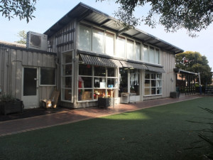
    Robert Cochrane Kindergarten, Hawthorn is a single storey timber building that was constructed in 1948-50 as part of the Free Kindergarten movement in Victoria. A free kindergarten was…

    Shortlist
    You must log in to shortlist items.
    Download
     
  • FLINDERS TELEGRAPH CABLE COMPLEX AND PIER

    THE ESPLANADE FLINDERS, MORNINGTON PENINSULA SHIRE

    Victorian Heritage Register

    VHR H2413
    Shortlist
    You must log in to shortlist items.
    Download

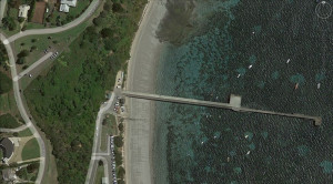
    Flinders Telegraph Cable Complex and Pier was established in the 1860s and provided an essential telegraphic link between mainland Australia and Tasmania for seven decades. Evidence of the…

    Shortlist
    You must log in to shortlist items.
    Download
     
  • MAISIE'S PLOTS

    BOGONG HIGH PLAINS ROAD BOGONG, ALPINE SHIRE

    Victorian Heritage Register

    VHR H2424
    Shortlist
    You must log in to shortlist items.
    Download

    Maisie’s Plots, two Alpine ecology monitoring sites, one at Rocky Valley and one at Pretty Valley, consisting of fenced exclusion plots and unfenced control plots. How is it…

    Shortlist
    You must log in to shortlist items.
    Download
     
  • MOUNT LITTLE DICK FIRE TOWER

    MOUNT LITTLE DICK ROAD DEPTFORD, EAST GIPPSLAND SHIRE

    Victorian Heritage Register

    VHR H2461
    Shortlist
    You must log in to shortlist items.
    Download

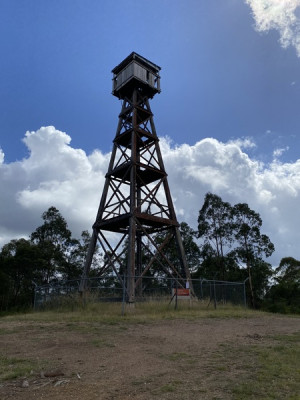
    The Mount Little Dick Fire Tower is on the land of the Gunaikurnai people. It is located on Crown land subject to both a Native Title determination and a Recognition and Settlement Agreement…

    Shortlist
    You must log in to shortlist items.
    Download
     
  • Roy Roger's Tree (Eucalyptus tricarpa)

    Eaglehawk-Neilborough Road, WHIPSTICK VIC 3556 - Property No 198895

    Greater Bendigo City

    Shortlist
    You must log in to shortlist items.
    Download

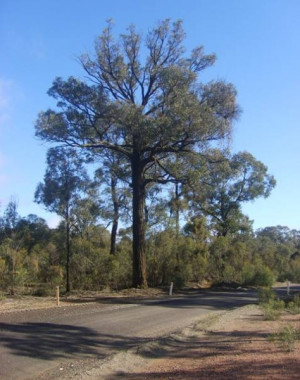
    Statement of Significance 'Roy Roger's Tree' is a mature specimen of Red Ironbark (Eucalyptus tricarpa), and a conspicuous remnant of the indigenous forest vegetation of the Whipstick and…

    Shortlist
    You must log in to shortlist items.
    Download
     
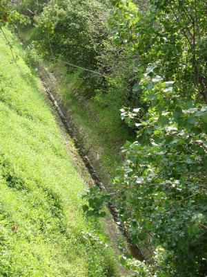
  • FIVE MILE CREEK BLUESTONE CHANNEL

    (off) PASCOE VALE ROAD, ESSENDON, MOONEE VALLEY CITY

    Moonee Valley City

    Shortlist
    You must log in to shortlist items.
    Download

    The section of Five Mile Creek between Pascoe Vale Road and the west of the North Eastern railway line, which is contained in a bluestone-lined channel, is significant. The channel floor is…

    Shortlist
    You must log in to shortlist items.
    Download
     
Account login
Create account

The Victorian Heritage Database is a searchable database containing information about thousands of heritage places and objects in Victoria. It includes entries for around 2400 places and objects of state significance listed in the Victorian Heritage Register as well as many places of archaeological interest included in the Victorian Heritage Inventory. Most of the database entries are local heritage places, listed on the heritage overlay from 29 local governments (out of 79 LGAs in the state). Information on heritage places from the National Trust and Victorian War Heritage Inventory is also included. Learn more.

State Government Victoria
  • Home
  • Advanced search
  • Account login
  • Heritage Council of Victoria
  • Heritage Victoria
  • Contact us
  • Copyright disclaimer
  • Privacy statement
  • Terms & Conditions
  • Accessibility statement
  • API
Digital Agency - Calico

You need to be logged into to perform this action. Please login here.