account anchor arrow-down arrow-left-thick arrow-right-solid arrow-right-thick arrow-right arrow-up audio bookmark-solid bookmark close compass dashboard delete download email explore hamburger help home image locate login marker-icon marker-multiple marker-single minus note options pause pdf play plus print refine search share shortlist signup skip sort-detail sort-image sort-list star tick timeline tour vhr welcome zoom
  • Home
  • Skip to content
  • Create account
  • Log in
Victorian Heritage Database
Search in:
  • Advanced places/objects search
  • Advanced shipwreck search
  • Search tips

Browse heritage places

  • and

Browse Shipwrecks

  • and
  • and

Browse Tours

  • Recommended tours
  • Contributed tours
  • Create your own tour
Account login
Create account

Browse heritage places

  • and

Browse Shipwrecks

  • and
  • and

Browse Tours

  • Recommended tours
  • Contributed tours
  • Create your own tour
Back to search
  • Save Search
    You must log in to do that.
  • Share Search
  • Download Search

    The download will only include records from the current search page. You can increase the number of records to download by changing the number of 'listings per page' at the bottom of this page. Note that the maximum number of records that can be listed per page is 300. The download may exceed the number of records listed as any 'nested' records that have met the search criteria will also download.

    Download file (.xls)
Search results:
Back to search

Refine results by

    • GLENELG SHIRE (17)
    • NILLUMBIK SHIRE (8)
    • GREATER BENDIGO CITY (7)
    • GOLDEN PLAINS SHIRE (4)
    • SOUTHERN GRAMPIANS SHIRE (4)
    • MAROONDAH CITY (3)
    • MORNINGTON PENINSULA SHIRE (3)
    • YARRA RANGES SHIRE (3)
    • MANNINGHAM CITY (2)
    • MOUNT ALEXANDER SHIRE (2)
    • MOYNE SHIRE (2)
    • NORTHERN GRAMPIANS SHIRE (2)
    • SURF COAST SHIRE (2)
    • CARDINIA SHIRE (1)
    • CASEY CITY (1)
    • CENTRAL GOLDFIELDS SHIRE (1)
    • COLAC OTWAY SHIRE (1)
    • CORANGAMITE SHIRE (1)
    • GREATER GEELONG CITY (1)
    • MACEDON RANGES SHIRE (1)
    • MARIBYRNONG CITY (1)
    • MELBOURNE CITY (1)
    • MOORABOOL SHIRE (1)
    • BASS COAST SHIRE (1)
    • UNINCORPORATED (1)
    • Glenelg Shire (17)
    • Nillumbik Shire (8)
    • Victorian Heritage Register (7)
    • Greater Bendigo City (7)
    • Victorian Heritage Inventory (4)
    • Southern Grampians Shire (4)
    • Golden Plains Shire (4)
    • Yarra Ranges Shire (3)
    • Maroondah City (3)
    • Northern Grampians Shire (2)
    • Manningham City (2)
    • Maribyrnong City (1)
    • Cardinia Shire (1)
    • Casey City (1)
    • National Trust (1)
    • Greater Geelong City (1)
    • Moorabool Shire (1)
    • Vic. War Heritage Inventory (1)
    • Interwar Period (c.1919-c.1940) American Bungalow (1)
    • Victorian Period (1851-1901) (1)
    • Federation/Edwardian Period (1902-c.1918) (1)
    • Interwar Period (c.1919-c.1940) (1)
    • 1850 - 1879 (7)
    • 1910 - 1939 (3)
    • < - 1849 (2)
    • 1880 - 1909 (1)
    • 1940 - 1969 (1)
    • Registered place (10)
    • Registered archaeological place (3)
    • Registered object integral to a registered place (1)
    • 1. Shaping Victoria's environment (4)
      • 1.1 Tracing climate and topographical change (1)
      • 1.6 Appreciating and protecting Victoria's natural wonders (4)
    • 3. Connecting Victorians by transport and communications (2)
      • 3.4 Linking Victorians by road in the 20th century (1)
      • 3.7 Establishing and maintaining communications (1)
    • 5. Building Victoria's industries and workforce (2)
      • 5.7 Catering for tourists (2)
    • 6. Building towns cities and the garden state (1)
      • 6.6 Marking significant phases in the development of Victoria's settlements, towns and cities (1)
    • 7. Governing Victorians (1)
      • 7.4 Defending Victoria and Australia (1)
    • 8. Building community life (1)
      • 8.5 Preserving traditions and commemorating (1)
    • 9. Shaping cultural and creative life (1)
      • 9.1 Participating in sport and recreation (1)
      • 9.3 Achieving design and artistic distinction (1)
    • Landscape - Natural (68)
      • Other - Landscape - Natural (15)
      • Flora species site or area (12)
      • Landform site or area (10)
      • Wetland or river (10)
      • Coastal environment (9)
      • Geological site or area (8)
      • Fauna habitat (2)
      • Palaeontological site (2)
      • Island environment (1)
      • Natural process (1)
      • Wilderness (1)
    • Landscape - Cultural (7)
      • Historic Landscape (6)
      • Other - Landscape - Cultural (1)
    • Parks, Gardens and Trees (5)
      • Reserve (2)
      • Memorial (1)
      • Tree groups - avenue (1)
      • Other - Parks, Gardens & Trees (1)
      • Park or Garden Precinct (1)
    • Monuments and Memorials (3)
      • War Memorial (2)
      • Memorial (1)
    • Cemeteries and Burial Sites (3)
      • Cemetery/Graveyard/Burial Ground (3)
    • Science (3)
      • Scientific Field Site (3)
    • Transport - Road (3)
      • Road (1)
      • Road Bridge (1)
      • Other - Transport - Road (1)
    • Mining and Mineral Processing (2)
      • Mine Dam (1)
      • Gold Mining Site (1)
    • Government and Administration (2)
      • Other - Government & Administration (2)
    • Military (1)
      • Other - Military (1)
    • Postal and Telecommunications (1)
      • Objects (movable) (1)
      • Housing & Quarters (1)
      • Postal or Telecommunication Precinct (1)
    • Recreation and Entertainment (1)
      • Reserve (2)
      • Objects (movable) (1)
      • Playing Ground/ Field (1)
      • Baths/Swimming Centre (1)
    • Residential buildings (private) (1)
      • Cottage (1)
    • Transient Accommodation (1)
      • Caravan Park (1)
    • Transport - Water (1)
      • Objects (movable) (1)
      • Pier/Jetty (1)
    • Aboriginal (1)
      • Place of significance (1)
    • Exploration, Survey and Events (1)
      • Cairn (1)
    • Farming and Grazing (1)
      • Woolshed/Shearing Shed (1)
      • Homestead Complex (1)

Success

Error

Back to search
  • Save Search
    You must log in to do that.
  • Share Search
  • Download Search

    The download will only include records from the current search page. You can increase the number of records to download by changing the number of 'listings per page' at the bottom of this page. Note that the maximum number of records that can be listed per page is 300. The download may exceed the number of records listed as any 'nested' records that have met the search criteria will also download.

    Download file (.xls)
Search results:
Results filtered by: Landscape - Natural
Displaying 1-25 of 68 records found 68 results
Name, details and heritage listing
Other authorities
  • COLLINS SETTLEMENT SITE

    2700-3148 POINT NEPEAN ROAD SORRENTO, MORNINGTON PENINSULA SHIRE

    Victorian Heritage Register

    VHR H1050
    Shortlist
    You must log in to shortlist items.
    Download

    The British Government's decision to establish a settlement in southern Australia appears to have been prompted by favourable reports of Port Phillip Bay and concerns about the interest of…

    Shortlist
    You must log in to shortlist items.
    Download
     
  • THOMAS SMITHS GOOD BED FOSSIL QUARRY

    414 BOUNDARY GULLY ROAD WERONA, MOUNT ALEXANDER SHIRE

    Victorian Heritage Register

    VHR H1413
    Shortlist
    You must log in to shortlist items.
    Download

    Thomas Smith, a local Sandon farmer, gained distinction as a geologist through the discovery and collection of graptolite fossils from the Sandon-Campbelltown district. Thomas Smith carried…

    Shortlist
    You must log in to shortlist items.
    Download
     
  • HANGING ROCK RESERVE

    SOUTH ROCK ROAD NEWHAM, MACEDON RANGES SHIRE

    Victorian Heritage Register

    VHR H2339
    Shortlist
    You must log in to shortlist items.
    Download

    Hanging Rock Reserve is a public reserve of approximately 67.6 hectares (167 acres) located near Woodend. It contains the Hanging Rock geological formation, the woodland that surrounds it…

    Shortlist
    You must log in to shortlist items.
    Download
     
  • GREAT OCEAN ROAD

    GREAT OCEAN ROAD BETWEEN TORQUAY AND ALLANSFORD, SURF COAST SHIRE, COLAC OTWAY SHIRE, CORANGAMITE SHIRE, MOYNE SHIRE

    Victorian Heritage Register

    VHR H2261
    Shortlist
    You must log in to shortlist items.
    Download

    The Great Ocean Road stretches 242 kilometres from Torquay to its junction with the Princes Highway east of Allansford in western Victoria. It was designed and supervised by Country Roads…

    Shortlist
    You must log in to shortlist items.
    Download
     
  • TOWER HILL STATE GAME RESERVE

    TOWER HILL AND CROSSLEY, MOYNE SHIRE

    Victorian Heritage Register

    VHR H2114
    Shortlist
    You must log in to shortlist items.
    Download

    The Tower Hill State Game Reserve is an area of approximately 6.2 sq km, 3 km inland from the coast between Warrnambool and Port Fairy managed by Parks Victoria since 1997. The Reserve…

    Shortlist
    You must log in to shortlist items.
    Download
     
  • ROYAL PARADE

    ROYAL PARADE PARKVILLE AND ROYAL PARADE CARLTON NORTH AND ELIZABETH STREET MELBOURNE, MELBOURNE CITY

    Victorian Heritage Register

    VHR H2198
    Shortlist
    You must log in to shortlist items.
    Download

    What is significant Royal Parade, the boulevard leading north out of Melbourne, runs between Park Street and Grattan Street in Parkville. A small section of Elizabeth Street from Grattan…

    Shortlist
    You must log in to shortlist items.
    Download
     
  • FLINDERS TELEGRAPH CABLE COMPLEX AND PIER

    THE ESPLANADE FLINDERS, MORNINGTON PENINSULA SHIRE

    Victorian Heritage Register

    VHR H2413
    Shortlist
    You must log in to shortlist items.
    Download

    Flinders Telegraph Cable Complex and Pier was established in the 1860s and provided an essential telegraphic link between mainland Australia and Tasmania for seven decades. Evidence of the…

    Shortlist
    You must log in to shortlist items.
    Download
     
  • MOONLIGHT GULLY DREDGE DAM

    ALMA-MOONLIGHT ROAD ALMA, CENTRAL GOLDFIELDS SHIRE

    Victorian Heritage Inventory

    H7623-0172
    Shortlist
    You must log in to shortlist items.
    Download
    Shortlist
    You must log in to shortlist items.
    Download
     
  • THOMAS SMITH'S GOOD BED FOSSIL QUARRY

    NEVENS ROAD WERONA, MOUNT ALEXANDER SHIRE

    Victorian Heritage Inventory

    H7723-0479
    Shortlist
    You must log in to shortlist items.
    Download

    Thomas Smith, a local Sandon farmer, gained distinction as a geologist through the discovery and collection of graptolite fossils from the Sandon-Campbelltown district. Thomas Smith carried…

    Shortlist
    You must log in to shortlist items.
    Download
     
  • SANDSTONE ISLAND

    SANDSTONE ISLAND WESTERN PORT, UNINCORPORATED

    Victorian Heritage Inventory

    H7921-0097
    Shortlist
    You must log in to shortlist items.
    Download

    The Island has potential archaeological research significance for understanding 19th Century Island life-ways and inter-island relationships. It has strong links with Churchill Island.

    Shortlist
    You must log in to shortlist items.
    Download
     
  • COAL OUTCROPS, CAPE PATERSON

    CAPE PATERSON-INVERLOCH ROAD CAPE PATERSON, BASS COAST SHIRE

    Victorian Heritage Inventory

    H8020-0021
    Shortlist
    You must log in to shortlist items.
    Download

    The site is significant as the location of the first discovery of coal in Victoria (Port Phillip District of New South Wales) in 1826. The site is also significant as a physical link to the…

    Shortlist
    You must log in to shortlist items.
    Download
     
  • BOLIN SWAMP

    193 Bulleen Road BULLEEN, Manningham City

    Manningham City

    Shortlist
    You must log in to shortlist items.
    Download

    Of State significance for its natural and cultural values.

    Shortlist
    You must log in to shortlist items.
    Download
     
  • THE 100 ACRES

    Knees Road PARK ORCHARDS, Manningham City

    Manningham City

    Shortlist
    You must log in to shortlist items.
    Download

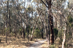
    Of State significance as an extensive and fairly complete remnant of native woodland within the metropolitan area

    Shortlist
    You must log in to shortlist items.
    Download
     
  • RECREATION RESERVE and SWIMMING POOL

    Henty Highway BRANXHOLME, Southern Grampians Shire

    Southern Grampians Shire

    Shortlist
    You must log in to shortlist items.
    Download

    The Branxholme Recreation Reserve was gazetted in 1870 and the Swimming Pool Reserve was gazetted in 1929. The reserves which total over 6.5 hectares straddle the Arrandoovong Creek…

    Shortlist
    You must log in to shortlist items.
    Download
     
  • MOUNT ROUSE AND CRATER RESERVE

    Mount Rouse Tourist Road PENSHURST, Southern Grampians Shire

    Southern Grampians Shire

    Shortlist
    You must log in to shortlist items.
    Download

    The Mount Rouse Crater reserve is located at the Termination of the Mount Rouse Tourist Road, approximately five kilometers south of the township of Penshurst. The reserve consists of…

    Shortlist
    You must log in to shortlist items.
    Download
     
  • Brisbane Ranges National Park

    DURDIDWARRAH, GOLDEN PLAINS SHIRE

    Golden Plains Shire

    Shortlist
    You must log in to shortlist items.
    Download

    National Estate Register: Location of the endemic GREVILLEA STEIGLITZIANA as well as unique site determined plant associations. Endemic genus CHORISTEMON restricted to the Brisbane Ranges…

    Shortlist
    You must log in to shortlist items.
    Download
     
  • WANNON RIVER AND VALLEY

    CULTURAL LANDSCAPE AREA WANNON, Southern Grampians Shire

    Southern Grampians Shire

    Shortlist
    You must log in to shortlist items.
    Download
    Shortlist
    You must log in to shortlist items.
    Download
     
  • Grange Burn Precinct Hamilton

    HAMILTON, Southern Grampians Shire

    Southern Grampians Shire

    Shortlist
    You must log in to shortlist items.
    Download

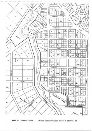
    The Grange Burn is of regional significance for its historical associations and for its landscape value. The creek has played a key role throughout the district's history and has seen some of…

    Shortlist
    You must log in to shortlist items.
    Download
     
  • Residence

    19 Margaret Street, NEWTOWN VIC 3220 - Property No 202709

    Greater Geelong City

    Shortlist
    You must log in to shortlist items.
    Download

    Not Significant - However is situated within Heritage Precinct

    Shortlist
    You must log in to shortlist items.
    Download
     
  • Canning Street Ford

    Canning St. Avondale Heights to Burke Rd. BRAYBROOK, Maribyrnong City

    Maribyrnong City

    Shortlist
    You must log in to shortlist items.
    Download

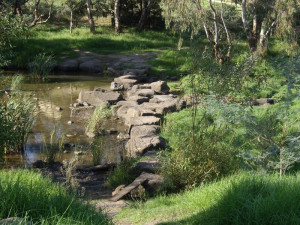
    The Canning Street Ford is of local historical significance as one of the first crossing places of the Maribyrnong River for European settlers from 1835 onwards. It is recorded in the first…

    Shortlist
    You must log in to shortlist items.
    Download
     
  • CANNIBAL HILL OR MT. CANNIBAL

    off Garfield North Road GARFIELD NORTH, Cardinia Shire

    Cardinia Shire

    Shortlist
    You must log in to shortlist items.
    Download

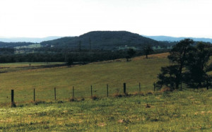
    Cannibal Hill or Mt. Cannibal is of significance to the Cardinia Shire because it has associations with early exploration and pioneering surveys of the Shire. Cannibal Hill and Cannibal Creek…

    Shortlist
    You must log in to shortlist items.
    Download
     
  • Mount Misery Creek Bridge

    Berringa - Dereel Road BERRINGA, GOLDEN PLAINS SHIRE

    Golden Plains Shire

    Shortlist
    You must log in to shortlist items.
    Download

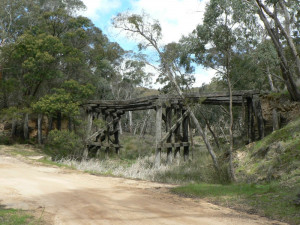
    The Mount Misery Creek Bridge is located on the Berringa - Dereel Road in the Enfield State Park. It was constructed in 1906 to provide permanent access to the township of Berringa and to…

    Shortlist
    You must log in to shortlist items.
    Download
     
  • Rokewood Cemetery

    Cemetery Road ROKEWOOD, Golden Plains Shire

    Golden Plains Shire

    Shortlist
    You must log in to shortlist items.
    Download

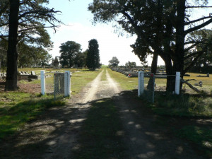
    The Rokewood Cemetery is located on the north side of Cemetery Road, 1.5 kilometers north east of the township of Rokewood. The first burial was recorded in 1855, with the cemetery…

    Shortlist
    You must log in to shortlist items.
    Download
     
  • DERRINAL ESTATE (HOMESTEAD, COTTAGE & HILL'S GLACIATED PAVEMENTS)

    345 HILLS ROAD, DERRINAL - PROPERTY NUMBER 216161, GREATER BENDIGO CITY

    Greater Bendigo City

    Shortlist
    You must log in to shortlist items.
    Download

    The property at 345 Hills Road Derrinal is of significance. It includes the brick house of 1905, and a timber cottage c.1850s. Other outbuildings are not of significance.  How is it…

    Shortlist
    You must log in to shortlist items.
    Download
     
  • 486 North Harcourt Road

    486 North Harcourt Road, HARCOURT NORTH VIC 3453 - Property No 192534

    Greater Bendigo City

    Shortlist
    You must log in to shortlist items.
    Download
    Shortlist
    You must log in to shortlist items.
    Download
     
  • ‹
  • 1
  • 2
  • 3
  • ›
Account login
Create account

The Victorian Heritage Database is a searchable database containing information about thousands of heritage places and objects in Victoria. It includes entries for around 2400 places and objects of state significance listed in the Victorian Heritage Register as well as many places of archaeological interest included in the Victorian Heritage Inventory. Most of the database entries are local heritage places, listed on the heritage overlay from 29 local governments (out of 79 LGAs in the state). Information on heritage places from the National Trust and Victorian War Heritage Inventory is also included. Learn more.

State Government Victoria
  • Home
  • Advanced search
  • Account login
  • Heritage Council of Victoria
  • Heritage Victoria
  • Contact us
  • Copyright disclaimer
  • Privacy statement
  • Terms & Conditions
  • Accessibility statement
  • API
Digital Agency - Calico

You need to be logged into to perform this action. Please login here.