-
Save Search
You must log in to do that.
-
Share Search
-
Download Search
The download will only include records from the current search page. You can increase the number of records to download by changing the number of 'listings per page' at the bottom of this page. Note that the maximum number of records that can be listed per page is 300. The download may exceed the number of records listed as any 'nested' records that have met the search criteria will also download.
Download file (.xls)
Success
Error
-
Save Search
You must log in to do that.
-
Share Search
-
Download Search
The download will only include records from the current search page. You can increase the number of records to download by changing the number of 'listings per page' at the bottom of this page. Note that the maximum number of records that can be listed per page is 300. The download may exceed the number of records listed as any 'nested' records that have met the search criteria will also download.
Download file (.xls)
-
4 HAMILTON HIGHWAY FYANSFORD, GREATER GEELONG CITY

Victorian Heritage Register
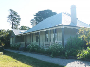
VHR H0267The Old Swan Inn including the buildings and outbuildings (interiors and exteriors); archaeological deposits, features and artefacts, including the ford and track; plantings, garden features…
-
1356 MURNDAL ROAD TAHARA, SOUTHERN GRAMPIANS SHIRE

Victorian Heritage Register
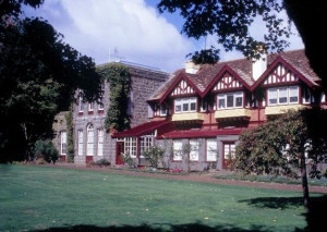
VHR H0289Murndal is at the heart of a pastoral run formerly known as Spring Valley, which was initially part of a larger squatting run called Tahara. Tahara was held in the 1840s under two licences…
-
51 OVERNEWTON ROAD KEILOR, BRIMBANK CITY

Victorian Heritage Register
VHR H0200Overnewton, located in Keilor, comprises the original homestead built in 1849 with substantial additions made in 1859, and associated outbuildings and structures including the butchery and…
-
3320 MIDLAND HIGHWAY LETHBRIDGE, GOLDEN PLAINS SHIRE

Victorian Heritage Register
VHR H0266Moranghurk is the remains of a large pastoral property originally called Morangourke, located on the Moorabool River near Lethbridge. The first squatters to occupy the run were the partners…
-
2700-3148 POINT NEPEAN ROAD SORRENTO, MORNINGTON PENINSULA SHIRE

Victorian Heritage Register
VHR H1050The British Government's decision to establish a settlement in southern Australia appears to have been prompted by favourable reports of Port Phillip Bay and concerns about the interest of…
-
YARRA BEND ROAD FAIRFIELD, YARRA CITY

Victorian Heritage Register
VHR H2398The Yarra Bend Park including all the land, trees, plantings, open parkland, roads and paths, asylum gate pillar, golf club house and course, and all archaeological deposits associated with…
-
HODDLE SURVEY TREE, KEW GOLF CLUB
120B BELFORD ROAD KEW EAST, BOROONDARA CITY

Victorian Heritage Register
VHR H2340A remnant River Red Gum tree used as a reference marker by the Government surveyor Robert Hoddle in April 1844 when surveying crown land for the first land sales in Kew in 1845. History…
-
BESSIEBELLE SHEEPWASHES AND YARDS
PYES ROAD BESSIEBELLE, MOYNE SHIRE

Victorian Heritage Register
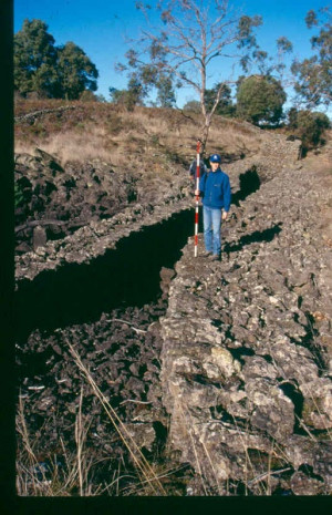
VHR H2033The Bessiebelle Sheepwashes and Yards complex is located on the former 14,000 acre Ardonachie Run, established in 1848 by pastoralist Samuel Gorrie, then carrying 6,000 sheep. In 1864 this…
-
BIRDWOOD AVENUE MELBOURNE, MELBOURNE CITY

Victorian Heritage Register
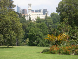
VHR H1459The Royal Botanic Gardens, commenced in 1846 on the south side of the Yarra River on a site selected by Superintendent Charles La Trobe, are located adjacent to Government House, Melbourne…
-
133-135 HESSE STREET QUEENSCLIFF, QUEENSCLIFFE BOROUGH

Victorian Heritage Register
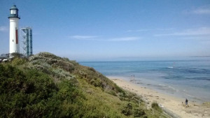
VHR H2367Shortlands Bluff including all of the landscape elements, navigational aids and defence bunkers. HOW IS IT SIGNIFICANT Shortlands Bluff is of historical significance to the State of…
-
Esplanade Foreshore Heritage Precinct
Esplanade WILLIAMSTOWN, Hobsons Bay City

Hobsons Bay City
The Esplanade Foreshore Heritage Precinct, whichcomprises the foreshore land adjacent to the Esplanade extending from Thompson Street to Bayview Street in Williamstown. How is it…
-
Point Gellibrand Heritage Precinct
approximately 24 hectares of foreshore land bounded by Kanowna Street, Hamner Street, Ann Street, Morris Street and the Cyril Curtain Reserve in the south and coastline to the eas WILLIAMSTOWN, HOBSONS BAY CITY

Hobsons Bay City
The Point Gellibrand Heritage Precinct, comprising approximately24 hectares of foreshore land bounded by Kanowna Street, Hamner Street, Ann Street, Morris Street and the Cyril Curtain…
-
MONIVAE HOMESTEAD ORIGINAL SITE
Port Fairy-Hamilton Road HAMILTON, Southern Grampians Shire

Southern Grampians Shire
The original Monivae homestead site is located 2kms south of Hamilton, immediately adjacent to the Hamilton-Port Fairy Road and on the Muddy Creek. The squatting run was taken up by Acheson…
-
Hilgay Road COLERAINE, Southern Grampians Shire

Southern Grampians Shire
The substantial remains of Hilgay Station are located behind a modern house at the intersection (and termination) of the Top and Lower Hilgay Road immediately south of the intersection with…
-
Natimuk - Hamilton Road, BALMORAL VIC 3407 - Property No 037

Southern Grampians Shire
The Englefield Homestead complex is located about 1.6kms south of Balmoral on a rise overlooking a creek which runs into the Glenelg River. The property straddles the Natimuk-Hamilton Road,…
-
Glenelg Highway and Morgiana Road WANNON, Southern Grampians Shire

Southern Grampians Shire
The Wannon Falls Reserve is located on the south side of the Henty Highway, about 18kms north-west of Hamilton where the highway crosses the Wannon river. The total area reserved is about…
-
Lower Hilgay Road COLERAINE, Southern Grampians Shire

Southern Grampians Shire
The Coleraine Public Cemetery is located approximately 2.5 kilometers to the south west of the Town, on Lower Hilgay Road. This road was previously the access road to Hilgay Station, and the…
-
MOUNT KOROITE HOMESTEAD (ORIGINAL SITE)
Heffernan Lane COLERAINE, Southern Grampians Shire

Southern Grampians Shire
The original site of Mount Koroite Homestead is located about eight kilometers east of the township of Coleraine, and north of the second homestead, which is located at the top of the hill.…
-
Glenelg Highway COLERAINE, Southern Grampians Shire

Southern Grampians Shire
The township of Coleraine is located on the Hamilton Highway, 30.0 km west of Hamilton. The town developed at the road crossing of Bryant's Creek, particularly for traffic between Adelaide,…
-
Digby Road HAMILTON, Southern Grampians Shire

Southern Grampians Shire
SIGNIFICANCE: Site of first permanent settlement in the district. STATEMENT OF SIGNIFICANCE Archaeological Site Digby Road This area has local significance as an important archaeological…

