-
Save Search
You must log in to do that.
-
Share Search
-
Download Search
The download will only include records from the current search page. You can increase the number of records to download by changing the number of 'listings per page' at the bottom of this page. Note that the maximum number of records that can be listed per page is 300. The download may exceed the number of records listed as any 'nested' records that have met the search criteria will also download.
Download file (.xls)
Success
Error
-
Save Search
You must log in to do that.
-
Share Search
-
Download Search
The download will only include records from the current search page. You can increase the number of records to download by changing the number of 'listings per page' at the bottom of this page. Note that the maximum number of records that can be listed per page is 300. The download may exceed the number of records listed as any 'nested' records that have met the search criteria will also download.
Download file (.xls)
-
COCOROC ROAD COCOROC, WYNDHAM CITY

Victorian Heritage Register
VHR H1416The tank at the Western Treatment plant, Werribee is a 150 000 gallon water tank erected originally in 1854, near the corner of Albert and Gisborne Streets, East Melbourne. John Davis, a…
-
1-3 RIVERVIEW ROAD BENALLA, BENALLA RURAL CITY

Victorian Heritage Register
VHR H1048The Benalla Water Supply Depot comprises a c.6 metre diameter riveted iron tank, with blacksmiths shop; a steel tank, a reinforced concrete tower; a carpenters shop; and a brick…
-
TOEDTBERG ROAD AND TWO CHAIN ROAD COLBINABBIN, CAMPASPE SHIRE

Victorian Heritage Register
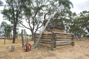
VHR H1937The Colbinabbin Community Well consists of a raised earth-filled platform retained by notched logs along with remains of decking. Angled above the well is a whip pole. Nearby are remnants of…
-
CLONBINANE, WHITTLESEA,HUMEVALE, YAN YEAN, DOREEN, MERNDA, SOUTH MORANG, MILL PARK, BUNDOORA, THOMASTOWN, RESERVOIR, PRESTON,THORNBURY, NORTHCOTE AND FITZROY NORTH, MITCHELL SHIRE, WHITTLESEA CITY, DAREBIN CITY, YARRA CITY

Victorian Heritage Register
VHR H2333The Yan Yean Water Supply System was constructed from 1853 as the first large scale engineered water supply system in Victoria. It consists of a series of catchment weirs and reservoirs…
-
ANAKIE GORGE WALKING TRACK STAUGHTON VALE, GREATER GEELONG CITY

Victorian Heritage Register
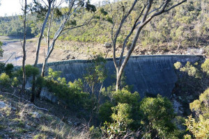
VHR H2371The Lower Stony Creek Dam Wall at the south end of the Lower Stony Creek Reservoir including the two valve houses, one containing an original outlet valve and a timber door. History…
-
off Hamilton- Port Fairy Road BYADUK NORTH, Southern Grampians Shire

Southern Grampians Shire
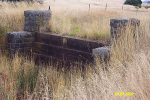
The bluestone weir is located about 150 metres northeast of the Hamilton-Port Fairy Road at North Byaduk. The structure, dating from after 1857, is built of dressed bluestone, and reveals a…
-
off Red Rock Creek Road, GLENISLA VIC 3408 - Property No 0510

Southern Grampians Shire
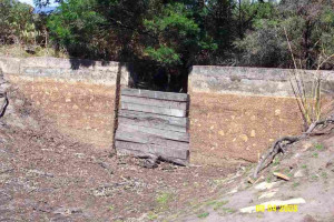
The Glenisla Weir, located west of Red Rock Road on Red Rock Creek and about 1.0km south of Anderson's Road was built in the 1860s by Samuel Carter. The principal owner of the Glen Isla…
-
766-858 Gisborne-Melton Road TOOLERN VALE, MELTON SHIRE

Melton City
Glen Elgin, 766 Gisborne-Melton Road, Toolern Vale, is significant as a surviving and substantial example of a late nineteenth and early twentieth century farm complex comprising a timber…
-
163 Hjorths Road TOOLERN VALE, Melton Shire

Melton City
Hjorth Farm, at 163 Hjorth Road Toolern Vale is significant as a substantial, evocative, and rare example of early intensive farming in the Shire, as a result of the Selection Acts, and the…
-
209-247 Plumpton Road DIGGERS REST, Melton Shire

Melton City
H7822-0978The former Murphy dam, at 209-247 Plumpton Road, Diggers Rest, is significant as an example of a type of dam constructed in nineteenth century Melton by some small pastoralists and farmers in…
-
HO75 - Former Melton Reservoir
Hannah Watts Park, High Street MELTON, MELTON SHIRE

Melton City
The former Melton Reservoir, now an ornamental duck pond in the Hannah Watts Park, High Street, Melton, comprises the excavated earth tank or reservoir, and a small bluestone structure on the…
-
HO104 - Moloney's Farm Site and Water Reserve
1884-1908 Mount Cottrell Road and 2182-2356 Boundary Road MOUNT COTTRELL, Melton Shire

Melton City
The underground tank of the Moloney farm on Mt Cottrell Road Mt Cottrell, and the adjacent Water Reserve, are significant as good representative examples of the management of water for both…
-
HO105 - Mt Cottrell Road Stock Yard, Ruins and Dry Stone Walls
1476-1570 Mount Cottrell Road MOUNT COTTRELL, Melton Shire

Melton City
H7822-0141The ruin, dry stone walls and sheep yards at 1476-1570 Mt Cottrell Road are an extensive, substantially intact, and unusual complex of dry stone walls, and stone farmhouse ruins and plantings…
-
WESTERN FREEWAY and BACCHUS MARSH ROAD MERRIMU HOPETOUN PARK, MOORABOOL SHIRE

Moorabool Shire
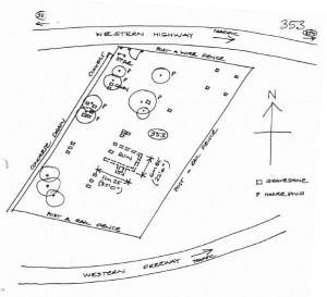
VHR H2059An early, pre-gold rush Catholic cemetery and chapel established in 1850-51, which closed in 1941, with the ruins of an early Catholic chapel and school, which closed in 1874. The cemetery…
-
Lerderderg River engineering works.
Holts Lane to Wheelans Road BACCHUS MARSH, MOORABOOL SHIRE

Moorabool Shire
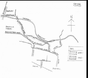
Engineering earth works by the Shire council from 1878-90 and from 1933 to formalise a channel for the Lerderderg River through the town to reduce flooding and reclaim marshland for…
-
Buninyong Botanic Gardens, Gong Reservoir
201 SCOTT STREET, AND 705 INGLIS STREET, BUNINYONG - PROPERTY NUMBERS 2028710,2016607, BALLARAT CITY

Ballarat City
VHR H1826How is it significant? Why is it significant?


