-
Save Search
You must log in to do that.
-
Share Search
-
Download Search
The download will only include records from the current search page. You can increase the number of records to download by changing the number of 'listings per page' at the bottom of this page. Note that the maximum number of records that can be listed per page is 300. The download may exceed the number of records listed as any 'nested' records that have met the search criteria will also download.
Download file (.xls)
Success
Error
-
Save Search
You must log in to do that.
-
Share Search
-
Download Search
The download will only include records from the current search page. You can increase the number of records to download by changing the number of 'listings per page' at the bottom of this page. Note that the maximum number of records that can be listed per page is 300. The download may exceed the number of records listed as any 'nested' records that have met the search criteria will also download.
Download file (.xls)
-
3210 MURRAY VALLEY HIGHWAY RUTHERGLEN, INDIGO SHIRE

Victorian Heritage Register
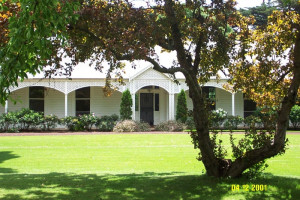
VHR H0700George Francis Morris (1834-1910) was one of the greatest of Victoria's nineteenth century vignerons. In 1904 his property, Fairfield,was described as the country's largest vineyard and…
-
3221 MURRAY VALLEY HIGHWAY RUTHERGLEN, INDIGO SHIRE

Victorian Heritage Register
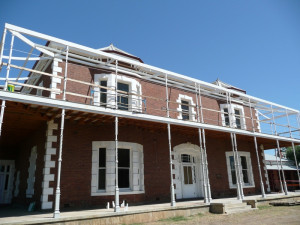
VHR H0698Olive Hills comprises a large country homestead and complex of related farm buildings. The homestead was constructed in 1886 for Hugh Fraser, a Scot who had worked at the Docker's Bontharambo…
-
99 COWANGIE SOUTH ROAD COWANGIE, MILDURA RURAL CITY

Victorian Heritage Register
VHR H0688Cow Plains Homestead Complex is unique for its associations with the earliest preagricultural history of the Mallee when large pastoral runs were the most characteristic form of settlement in…
-
108 WINDERMERE ROAD LARA, GREATER GEELONG CITY

Victorian Heritage Register
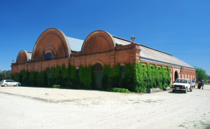
VHR H1723Pirra Homestead, 110 Windermere Road, Lara, is significant for its highly unusual historical buildings constructed in the 19th and early 20th centuries and for its remnant 19th century…
-
36-40 LORD SOMERS ROAD SOMERS, MORNINGTON PENINSULA SHIRE

Victorian Heritage Register
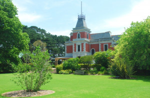
VHR H0759Coolart originally formed part of one of the oldest grazing properties on the Mornington Peninsula. "Coolart" or "Coolourt" (meaning sandy area in the local aboriginal dialect) was first…
-
Macarthur-Penshurst Rd GAZETTE, Southern Grampians Shire

Southern Grampians Shire
The present Gazette Homestead complex is located about 10kms south-west of Penshurst, on the edge of the lava flow from Mount Rouse and on the Eumeralla River. The squatting run called…
-
Pigeon Ponds Road PIGEON PONDS, Southern Grampians Shire

Southern Grampians Shire
Fairview, Pigeon Ponds Road, Pigeon Ponds is a small homestead complex comprising a dwelling, a detached kitchen, a range of outbuildings and a woolshed. The land seems to have been taken up…
-
Blackwood-Dunkeld Road DUNKELD, Southern Grampians Shire

Southern Grampians Shire
Devon Park, formerly known as Linlithgow Plains, was taken up by Donald and Duncan Cameron Kennedy in October 1845. Some parts of the surviving bluestone structures may date from this time.…
-
Coleraine-Nareen Road NAREEN, Southern Grampians Shire

Southern Grampians Shire
Nareen Homestead Complex is located immediately north of the small settlement of Nareen which grew up at a crossroad during the 1860s as a result of the Land Selection Acts. The property…
-
Murroa Lane BUCKLEY SWAMP BUCKLEY SWAMP, Southern Grampians Shire

Southern Grampians Shire
Murroa located 9 kilometres south of Hamilton was originally the Cape Wrath squatting run. John and Robert McKay first took up the licence in 1842 but probably achieved little because of the…
-
Green's Lane HARROW, West Wimmera Shire

Southern Grampians Shire
Carrigeen Homestead Complex is located at the end of a long drive with terminal turning circle, off Greens Road, some three kilometers south east of Harrow. The complex is made up of a large…
-
Henty Highway BRANXHOLME, Southern Grampians Shire

Southern Grampians Shire
The Koornong Homestead Complex is located about 10kms north of Branxholme. The main house reflects three major periods of construction. Started by George Derbyshire, the local government…
-
McKellar's Road YULECART, Southern Grampians Shire

Southern Grampians Shire
Viladale is located on the east side of McKellar's Road about 5kms west of Hamilton. It is a single storeyed bluestone and timber homestead with corrugated iron roof, commenced in 1904 by…
-
Lake Road, CROXTON EAST VIC 3301 - Property No 4041810

Southern Grampians Shire
The present Croxton East homestead, Lake Road, Tabor was built soon after 1902 for Wilhelm Huf and his wife Johanna Augusta, nee Schultz. It superseded the original timber cottage of…
-
CHERITTA HOMESTEAD COMPLEX (former)
Wallacedale North - Hamilton Road BRANXHOLME, Southern Grampians Shire

Southern Grampians Shire
Cheritta Homestead Complex (former) was a large single storey bluestone homestead, with significant outbuildings and a substantial garden. It was destroyed by fire in the late twentieth…
-
Falkenbergs Road, WANNON VIC 3301 - Property No 1529

Southern Grampians Shire
Riverside Homestead is located on the east side of Falkenberg's Road about 5.5kms south-west of Wannon overlooking the Wannon River valley. It is a single storey timber house with an…
-
C. Fry's Road, VICTORIA VALLEY VIC 3294 - Property No 0030

Southern Grampians Shire
The Brooksdale homestead complex has two homesteads, the older timber homestead, dating from prior to 1890, and a newer homestead, which dates from 1952, and was designed by Warrnambool…
-
Murndal Road YULECART, Southern Grampians Shire

Southern Grampians Shire
Kinvonvie is located on north side of Murndal Road, approximately 23 kilometres south of Hamilton. The house was built in 1894 of bricks quarried and fired on the property for James…
-
Hamilton Highway Burn Brae Lane PENSHURST, Southern Grampians Shire

Southern Grampians Shire
Burnbrae Homestead complex, located on the south side of the Hamilton Highway 7.0kms east of Penshurst, dates from at least 1880. It appears to have begun as a small stone house which has…
-
Macarthur-Penshurst Road and Springfield Lane PENSHURST, Southern Grampians Shire

Southern Grampians Shire
The original Willowbrook farm was established about 1860 by Andreas Burger and his wife, Anna, nee Mirtschin. He was the fourth son of the pioneering family of Burgers and an important…
-
Wando Dale Road, NAREEN VIC 3315 - Property No 1190

Southern Grampians Shire
Wando Dale Homestead Complex is located on the south bank of the Wando River immediately west of the Coleraine-Nareen Road and at the end of the former road. The homestead itself is a large…
-
Coleraine-Balmoral Road, KONONG WOOTONG VIC 3315 - Property No 1590

Southern Grampians Shire
Myrniong is a deliberately asymmetrical brick house constructed on a steep slope over two levels. The house is located on the west side of the Coleraine - Balmoral Road overlooking the…
-
Batesworth Lane, PENSHURST VIC 3289 - Property No 14/32/

Southern Grampians Shire
The Batesworth homestead complex is located in Batesworth Lane about 3.5kms north of Penshurst off the Penshurst-Dunkeld Road. It comprises: the present post World War Two cream brick…
-
off Anderson's Road, GLENISLA VIC 3408 - Property No 0510

Southern Grampians Shire
Anderson's Beekeeper's Farm, located at the end of Anderson's Road, 3.2kms east of its intersection with the Henty Highway and 7.0kms south-south-east of Glen Isla Homestead, dates from…
-
2389-2485 Diggers Rest-Coimadai Road DIGGERS REST, Melton Shire

Melton City
Cornwall Park Stud, 2389-2485 Diggers Rest-Coimadai Road, Diggers Rest, is significant as a moderately intact example of an unusual Federation styled main house and former coach house…
