-
Save Search
You must log in to do that.
-
Share Search
-
Download Search
The download will only include records from the current search page. You can increase the number of records to download by changing the number of 'listings per page' at the bottom of this page. Note that the maximum number of records that can be listed per page is 300. The download may exceed the number of records listed as any 'nested' records that have met the search criteria will also download.
Download file (.xls)
Success
Error
-
Save Search
You must log in to do that.
-
Share Search
-
Download Search
The download will only include records from the current search page. You can increase the number of records to download by changing the number of 'listings per page' at the bottom of this page. Note that the maximum number of records that can be listed per page is 300. The download may exceed the number of records listed as any 'nested' records that have met the search criteria will also download.
Download file (.xls)
-
CAVES ROAD BUCHAN, EAST GIPPSLAND SHIRE

Victorian Heritage Register
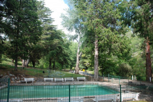
VHR H1978The 285ha Buchan Caves Reserve is situated in the Buchan-Murrindal cave system, a large outcrop of cave and karst-forming limestones in south-eastern Victoria. The earliest known written…
-
165 BLANDS ROAD YARRAM, WELLINGTON SHIRE

Victorian Heritage Register
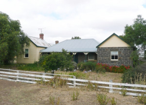
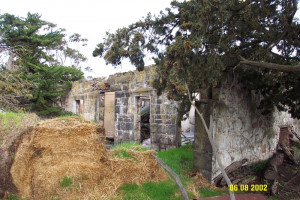
VHR H0256Hawthorn Bank is a farmhouse complex (now in a ruinous state) apparently constructed in three main stages. The construction dates of the various stages are not known, though the earliest…
-
76-78 TUCKER STREET BREAKWATER, GREATER GEELONG CITY

Victorian Heritage Register
VHR H1146The land on which the Sunnyside Wool Scour stands was first purchased in 1853 by John Ford Strachan, who was involved in the Geelong wool trade. By 1862 the site had been purchased by a…
-
KING STREET AND WILLIAM STREET AND LA TROBE STREET AND DUDLEY STREET WEST MELBOURNE, MELBOURNE CITY

Victorian Heritage Register
VHR H2041Flagstaff Hill including the Flagstaff Gardens occupies an elevated position to the north west of Melbourne's CBD. Consisting of 7.7 hectares, it was originally called Burial Hill by the…
-
155-159 MOUNT HESSE ESTATE ROAD OMBERSLEY, COLAC OTWAY SHIRE

Victorian Heritage Register
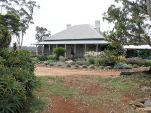
VHR H1208Mount Hesse Station was established as a pastoral property in the late 1830s by William Harding and John Highett. Harding's homestead, the first homestead on the property, dates from the…
-
CHANDLER HIGHWAY ALPHINGTON AND CHANDLER HIGHWAY KEW, YARRA CITY, BOROONDARA CITY

Victorian Heritage Register
VHR H2354The Chandler Highway Bridge, a 137 metre wrought iron lattice-truss girder bridge with four spans supported on red brick piers with moulded bluestone cappings. The bridge has a cantilevered…
-
FORMER ST JOHN'S THE LESS ANGLICAN CHURCH AND SCHOOLROOM
1 BEDDOE AVENUE BRIGHTON EAST, BAYSIDE CITY

Victorian Heritage Register
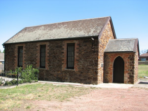
VHR H1970The former St John's the Less Anglican church and schoolroom, designed to seat about 120 people, was opened on 1 February 1850 to serve the pioneer agricultural settlement around the Elster…
-
77-79 BURKE ROAD NORTH IVANHOE, BANYULE CITY

Victorian Heritage Register
VHR H1140Charterisville was built c. 1840 by David Charteris McArthur, Melbourne's first bank manager. The house was built of sandstone quarried on the site and remains today as a partially complete…
-
SALTWATER RIVER CROSSING SITE AND FOOTSCRAY WHARVES PRECINCT
MARIBYRNONG RIVER AND MORELAND STREET AND BUNBURY STREET AND WINGFIELD STREET AND NAPIER STREET AND HOPKINS STREET AND MARIBYRNONG STREET FOOTSCRAY, MARIBYRNONG CITY

Victorian Heritage Register
VHR H1397The Saltwater River Crossing site and Footscray wharves are located on the west bank of the Maribyrnong River, running south from Hopkins Street, Footscray. The site contains significant…
-
1402-1600 GREIGS ROAD AND 439-735 FERRIS ROAD STRATHTULLOH, MELTON CITY

Victorian Heritage Register
VHR H0317The Strathtulloh property was established in 1840 by Charles James Garrard with the detached kitchen building built of local stone being the earliest remaining structure. The random coursed…
-
4876 GLENELG HIGHWAY MUNTHAM, SOUTHERN GRAMPIANS SHIRE

Victorian Heritage Register
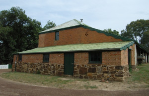
VHR H0294The Red Brick Barn at Muntham Station is located on one of the oldest established pastoral properties in Victoria. Edward Henty was the first permanent settler in Victoria and Muntham was…
-
3320 MIDLAND HIGHWAY LETHBRIDGE, GOLDEN PLAINS SHIRE

Victorian Heritage Register
VHR H0266Moranghurk is the remains of a large pastoral property originally called Morangourke, located on the Moorabool River near Lethbridge. The first squatters to occupy the run were the partners…
-
490 SLATE QUARRY ROAD MEREDITH, GOLDEN PLAINS SHIRE

Victorian Heritage Register
VHR H0268Darra, originally known as Durdiwarrah pastoral station, was licensed with 24,000 acres to Charles Augustus Von Steiglitz in 1842. Charles Augustus Von Steiglitz, who arrived in Port Phillip…
Also listed in:
-
53 JACKSON STREET ST KILDA, PORT PHILLIP CITY

Victorian Heritage Register
VHR H0632Wattle House, which was Samuel Jackson's own residence from the 1840s until the 1860s, has both architectural and historical significance because of its associations with this important…
Also listed in:
-
4 PERCY STREET PORTLAND, GLENELG SHIRE

Victorian Heritage Register
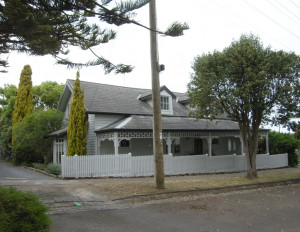
VHR H2071William Frost, described as a gentleman, purchased the site known as Allotment 17, Section 2, Township of Portland, for £200 in early October 1840 a the first Portland land sales held…
Also listed in:
-
EPSOM ROAD AND SMITHFIELD ROAD FLEMINGTON, MELBOURNE CITY

Victorian Heritage Register
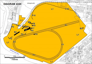
VHR H2220Flemington Racecourse has operated continuously since 1840, when the first race meeting was held here on the Maribyrnong River flats north of the city, and in 1848 352 acres of Crown Land…
-
133-135 HESSE STREET QUEENSCLIFF, QUEENSCLIFFE BOROUGH

Victorian Heritage Register
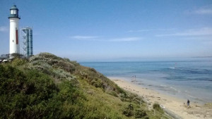
VHR H2367Shortlands Bluff including all of the landscape elements, navigational aids and defence bunkers. HOW IS IT SIGNIFICANT Shortlands Bluff is of historical significance to the State of…
-
Calder Highway; Sydenham Park, KEILOR VIC 3036 - Property No 34

Brimbank City
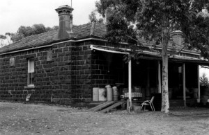
Statement of Significance Of regional significance as a rare and intact bluestone homestead relating to the first phase of European occupation and pastoral economy in the Keilor -Werribee…
-
HO124 - Grave, Ruin & Archaeological Site, Former Greenhills Pastoral Station
36-49 O'Connell Avenue TOOLERN VALE, Melton Shire

Melton City
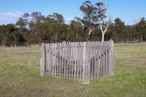
The grave, ruin and archaeological site associated with the former Greenhills pastoral station, situated at 36-49 O'Connell Avenue Toolern Vale, are significant for their association with the…
-
Melbourne-Geelong Road Precinct
Geelong Road BROOKLYN, Hobsons Bay City

Hobsons Bay City
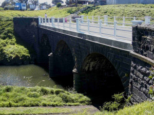
The Melbourne-Geelong Road Heritage Precinct, which comprises land generally within the original Melbourne-Geelong roadway reserve, together with the identified stone bridge, and town and…
-
Nelson Place Heritage Precinct
Cole Street (part), Nelson Place (part) and Parker Street (part), Williamstown WILLIAMSTOWN, HOBSONS BAY CITY

Hobsons Bay City
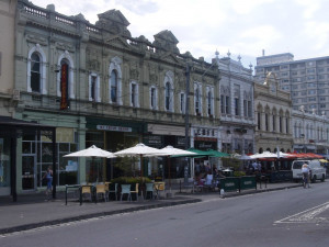
The Nelson Place Heritage Precinct, which comprises all land in HO21 and generally includes all properties fronting Nelson Place between Thompson Street and Pasco Street, Williamstown. How…
-
Point Gellibrand Heritage Precinct
approximately 24 hectares of foreshore land bounded by Kanowna Street, Hamner Street, Ann Street, Morris Street and the Cyril Curtain Reserve in the south and coastline to the eas WILLIAMSTOWN, HOBSONS BAY CITY

Hobsons Bay City
The Point Gellibrand Heritage Precinct, comprising approximately24 hectares of foreshore land bounded by Kanowna Street, Hamner Street, Ann Street, Morris Street and the Cyril Curtain…
-
Hilgay Road COLERAINE, Southern Grampians Shire

Southern Grampians Shire
The substantial remains of Hilgay Station are located behind a modern house at the intersection (and termination) of the Top and Lower Hilgay Road immediately south of the intersection with…
-
Heenan-Ferrier Road, TARRENLEA VIC 3315 - Property No 1573

Southern Grampians Shire
The squatting run Winninburn, as part of the Tahara run, was one of the earliest in the Portland Bay District, being taken up by George and Samuel Winter. The Winter brothers and the Whyte…
-
Natimuk - Hamilton Road, BALMORAL VIC 3407 - Property No 037

Southern Grampians Shire
The Englefield Homestead complex is located about 1.6kms south of Balmoral on a rise overlooking a creek which runs into the Glenelg River. The property straddles the Natimuk-Hamilton Road,…
